
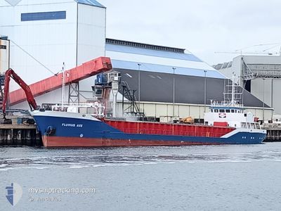
FLUVIUS AXE
General Cargo
Current Trip
| Time Travelled | 1 day |
|---|---|
| Remaining Time | 8 h, 50 mins |
| Distance Travelled | 336.90 nm |
| Remaining Distance | 116.24 nm |
| AVG Speed | 10.4 Knots |
| MAX Speed | 13.2 Knots |
| AVG Wind | 8.9 knots |
| MAX Wind | 18 knots |
| MIN Temp | 9.3°C / 48.74°F |
| MAX Temp | 13.9°C / 57.02°F |
| Draught | 4.7 m |
| Position Received | 1 h, 29 m ago |
Current Position
| Longitude | 1.59052° |
|---|---|
| Latitude | 52.89526° |
| Status | Under way using engine |
| Speed | 12.7 Knots |
| Course | 136.1° |
| Area | North Sea |
| Station | T-AIS |
| Position Received | 1 h, 29 m ago |
Info
Information
The current position of FLUVIUS AXE is in North Sea with coordinates 52.89526° / 1.59052° as reported on 2024-05-09 21:08 by AIS to our vessel tracker app. The vessel's current speed is 12.7 Knots and is heading at the port of ERITH. The estimated time of arrival as calculated by vessel tracking app is 2024-05-10 07:28 LT
The vessel FLUVIUS AXE (IMO: 9163623, MMSI: 314654000) is a General Cargo that was built in 1998 ( 26 years old ). It's sailing under the flag of [BB] Barbados.
In this page you can find informations about the vessels current position, last detected port calls, and current voyage information. If the vessels is not in coverage by AIS you will find the latest position.
The current position of FLUVIUS AXE is detected by our AIS receivers and we are not responsible for the reliability of the data. The last position was recorded while the vessel was in Coverage by the Ais receivers of our vessel tracking app.
The current draught of FLUVIUS AXE as reported by AIS is 4.7 meters
Weather
| Temperature | 11.9°C / 53.42°F |
|---|---|
| Wind Speed | 1 knots |
| Direction | 56° NE |
| Pressure | 1025.4 hPa |
| Humidity | 87.8 % |
| Cloud Coverage | 15 % |
Featured Company
Last Port Calls
| Port | Arrival | Departure | Time In Port |
|---|---|---|---|
| 2024-05-06 08:42 | 2024-05-08 14:44 | 2 d | |
| 2024-05-02 04:42 | 2024-05-02 18:34 | 13 h | |
| 2024-04-26 07:36 | 2024-04-27 20:17 | 1 d | |
| 2024-04-22 04:01 | 2024-04-22 14:53 | 10 h | |
| 2024-04-21 01:21 | 2024-04-22 02:22 | 1 d | |
| 2024-04-19 20:38 | 2024-04-20 19:57 | 23 h | |
| 2024-04-17 20:03 | 2024-04-17 21:04 | 1 h | |
| 2024-04-16 08:57 | 2024-04-17 18:25 | 1 d | |
| 2024-04-12 13:31 | 2024-04-13 13:09 | 23 h | |
| 2024-04-09 23:59 | 2024-04-12 00:04 | 2 d |
Most Visited Ports (Last year)
| Port | Arrivals | |
|---|---|---|
| 20 | ||
| 10 | ||
| 5 | ||
| 3 | ||
| 3 | ||
| 3 |
Last Trips
| Origin | Departure | Destination | Arrival | Distance | |
|---|---|---|---|---|---|
| 2024-05-02 19:34 | 2024-05-06 09:42 | 89.84 nm | |||
| 2024-04-27 21:17 | 2024-05-02 05:42 | 389.55 nm | |||
| 2024-04-22 16:53 | 2024-04-26 08:36 | 402.68 nm | |||
| 2024-04-22 04:22 | 2024-04-22 06:01 | 12.56 nm | |||
| 2024-04-20 21:57 | 2024-04-21 03:21 | 0.19 nm | |||
| 2024-04-17 23:04 | 2024-04-19 22:38 | 337.59 nm | |||
| 2024-04-17 20:25 | 2024-04-17 22:03 | 9.54 nm | |||
| 2024-04-13 14:09 | 2024-04-16 10:57 | 657.17 nm | |||
| 2024-04-12 01:04 | 2024-04-12 14:31 | 127.16 nm | |||
| 2024-04-05 04:11 | 2024-04-10 00:59 | 762.84 nm |
Events
| Time | Event | Details | Position / Dest | Info |
|---|---|---|---|---|
| 2024-05-09 21:12 | Status Changed | Default Under way using engine |
52.88344 / 1.60943
GBERI
|
Speed: 12.7 kn Course: 136.1° |
| 2024-05-09 21:08 | OUT of Coverage |
52.89526 / 1.59052
North Sea
GBERI
|
Speed: 12.7 kn Course: 136.1° |
|
| 2024-05-09 19:13 | Status Changed | Under way using engine Default |
53.08693 / 1.00236
GBERI
|
Speed: 12 kn Course: 129° |
| 2024-05-09 19:11 | IN Coverage |
53.08693 / 1.00236
North Sea
GBERI
|
Speed: 12.2 kn Course: 131.1° |
|
| 2024-05-09 14:53 | Status Changed | Default Under way using engine |
53.85812 / .29016
GBERI
|
Speed: 11.7 kn Course: 144.8° |
| 2024-05-09 14:48 | OUT of Coverage |
53.87145 / .27422
North Sea
GBERI
|
Speed: 11.7 kn Course: 144.8° |
|
| 2024-05-09 12:42 | Status Changed | Under way using engine Default |
54.18900 / -.05817
GBERI
|
Speed: 9.5 kn Course: 140° |
| 2024-05-09 12:29 | IN Coverage |
54.18900 / -.05817
North Sea
GBERI
|
Speed: 9.6 kn Course: 140.8° |
|
| 2024-05-09 09:57 | Status Changed | Default Under way using engine |
54.50514 / -.52170
GBERI
|
Speed: 8.8 kn Course: 139.8° |
| 2024-05-09 09:50 | OUT of Coverage |
54.51718 / -.54062
North Sea
GBERI
|
Speed: 8.8 kn Course: 139.8° |