
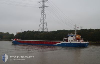
FLUVIUS PLYM
General Cargo
Current Trip
| Time Travelled | 16 h, 13 mins |
|---|---|
| Remaining Time | 6 h, 36 mins |
| Distance Travelled | 152.08 nm |
| Remaining Distance | 69.40 nm |
| AVG Speed | 7.9 Knots |
| MAX Speed | 11.6 Knots |
| AVG Wind | 12.6 knots |
| MAX Wind | 17 knots |
| MIN Temp | 12.3°C / 54.14°F |
| MAX Temp | 13.5°C / 56.3°F |
| Draught | 3 m |
| Position Received | Now |
Current Position
| Longitude | 3.04389° |
|---|---|
| Latitude | 51.84882° |
| Status | Under way using engine |
| Speed | 10.6 Knots |
| Course | 127.6° |
| Area | North Sea |
| Station | T-AIS |
| Position Received | Now |
Info
Information
The current position of FLUVIUS PLYM is in North Sea with coordinates 51.84882° / 3.04389° as reported on 2024-05-23 08:16 by AIS to our vessel tracker app. The vessel's current speed is 10.6 Knots and is heading at the port of ANTWERP. The estimated time of arrival as calculated by vessel tracking app is 2024-05-23 14:53 LT
The vessel FLUVIUS PLYM (IMO: 9163611, MMSI: 314656000) is a General Cargo that was built in 1998 ( 26 years old ). It's sailing under the flag of [BB] Barbados.
In this page you can find informations about the vessels current position, last detected port calls, and current voyage information. If the vessels is not in coverage by AIS you will find the latest position.
The current position of FLUVIUS PLYM is detected by our AIS receivers and we are not responsible for the reliability of the data. The last position was recorded while the vessel was in Coverage by the Ais receivers of our vessel tracking app.
The current draught of FLUVIUS PLYM as reported by AIS is 3 meters
Weather
| Temperature | 13.2°C / 55.76°F |
|---|---|
| Wind Speed | 16 knots |
| Direction | 230° SW |
| Pressure | 1012.6 hPa |
| Humidity | 89.7 % |
| Cloud Coverage | 8 % |
Featured Company
Last Port Calls
| Port | Arrival | Departure | Time In Port |
|---|---|---|---|
| 2024-05-22 05:28 | 2024-05-22 16:04 | 10 h | |
| 2024-05-14 20:50 | 2024-05-16 16:39 | 1 d | |
| 2024-05-09 17:03 | 2024-05-10 21:38 | 1 d | |
| 2024-05-01 22:20 | 2024-05-03 20:45 | 1 d | |
| 2024-04-24 04:35 | 2024-04-24 18:55 | 14 h | |
| 2024-04-23 08:48 | 2024-04-23 19:07 | 10 h | |
| 2024-04-16 20:18 | 2024-04-17 15:21 | 19 h | |
| 2024-04-14 04:44 | 2024-04-15 17:11 | 1 d | |
| 2024-04-09 20:08 | 2024-04-10 19:12 | 23 h | |
| 2024-04-06 07:57 | 2024-04-08 20:59 | 2 d |
Most Visited Ports (Last year)
| Port | Arrivals | |
|---|---|---|
| 6 | ||
| 5 | ||
| 4 | ||
| 3 | ||
| 3 | ||
| 3 |
Last Trips
| Origin | Departure | Destination | Arrival | Distance | |
|---|---|---|---|---|---|
| 2024-05-16 17:39 | 2024-05-22 06:28 | 1173.79 nm | |||
| 2024-05-10 23:38 | 2024-05-14 21:50 | 259.13 nm | |||
| 2024-05-03 22:45 | 2024-05-09 19:03 | 1419.01 nm | |||
| 2024-04-24 20:55 | 2024-05-02 00:20 | 950.35 nm | |||
| 2024-04-23 21:07 | 2024-04-24 06:35 | 87.37 nm | |||
| 2024-04-17 17:21 | 2024-04-23 10:48 | 847.11 nm | |||
| 2024-04-15 18:11 | 2024-04-16 22:18 | 204.07 nm | |||
| 2024-04-10 20:12 | 2024-04-14 05:44 | 705.76 nm | |||
| 2024-04-08 21:59 | 2024-04-09 21:08 | 157.82 nm | |||
| 2024-04-02 19:19 | 2024-04-06 08:57 | 721.82 nm |
Events
| Time | Event | Details | Position / Dest | Info |
|---|---|---|---|---|
| 2024-05-23 06:54 | Change Sea Area | Dutch part of the North Sea United Kingdom part of the North Sea |
52.00169 / 2.73187
North Sea
BEANT
|
Speed: 10.9 kn Course: 132° |
| 2024-05-23 06:54 | Status Changed | Under way using engine Default |
52.00169 / 2.73187
BEANT
|
Speed: 10.9 kn Course: 128° |
| 2024-05-23 06:39 | IN Coverage |
52.00169 / 2.73187
North Sea
BEANT
|
Speed: 10.9 kn Course: 132° |
|
| 2024-05-23 03:45 | Status Changed | Default Under way using engine |
52.32481 / 2.04706
BEANT
|
Speed: 9.3 kn Course: 127.8° |
| 2024-05-23 03:39 | OUT of Coverage |
52.33423 / 2.02684
North Sea
BEANT
|
Speed: 9.3 kn Course: 127.8° |
|
| 2024-05-23 00:16 | Status Changed | Under way using engine Default |
52.70676 / 1.76737
BEANT
|
Speed: 7.5 kn Course: 152° |
| 2024-05-23 00:08 | Status Changed | Default Under way using engine |
52.72140 / 1.75438
BEANT
|
Speed: 7.7 kn Course: 161.2° |
| 2024-05-23 00:00 | Status Changed | Under way using engine Default |
52.73890 / 1.74346
BEANT
|
Speed: 7.9 kn Course: 152° |
| 2024-05-22 23:37 | Status Changed | Default Under way using engine |
52.78354 / 1.69992
BEANT
|
Speed: 8.4 kn Course: 135° |
| 2024-05-22 20:31 | Draught Changed | 3 4.8 |
53.05551 / 1.01358
BEANT
|
Speed: 11 kn Course: 110.5° |