
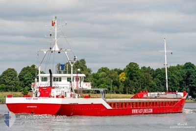
FLYING SPUR
General Cargo
Current Trip
| Trip Time | --- |
|---|---|
| Trip Distance | --- |
| AVG Speed | --- |
| MAX Speed | --- |
| Draught | --- |
| AVG Wind | --- |
| MAX Wind | --- |
| MIN Temp | --- |
| MAX Temp | --- |
| Position Received | 1 d ago |
Current Position
| Longitude | 28.64876° |
|---|---|
| Latitude | 44.10657° |
| Status | Under way using engine |
| Speed | 3.5 Knots |
| Course | 209.4° |
| Area | Black Sea |
| Station | T-AIS |
| Position Received | 1 d ago |
Info
Information
The current position of FLYING SPUR is in Black Sea with coordinates 44.10657° / 28.64876° as reported on 2024-06-19 03:52 by AIS to our vessel tracker app. The vessel's current speed is 3.5 Knots and is currently inside the port of MEDGIDIA.
The vessel FLYING SPUR (IMO: 9085455, MMSI: 341250001) is a General Cargo that was built in 1994 ( 30 years old ). It's sailing under the flag of [KN] St Kitts Nevis.
In this page you can find informations about the vessels current position, last detected port calls, and current voyage information. If the vessels is not in coverage by AIS you will find the latest position.
The current position of FLYING SPUR is detected by our AIS receivers and we are not responsible for the reliability of the data. The last position was recorded while the vessel was in Coverage by the Ais receivers of our vessel tracking app.
The current draught of FLYING SPUR as reported by AIS is 2.7 meters
Weather
| Temperature | 20.2°C / 68.36°F |
|---|---|
| Wind Speed | 5 knots |
| Direction | 200° SSW |
| Pressure | 1017.1 hPa |
| Humidity | 56.6 % |
| Cloud Coverage | 7 % |
Featured Company
Last Port Calls
| Port | Arrival | Departure | Time In Port |
|---|---|---|---|
| 2024-06-13 21:57 | |||
| 2024-05-29 10:21 | 2024-06-03 15:51 | 5 d | |
| 2024-05-25 09:04 | 2024-05-26 13:16 | 1 d | |
| 2024-05-19 23:17 | |||
| 2024-05-11 12:17 | |||
| 2024-04-25 04:10 | 2024-04-29 14:18 | 4 d | |
| 2024-04-15 13:59 | 2024-04-19 12:57 | 3 d |
Most Visited Ports (Last year)
| Port | Arrivals | |
|---|---|---|
| 3 | ||
| 2 | ||
| 2 | ||
| 1 | ||
| 1 | ||
| 1 |
Last Trips
| Origin | Departure | Destination | Arrival | Distance | |
|---|---|---|---|---|---|
| 2024-05-26 16:16 | 2024-05-29 13:21 | 633.24 nm | |||
| 2024-05-20 02:17 | 2024-05-25 12:04 | 543.02 nm | |||
| 2024-04-19 15:57 | 2024-04-25 07:10 | 469.68 nm | |||
| 2024-03-21 11:55 | 2024-04-15 16:59 | 1602.52 nm |
Events
| Time | Event | Details | Position / Dest | Info |
|---|---|---|---|---|
| 2024-06-19 07:01 | START Moving | 2.99 nm, South West of CONSTANTA |
44.10076 / 28.60948
MEDGIDIYA
|
Speed: 5.7 kn Course: 276° |
| 2024-06-19 04:33 | STOP Moving | 2.49 nm, South West of CONSTANTA |
44.10062 / 28.62296
MEDGIDIYA
|
Speed: 0.2 kn Course: -1° |
| 2024-06-19 03:57 | Status Changed | Default Under way using engine |
44.10184 / 28.64331
MEDGIDIYA
|
Speed: 3.5 kn Course: 209.4° |
| 2024-06-19 03:52 | OUT of Coverage |
44.10657 / 28.64876
Black Sea
|
Speed: 3.5 kn Course: 209.4° |
|
| 2024-06-19 03:09 | Draught Changed | 2.7 4.6 |
44.09064 / 28.71608
MEDGIDIYA
|
Speed: 9.2 kn Course: 329.1° |
| 2024-06-19 03:09 | Destination Changed | MEDGIDIYA RU NVS |
44.09064 / 28.71608
MEDGIDIYA
|
Speed: 9.2 kn Course: 329.1° |
| 2024-06-19 03:09 | ETA Changed | 2024/06/18 23:30 2024/06/10 12:00 |
44.09064 / 28.71608
MEDGIDIYA
|
Speed: 9.2 kn Course: 329.1° |
| 2024-06-19 03:07 | Change Sea Area | Romanian part of the Black Sea Russian part of the Black Sea |
44.08865 / 28.71820
Black Sea
|
Speed: 6.8 kn Course: 319.6° |
| 2024-06-19 03:06 | Status Changed | Under way using engine Default |
44.08712 / 28.72003
RU NVS
|
Speed: 4.4 kn Course: -1° |
| 2024-06-19 03:01 | IN Coverage |
44.08865 / 28.71820
Black Sea
|
Speed: 6.8 kn Course: 319.6° |