
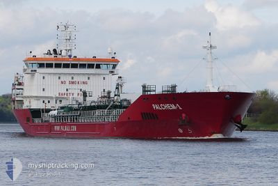
FMT GUMULDUR
Oil/Chemical Tanker
Current Trip
| Trip Time | 10 days |
|---|---|
| Trip Distance | 1445.41 nm |
| AVG Speed | 8.9 Knots |
| MAX Speed | 13.9 Knots |
| Draught | 6.2 m |
| AVG Wind | 9.5 knots |
| MAX Wind | 24 knots |
| MIN Temp | 18.5°C / 65.3°F |
| MAX Temp | 30.6°C / 87.08°F |
| Position Received | 7 d ago |
Current Position
| Longitude | 14.59364° |
|---|---|
| Latitude | 35.26733° |
| Status | Under way using engine |
| Speed | 8.3 Knots |
| Course | 127.9° |
| Area | Mediterranean Sea - Eastern Basin |
| Station | T-AIS |
| Position Received | 7 d ago |
Info
Information
The current position of FMT GUMULDUR is in Mediterranean Sea - Eastern Basin with coordinates 35.26733° / 14.59364° as reported on 2024-06-02 18:14 by AIS to our vessel tracker app. The vessel's current speed is 8.3 Knots and is currently inside the port of MARSA BREGA.
The vessel FMT GUMULDUR (IMO: 9427976, MMSI: 249955000) is a Oil/Chemical Tanker that was built in 2009 ( 15 years old ). It's sailing under the flag of [MT] Malta.
In this page you can find informations about the vessels current position, last detected port calls, and current voyage information. If the vessels is not in coverage by AIS you will find the latest position.
The current position of FMT GUMULDUR is detected by our AIS receivers and we are not responsible for the reliability of the data. The last position was recorded while the vessel was in Coverage by the Ais receivers of our vessel tracking app.
The current draught of FMT GUMULDUR as reported by AIS is 6.2 meters
Weather
| Temperature | 25.4°C / 77.72°F |
|---|---|
| Wind Speed | 2 knots |
| Direction | 267° W |
| Pressure | 1013.4 hPa |
| Humidity | 59.3 % |
| Cloud Coverage | --- |
Featured Company
Last Port Calls
| Port | Arrival | Departure | Time In Port |
|---|---|---|---|
| 2024-06-08 06:39 | |||
| 2024-05-26 20:34 | 2024-05-28 18:27 | 1 d | |
| 2024-05-20 21:05 | 2024-05-22 08:03 | 1 d | |
| 2024-05-17 04:50 | 2024-05-18 13:20 | 1 d |
Most Visited Ports (Last year)
| Port | Arrivals | |
|---|---|---|
| 3 | ||
| 3 | ||
| 2 | ||
| 2 | ||
| 2 | ||
| 2 |
Last Trips
| Origin | Departure | Destination | Arrival | Distance | |
|---|---|---|---|---|---|
| 2024-05-28 20:27 | 2024-06-08 08:39 | 1445.41 nm | |||
| 2024-05-22 10:03 | 2024-05-26 22:34 | 651.89 nm | |||
| 2024-05-18 15:20 | 2024-05-20 23:05 | 320.95 nm | |||
| 2024-03-28 11:21 | 2024-05-17 06:50 | 11158.18 nm |
Events
| Time | Event | Details | Position / Dest | Info |
|---|---|---|---|---|
| 2024-06-08 06:39 | PORT ARRIVAL |
|
30.41999 / 19.59237
[LY] MARSA BREGA
|
Speed: 6.8 kn Course: 169° |
| 2024-06-08 05:25 | START Moving | 6.98 nm, North of MARSA BREGA |
30.52805 / 19.61802
LY LMQ
|
Speed: 4.4 kn Course: 212° |
| 2024-06-02 18:14 | Status Changed | Default Under way using engine |
35.26662 / 14.59471
LY LMQ
|
Speed: 8.3 kn Course: 127.9° |
| 2024-06-02 18:14 | OUT of Coverage |
35.26733 / 14.59364
Mediterranean Sea - Eastern Basin
LY LMQ
|
Speed: 8.3 kn Course: 127.9° |
|
| 2024-06-02 17:37 | Detected in Sea | Maltese part of the Mediterranean Sea - Eastern Basin |
35.31771 / 14.51244
Mediterranean Sea - Eastern Basin
LY LMQ
|
Speed: 8.1 kn Course: 119.9° |
| 2024-06-02 17:37 | Status Changed | Under way using engine Default |
35.31771 / 14.51244
LY LMQ
|
Speed: 8.1 kn Course: 120° |
| 2024-06-02 17:21 | IN Coverage |
35.31771 / 14.51244
Mediterranean Sea - Eastern Basin
LY LMQ
|
Speed: 8.1 kn Course: 119.9° |
|
| 2024-06-01 23:05 | Status Changed | Default Under way using engine |
36.85015 / 12.37275
LY LMQ
|
Speed: 8.1 kn Course: 128.1° |
| 2024-06-01 23:04 | OUT of Coverage |
36.85104 / 12.37131
Mediterranean Sea - Eastern Basin
LY LMQ
|
Speed: 8.1 kn Course: 128.1° |
|
| 2024-06-01 22:49 | Status Changed | Under way using engine Default |
36.87258 / 12.33659
LY LMQ
|
Speed: 8.1 kn Course: 124° |