
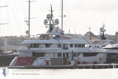
FOREVER YOU
Pleasure Craft
Current Trip
| Trip Time | 2 h, 29 mins |
|---|---|
| Trip Distance | 31.54 nm |
| AVG Speed | 12.1 Knots |
| MAX Speed | 13.8 Knots |
| Draught | 3.5 m |
| AVG Wind | 7.4 knots |
| MAX Wind | 8 knots |
| MIN Temp | 20.8°C / 69.44°F |
| MAX Temp | 21.3°C / 70.34°F |
| Position Received | 2 d ago |
Current Position
| Longitude | 14.51932° |
|---|---|
| Latitude | 35.88965° |
| Status | Moored |
| Speed | |
| Course | 250° |
| Area | Mediterranean Sea - Eastern Basin |
| Station | T-AIS |
| Position Received | 2 d ago |
Info
Information
The current position of FOREVER YOU is in Mediterranean Sea - Eastern Basin with coordinates 35.88965° / 14.51932° as reported on 2024-05-29 11:47 by AIS to our vessel tracker app. The vessel's current speed is 0 Knots and is currently inside the port of VALLETTA.
The vessel FOREVER YOU (IMO: 9658721, MMSI: 319072200) is a Pleasure Craft It's sailing under the flag of [KY] Cayman Is.
In this page you can find informations about the vessels current position, last detected port calls, and current voyage information. If the vessels is not in coverage by AIS you will find the latest position.
The current position of FOREVER YOU is detected by our AIS receivers and we are not responsible for the reliability of the data. The last position was recorded while the vessel was in Coverage by the Ais receivers of our vessel tracking app.
The current draught of FOREVER YOU as reported by AIS is 3.5 meters
Weather
| Temperature | 22.6°C / 72.68°F |
|---|---|
| Wind Speed | 6 knots |
| Direction | 286° WNW |
| Pressure | 1014.8 hPa |
| Humidity | 60.5 % |
| Cloud Coverage | 34 % |
Featured Company
Events
| Time | Event | Details | Position / Dest | Info |
|---|---|---|---|---|
| 2024-05-29 11:47 | OUT of Coverage |
35.88965 / 14.51932
Mediterranean Sea - Eastern Basin
[MT] VALLETTA
|
Speed: Course: 250° |
|
| 2024-05-29 10:43 | IN Coverage |
35.88971 / 14.51935
Mediterranean Sea - Eastern Basin
[MT] VALLETTA
|
Speed: Course: 250° |
|
| 2024-05-24 07:52 | OUT of Coverage |
35.89130 / 14.51527
Mediterranean Sea - Eastern Basin
[MT] VALLETTA
|
Speed: 3.2 kn Course: 122.7° |
|
| 2024-05-24 07:22 | PORT ARRIVAL |
|
35.90113 / 14.52577
[MT] VALLETTA
|
Speed: 6.1 kn Course: 246.9° |
| 2024-05-24 05:06 | ETA Changed | 2024/05/24 10:30 2024/05/21 10:30 |
35.91744 / 14.55503
MTMLA
|
Speed: 12.9 kn Course: 50° |
| 2024-05-24 05:02 | Status Changed | Under way using engine Moored |
35.90877 / 14.54227
MTMLA
|
Speed: 11.4 kn Course: 51.4° |
| 2024-05-24 04:58 | IN Coverage |
35.90247 / 14.53190
Mediterranean Sea - Eastern Basin
|
Speed: 10.3 kn Course: 72.3° |
|
| 2024-05-24 04:53 | PORT DEPARTURE |
|
35.90247 / 14.53190
MTMLA
|
Speed: Course: 249° |
| 2024-05-23 09:17 | OUT of Coverage |
35.88957 / 14.51933
Mediterranean Sea - Eastern Basin
[MT] VALLETTA
|
Speed: Course: 249° |
|
| 2024-05-23 09:17 | IN Coverage |
35.88957 / 14.51933
Mediterranean Sea - Eastern Basin
[MT] VALLETTA
|
Speed: Course: 249° |