
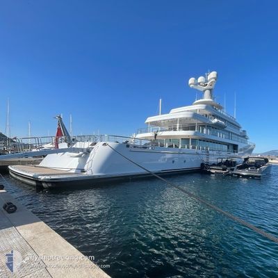
FOUNTAINHEAD
Yacht
Current Trip
| Time Travelled | 15 days |
|---|---|
| Remaining Time | 4 h, 23 mins |
| Distance Travelled | 524.08 nm |
| Remaining Distance | 75.15 nm |
| AVG Speed | 14.9 Knots |
| MAX Speed | 16.9 Knots |
| AVG Wind | 5.7 knots |
| MAX Wind | 17 knots |
| MIN Temp | 12.6°C / 54.68°F |
| MAX Temp | 26.5°C / 79.7°F |
| Draught | 4.2 m |
| Position Received | Now |
Current Position
| Longitude | 8.96883° |
|---|---|
| Latitude | 44.14427° |
| Status | Under way using engine |
| Speed | 16.5 Knots |
| Course | 248.2° |
| Area | Ligurian Sea |
| Station | T-AIS |
| Position Received | Now |
Info
Information
The current position of FOUNTAINHEAD is in Ligurian Sea with coordinates 44.14427° / 8.96883° as reported on 2024-06-06 17:35 by AIS to our vessel tracker app. The vessel's current speed is 16.5 Knots and is heading at the port of MONACO. The estimated time of arrival as calculated by vessel tracking app is 2024-06-06 21:59 LT
The vessel FOUNTAINHEAD (IMO: 1010753, MMSI: 319028100) is a Yacht that was built in 2011 ( 13 years old ). It's sailing under the flag of [KY] Cayman Is.
In this page you can find informations about the vessels current position, last detected port calls, and current voyage information. If the vessels is not in coverage by AIS you will find the latest position.
The current position of FOUNTAINHEAD is detected by our AIS receivers and we are not responsible for the reliability of the data. The last position was recorded while the vessel was in Coverage by the Ais receivers of our vessel tracking app.
The current draught of FOUNTAINHEAD as reported by AIS is 4.2 meters
Weather
| Temperature | 20.5°C / 68.9°F |
|---|---|
| Wind Speed | 6 knots |
| Direction | 118° ESE |
| Pressure | 1018.3 hPa |
| Humidity | 79.3 % |
| Cloud Coverage | 48 % |
Featured Company
Most Visited Ports (Last year)
| Port | Arrivals | |
|---|---|---|
| 6 | ||
| 2 | ||
| 1 | ||
| 1 | ||
| 1 | ||
| 1 |
Events
| Time | Event | Details | Position / Dest | Info |
|---|---|---|---|---|
| 2024-06-06 16:45 | Destination Changed | MONACO PORTOFINO |
44.27064 / 9.21274
MONACO
|
Speed: 16.6 kn Course: 235.2° |
| 2024-06-06 16:45 | ETA Changed | 2024/06/06 22:08 2024/06/06 10:30 |
44.27064 / 9.21274
MONACO
|
Speed: 16.6 kn Course: 235.2° |
| 2024-06-06 16:40 | IN Coverage |
44.28926 / 9.23275
Ligurian Sea
|
Speed: 16.5 kn Course: 199.5° |
|
| 2024-06-06 10:26 | OUT of Coverage |
44.29500 / 9.23262
Ligurian Sea
PORTOFINO
|
Speed: 15.7 kn Course: 35.9° |
|
| 2024-06-06 09:43 | Destination Changed | PORTOFINO VARAZZE |
44.29798 / 8.98678
PORTOFINO
|
Speed: 15.5 kn Course: 98.7° |
| 2024-06-06 09:43 | ETA Changed | 2024/06/06 10:30 2024/06/06 00:30 |
44.29798 / 8.98678
PORTOFINO
|
Speed: 15.5 kn Course: 98.7° |
| 2024-06-06 08:32 | IN Coverage |
44.35001 / 8.58228
Ligurian Sea
|
Speed: 4.2 kn Course: 85.1° |
|
| 2024-06-06 04:07 | OUT of Coverage |
44.35007 / 8.58030
Ligurian Sea
VARAZZE
|
Speed: Course: 93.6° |
|
| 2024-06-06 04:07 | IN Coverage |
44.35007 / 8.58030
Ligurian Sea
VARAZZE
|
Speed: Course: 93.6° |
|
| 2024-06-06 02:25 | OUT of Coverage |
44.35006 / 8.58027
Ligurian Sea
VARAZZE
|
Speed: Course: 93.6° |