
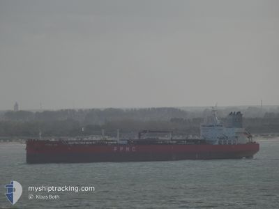
FPMC 35
Tanker C
Current Trip
| Time Travelled | 2 days |
|---|---|
| Remaining Time | --- |
| Distance Travelled | 746.79 nm |
| Remaining Distance | --- |
| AVG Speed | 12.3 Knots |
| MAX Speed | 14.3 Knots |
| AVG Wind | 20 knots |
| MAX Wind | 28.9 knots |
| MIN Temp | 12.6°C / 54.68°F |
| MAX Temp | 16.3°C / 61.34°F |
| Draught | 11.8 m |
| Position Received | 1 d ago |
Current Position
| Longitude | -4.05527° |
|---|---|
| Latitude | 49.63222° |
| Status | Under way using engine |
| Speed | 13.1 Knots |
| Course | 236.1° |
| Area | English Channel |
| Station | T-AIS |
| Position Received | 1 d ago |
Info
Information
The current position of FPMC 35 is in English Channel with coordinates 49.63222° / -4.05527° as reported on 2024-06-14 21:35 by AIS to our vessel tracker app. The vessel's current speed is 13.1 Knots and is heading at the port of BUENOS AIRES. The estimated time of arrival as calculated by vessel tracking app is 2024-07-02 18:00 LT
The vessel FPMC 35 (IMO: 9845178, MMSI: 636018727) is a Tanker C It's sailing under the flag of [LR] Liberia.
In this page you can find informations about the vessels current position, last detected port calls, and current voyage information. If the vessels is not in coverage by AIS you will find the latest position.
The current position of FPMC 35 is detected by our AIS receivers and we are not responsible for the reliability of the data. The last position was recorded while the vessel was in Coverage by the Ais receivers of our vessel tracking app.
The current draught of FPMC 35 as reported by AIS is 11.8 meters
Weather
| Temperature | 16.3°C / 61.34°F |
|---|---|
| Wind Speed | 22 knots |
| Direction | 243° WSW |
| Pressure | 1010.3 hPa |
| Humidity | 95 % |
| Cloud Coverage | 100 % |
Featured Company
Last Port Calls
| Port | Arrival | Departure | Time In Port |
|---|---|---|---|
| 2024-06-13 14:54 | 2024-06-13 15:42 | 48 m | |
| 2024-06-07 17:59 | 2024-06-13 14:00 | 5 d | |
| 2024-06-01 07:48 | 2024-06-04 20:55 | 3 d | |
| 2024-05-30 15:20 | 2024-05-31 16:26 | 1 d | |
| 2024-05-25 19:11 | 2024-05-27 19:19 | 2 d | |
| 2024-05-23 10:59 | 2024-05-24 09:46 | 22 h | |
| 2024-05-22 11:55 | 2024-05-23 10:24 | 22 h | |
| 2024-04-24 05:14 | 2024-04-27 20:23 | 3 d | |
| 2024-04-18 12:10 | 2024-04-22 12:14 | 4 d | |
| 2024-04-14 07:50 | 2024-04-16 20:09 | 2 d |
Last Trips
| Origin | Departure | Destination | Arrival | Distance | |
|---|---|---|---|---|---|
| 2024-06-13 16:00 | 2024-06-13 16:54 | 4.71 nm | |||
| 2024-06-04 22:55 | 2024-06-07 19:59 | 115.98 nm | |||
| 2024-05-31 17:26 | 2024-06-01 09:48 | 181.66 nm | |||
| 2024-05-27 20:19 | 2024-05-30 16:20 | 247.32 nm | |||
| 2024-05-24 10:46 | 2024-05-25 20:11 | 259.68 nm | |||
| 2024-05-23 11:24 | 2024-05-23 11:59 | 1.69 nm | |||
| 2024-04-27 15:23 | 2024-05-22 12:55 | 5133.13 nm | |||
| 2024-04-22 07:14 | 2024-04-24 00:14 | 433.40 nm | |||
| 2024-04-16 15:09 | 2024-04-18 07:10 | 481.62 nm | |||
| 2024-04-02 06:29 | 2024-04-14 02:50 | 2318.38 nm |
Events
| Time | Event | Details | Position / Dest | Info |
|---|---|---|---|---|
| 2024-06-14 21:41 | Status Changed | Default Under way using engine |
49.62071 / -4.08240
ARBUE
|
Speed: 13.1 kn Course: 236.1° |
| 2024-06-14 21:35 | OUT of Coverage |
49.63222 / -4.05527
English Channel
ARBUE
|
Speed: 13.1 kn Course: 236.1° |
|
| 2024-06-14 21:15 | Status Changed | Under way using engine Default |
49.67181 / -3.96204
ARBUE
|
Speed: 13.2 kn Course: 237° |
| 2024-06-14 21:03 | IN Coverage |
49.66974 / -3.96680
English Channel
ARBUE
|
Speed: 13.1 kn Course: 236.5° |
|
| 2024-06-14 19:59 | Status Changed | Default Under way using engine |
49.82798 / -3.59361
ARBUE
|
Speed: 14.1 kn Course: 238.5° |
| 2024-06-14 19:51 | OUT of Coverage |
49.84544 / -3.54994
English Channel
ARBUE
|
Speed: 14.1 kn Course: 238.5° |
|
| 2024-06-14 19:35 | Change Sea Area | United Kingdom part of the English Channel Guernsey part of the English Channel |
49.87377 / -3.46749
English Channel
ARBUE
|
Speed: 14.1 kn Course: 253.9° |
| 2024-06-14 19:35 | Status Changed | Under way using engine Default |
49.87377 / -3.46749
ARBUE
|
Speed: 14 kn Course: 253° |
| 2024-06-14 19:31 | IN Coverage |
49.87377 / -3.46749
English Channel
ARBUE
|
Speed: 14.1 kn Course: 253.9° |
|
| 2024-06-14 17:26 | OUT of Coverage |
50.02492 / -2.71806
English Channel
ARBUE
|
Speed: 13.9 kn Course: 258.6° |