
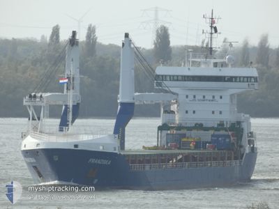
FRANZISKA
General Cargo
Current Trip
USMOB
| Time Travelled | 9 days |
|---|---|
| Remaining Time | --- |
| Distance Travelled | 2780.94 nm |
| Remaining Distance | --- |
| AVG Speed | 12.7 Knots |
| MAX Speed | 15.4 Knots |
| AVG Wind | 7.2 knots |
| MAX Wind | 12.5 knots |
| MIN Temp | 18.2°C / 64.76°F |
| MAX Temp | 28.3°C / 82.94°F |
| Draught | 5.8 m |
| Position Received | 10 h, 13 m ago |
Current Position
| Longitude | -46.23299° |
|---|---|
| Latitude | 35.83935° |
| Status | Under way using engine |
| Speed | 12.4 Knots |
| Course | 67.8° |
| Area | North Atlantic Ocean |
| Station | T-AIS |
| Position Received | 10 h, 13 m ago |
Info
Information
The current position of FRANZISKA is in North Atlantic Ocean with coordinates 35.83935° / -46.23299° as reported on 2024-06-01 03:11 by AIS to our vessel tracker app. The vessel's current speed is 12.4 Knots
The vessel FRANZISKA (IMO: 9535618, MMSI: 305700000) is a General Cargo that was built in 2011 ( 13 years old ). It's sailing under the flag of [AG] Antigua Barbuda.
In this page you can find informations about the vessels current position, last detected port calls, and current voyage information. If the vessels is not in coverage by AIS you will find the latest position.
The current position of FRANZISKA is detected by our AIS receivers and we are not responsible for the reliability of the data. The last position was recorded while the vessel was in Coverage by the Ais receivers of our vessel tracking app.
The current draught of FRANZISKA as reported by AIS is 5.8 meters
Weather
| Temperature | 19.7°C / 67.46°F |
|---|---|
| Wind Speed | 10 knots |
| Direction | 309° NW |
| Pressure | 1021 hPa |
| Humidity | 82.8 % |
| Cloud Coverage | 57 % |
Featured Company
Last Port Calls
| Port | Arrival | Departure | Time In Port |
|---|---|---|---|
| 2024-05-20 10:30 | 2024-05-23 08:38 | 2 d | |
| 2024-05-14 22:30 | 2024-05-16 00:28 | 1 d | |
| 2024-05-06 20:51 | 2024-05-11 05:01 | 4 d | |
| 2024-04-12 18:06 | 2024-04-16 22:04 | 4 d | |
| 2024-04-12 17:13 | 2024-04-12 17:43 | 29 m | |
| 2024-04-11 11:05 | 2024-04-11 18:56 | 7 h | |
| 2024-04-06 10:01 | 2024-04-10 12:52 | 4 d |
Last Trips
| Origin | Departure | Destination | Arrival | Distance | |
|---|---|---|---|---|---|
| 2024-05-15 19:28 | 2024-05-20 05:30 | 809.01 nm | |||
| 2024-05-11 00:01 | 2024-05-14 17:30 | 512.67 nm | |||
| 2024-04-16 23:04 | 2024-05-06 15:51 | 5224.36 nm | |||
| 2024-04-12 18:43 | 2024-04-12 19:06 | 1.35 nm | |||
| 2024-04-11 20:56 | 2024-04-12 18:13 | 272.50 nm | |||
| 2024-04-10 14:52 | 2024-04-11 13:05 | 222.39 nm | |||
| 2024-03-24 04:30 | 2024-04-06 12:01 | 3364.07 nm |
Events
| Time | Event | Details | Position / Dest | Info |
|---|---|---|---|---|
| 2024-06-01 03:26 | Status Changed | Default Under way using engine |
35.85136 / -46.16892
USMOB
|
Speed: 12.4 kn Course: 67.8° |
| 2024-06-01 03:11 | Change Sea Area | High seas of the North Atlantic Ocean Bahamas part of the North Atlantic Ocean |
35.83935 / -46.23299
North Atlantic Ocean
|
Speed: 12.4 kn Course: 67.8° |
| 2024-06-01 03:11 | Status Changed | Under way using engine Default |
35.83935 / -46.23299
USMOB
|
Speed: 12.8 kn Course: 75° |
| 2024-06-01 03:11 | IN Coverage |
35.83935 / -46.23299
North Atlantic Ocean
|
Speed: 12.4 kn Course: 67.8° |
|
| 2024-06-01 03:11 | OUT of Coverage |
35.83935 / -46.23299
North Atlantic Ocean
|
Speed: 12.4 kn Course: 67.8° |
|
| 2024-05-26 15:40 | OUT of Coverage |
26.19161 / -76.32968
North Atlantic Ocean
|
Speed: 12.7 kn Course: 61.8° |
|
| 2024-05-26 13:27 | Status Changed | Under way using engine Default |
25.95691 / -76.78287
USMOB
|
Speed: 12.7 kn Course: 60° |
| 2024-05-26 13:27 | IN Coverage |
25.95920 / -76.77833
North Atlantic Ocean
|
Speed: 12.6 kn Course: 59.2° |
|
| 2024-05-26 04:44 | Status Changed | Default Under way using engine |
26.11574 / -78.68958
USMOB
|
Speed: 12.6 kn Course: 98.7° |
| 2024-05-26 04:41 | OUT of Coverage |
26.11673 / -78.70189
North Atlantic Ocean
|
Speed: 12.6 kn Course: 98.7° |