
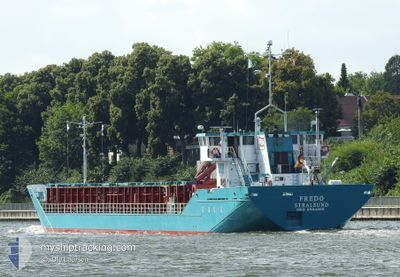
FREDO
General Cargo
Current Trip
| Time Travelled | 20 h, 1 mins |
|---|---|
| Remaining Time | 50 mins |
| Distance Travelled | 77.91 nm |
| Remaining Distance | 14.11 nm |
| AVG Speed | 7.9 Knots |
| MAX Speed | 12.4 Knots |
| AVG Wind | 8.2 knots |
| MAX Wind | 10 knots |
| MIN Temp | 13.5°C / 56.3°F |
| MAX Temp | 22.8°C / 73.04°F |
| Draught | 3.8 m |
| Position Received | 1 m ago |
Current Position
| Longitude | 9.60550° |
|---|---|
| Latitude | 53.59002° |
| Status | Under way using engine |
| Speed | 10.8 Knots |
| Course | 130° |
| Area | North Sea |
| Station | T-AIS |
| Position Received | 1 m ago |
Info
Information
The current position of FREDO is in North Sea with coordinates 53.59002° / 9.60550° as reported on 2024-06-01 19:07 by AIS to our vessel tracker app. The vessel's current speed is 10.8 Knots and is heading at the port of HAMBURG. The estimated time of arrival as calculated by vessel tracking app is 2024-06-01 19:58 LT
The vessel FREDO (IMO: 8504208, MMSI: 211202400) is a General Cargo that was built in 1985 ( 39 years old ). It's sailing under the flag of [DE] Germany.
In this page you can find informations about the vessels current position, last detected port calls, and current voyage information. If the vessels is not in coverage by AIS you will find the latest position.
The current position of FREDO is detected by our AIS receivers and we are not responsible for the reliability of the data. The last position was recorded while the vessel was in Coverage by the Ais receivers of our vessel tracking app.
The current draught of FREDO as reported by AIS is 3.8 meters
Weather
| Temperature | 17.8°C / 64.04°F |
|---|---|
| Wind Speed | 5 knots |
| Direction | 350° N |
| Pressure | 1014.9 hPa |
| Humidity | 92.1 % |
| Cloud Coverage | 85 % |
Featured Company
Last Port Calls
| Port | Arrival | Departure | Time In Port |
|---|---|---|---|
| 2024-05-31 22:20 | 2024-05-31 23:07 | 46 m | |
| 2024-05-30 20:37 | 2024-05-31 15:46 | 19 h | |
| 2024-05-28 14:04 | 2024-05-30 12:09 | 1 d | |
| 2024-05-24 19:53 | 2024-05-27 23:38 | 3 d | |
| 2024-05-24 00:30 | 2024-05-24 15:56 | 15 h | |
| 2024-05-18 18:36 | 2024-05-23 03:48 | 4 d | |
| 2024-05-16 11:36 | 2024-05-17 05:38 | 18 h | |
| 2024-05-15 13:24 | 2024-05-15 13:28 | 3 m | |
| 2024-05-11 01:04 | 2024-05-14 19:51 | 3 d | |
| 2024-05-09 05:15 | 2024-05-09 11:56 | 6 h |
Most Visited Ports (Last year)
| Port | Arrivals | |
|---|---|---|
| 25 | ||
| 16 | ||
| 15 | ||
| 14 | ||
| 13 | ||
| 11 |
Last Trips
| Origin | Departure | Destination | Arrival | Distance | |
|---|---|---|---|---|---|
| 2024-05-31 17:46 | 2024-06-01 00:20 | 56.95 nm | |||
| 2024-05-30 14:09 | 2024-05-30 22:37 | 59.81 nm | |||
| 2024-05-28 01:38 | 2024-05-28 16:04 | 101.78 nm | |||
| 2024-05-24 17:56 | 2024-05-24 21:53 | 34.33 nm | |||
| 2024-05-23 05:48 | 2024-05-24 02:30 | 163.07 nm | |||
| 2024-05-17 07:38 | 2024-05-18 20:36 | 298.48 nm | |||
| 2024-05-15 15:28 | 2024-05-16 13:36 | 176.19 nm | |||
| 2024-05-14 21:51 | 2024-05-15 15:24 | 122.08 nm | |||
| 2024-05-09 13:56 | 2024-05-11 03:04 | 300.99 nm | |||
| 2024-05-08 17:25 | 2024-05-09 07:15 | 125.06 nm |
Events
| Time | Event | Details | Position / Dest | Info |
|---|---|---|---|---|
| 2024-06-01 16:49 | START Moving | 0.88 nm, South West of BRUNSBUETTEL |
53.89078 / 9.14607
DEHAM
|
Speed: 4.8 kn Course: 220° |
| 2024-06-01 16:29 | STOP Moving | 0.77 nm, South West of BRUNSBUETTEL |
53.89228 / 9.14827
DEHAM
|
Speed: 0.2 kn Course: 218° |
| 2024-06-01 16:27 | Change Sea Area | German part of the North Sea German part of the Baltic Sea |
53.89272 / 9.14881
North Sea
DEHAM
|
Speed: 2 kn Course: 217.5° |
| 2024-06-01 15:00 | Status Changed | Under way using engine Default |
53.99713 / 9.29075
DEHAM
|
Speed: 6.6 kn Course: 190° |
| 2024-06-01 14:52 | Status Changed | Default Under way using engine |
54.01224 / 9.29591
DEHAM
|
Speed: 6.6 kn Course: 189.1° |
| 2024-06-01 14:46 | IN Coverage |
54.02256 / 9.29864
Baltic Sea
DEHAM
|
Speed: 6.6 kn Course: 188.6° |
|
| 2024-06-01 14:46 | Status Changed | Under way using engine Default |
54.02314 / 9.29878
DEHAM
|
Speed: 6.6 kn Course: 189° |
| 2024-06-01 13:29 | Status Changed | Default Under way using engine |
54.15213 / 9.36950
DEHAM
|
Speed: 6.7 kn Course: 242.3° |
| 2024-06-01 13:26 | OUT of Coverage |
54.15541 / 9.37899
Baltic Sea
DEHAM
|
Speed: 6.7 kn Course: 242.3° |
|
| 2024-06-01 10:59 | START Moving | 0.2 nm, South West of AUDORF |
54.31645 / 9.71154
DEHAM
|
Speed: 3.1 kn Course: 173° |