
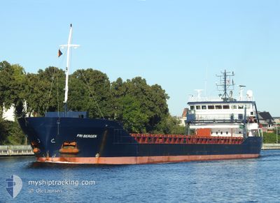
FRI BERGEN
General Cargo
Current Trip
| Time Travelled | 19 h, 17 mins |
|---|---|
| Remaining Time | 2 days |
| Distance Travelled | 171.21 nm |
| Remaining Distance | 492.32 nm |
| AVG Speed | 9 Knots |
| MAX Speed | 11.1 Knots |
| AVG Wind | 12.2 knots |
| MAX Wind | 19.1 knots |
| MIN Temp | 10.6°C / 51.08°F |
| MAX Temp | 14.2°C / 57.56°F |
| Draught | 6.4 m |
| Position Received | 3 h, 5 m ago |
Current Position
| Longitude | -5.58224° |
|---|---|
| Latitude | 52.35663° |
| Status | Under way using engine |
| Speed | 9.7 Knots |
| Course | 199.3° |
| Area | Irish Sea and St. George's Channel |
| Station | T-AIS |
| Position Received | 3 h, 5 m ago |
Info
Information
The current position of FRI BERGEN is in Irish Sea and St. George's Channel with coordinates 52.35663° / -5.58224° as reported on 2024-06-01 09:23 by AIS to our vessel tracker app. The vessel's current speed is 9.7 Knots and is heading at the port of ANTWERP. The estimated time of arrival as calculated by vessel tracking app is 2024-06-03 15:22 LT
The vessel FRI BERGEN (IMO: 9361122, MMSI: 257561000) is a General Cargo that was built in 2009 ( 15 years old ). It's sailing under the flag of [NO] Norway.
In this page you can find informations about the vessels current position, last detected port calls, and current voyage information. If the vessels is not in coverage by AIS you will find the latest position.
The current position of FRI BERGEN is detected by our AIS receivers and we are not responsible for the reliability of the data. The last position was recorded while the vessel was in Coverage by the Ais receivers of our vessel tracking app.
The current draught of FRI BERGEN as reported by AIS is 6.4 meters
Weather
| Temperature | 11.6°C / 52.88°F |
|---|---|
| Wind Speed | 11 knots |
| Direction | 12° NNE |
| Pressure | 1029.8 hPa |
| Humidity | 88.5 % |
| Cloud Coverage | 87 % |
Featured Company
Last Port Calls
| Port | Arrival | Departure | Time In Port |
|---|---|---|---|
| 2024-05-31 16:24 | 2024-05-31 17:12 | 47 m | |
| 2024-05-31 15:24 | 2024-05-31 15:56 | 32 m | |
| 2024-05-29 19:22 | 2024-05-31 14:33 | 1 d | |
| 2024-05-29 18:20 | 2024-05-29 18:41 | 20 m | |
| 2024-05-29 17:18 | 2024-05-29 17:59 | 41 m | |
| 2024-05-28 00:40 | 2024-05-29 13:39 | 1 d | |
| 2024-05-14 13:15 | 2024-05-15 15:39 | 1 d | |
| 2024-05-04 20:41 | 2024-05-07 18:55 | 2 d | |
| 2024-04-24 07:20 | 2024-04-25 07:20 | 1 d | |
| 2024-04-18 10:36 | 2024-04-19 16:42 | 1 d |
Most Visited Ports (Last year)
| Port | Arrivals | |
|---|---|---|
| 4 | ||
| 2 | ||
| 2 | ||
| 2 | ||
| 2 | ||
| 2 |
Last Trips
| Origin | Departure | Destination | Arrival | Distance | |
|---|---|---|---|---|---|
| 2024-05-31 16:56 | 2024-05-31 17:24 | 1.52 nm | |||
| 2024-05-31 15:33 | 2024-05-31 16:24 | 4.56 nm | |||
| 2024-05-29 19:41 | 2024-05-29 20:22 | 4.32 nm | |||
| 2024-05-29 18:59 | 2024-05-29 19:20 | 2.20 nm | |||
| 2024-05-29 14:39 | 2024-05-29 18:18 | 7.12 nm | |||
| 2024-05-15 17:39 | 2024-05-28 01:40 | 2399.61 nm | |||
| 2024-05-07 19:55 | 2024-05-14 15:15 | 1651.19 nm | |||
| 2024-04-25 09:20 | 2024-05-04 21:41 | 1020.38 nm | |||
| 2024-04-19 18:42 | 2024-04-24 09:20 | 1114.29 nm | |||
| 2024-04-16 19:07 | 2024-04-18 12:36 | 161.73 nm |
Events
| Time | Event | Details | Position / Dest | Info |
|---|---|---|---|---|
| 2024-06-01 09:25 | Status Changed | Default Under way using engine |
52.35110 / -5.58518
BEANR
|
Speed: 9.7 kn Course: 199.3° |
| 2024-06-01 09:23 | Status Changed | Under way using engine Default |
52.35663 / -5.58224
BEANR
|
Speed: 9.9 kn Course: 198° |
| 2024-06-01 09:23 | OUT of Coverage |
52.35663 / -5.58224
Irish Sea and St. George's Channel
|
Speed: 9.7 kn Course: 199.3° |
|
| 2024-06-01 09:23 | Change Sea Area | Irish part of the Irish Sea and St. George's Channel United Kingdom part of the Irish Sea and St. George's Channel |
52.35663 / -5.58224
Irish Sea and St. George's Channel
|
Speed: 9.7 kn Course: 199.3° |
| 2024-06-01 09:04 | IN Coverage |
52.35663 / -5.58224
Irish Sea and St. George's Channel
|
Speed: 9.7 kn Course: 199.3° |
|
| 2024-06-01 06:19 | Status Changed | Default Under way using engine |
52.83294 / -5.27148
BEANR
|
Speed: 9.6 kn Course: 198.8° |
| 2024-06-01 06:15 | OUT of Coverage |
52.84264 / -5.26566
Irish Sea and St. George's Channel
|
Speed: 9.6 kn Course: 198.8° |
|
| 2024-06-01 06:15 | Status Changed | Under way using engine Default |
52.84391 / -5.26494
BEANR
|
Speed: 9.5 kn Course: 200° |
| 2024-06-01 06:04 | IN Coverage |
52.84264 / -5.26566
Irish Sea and St. George's Channel
|
Speed: 9.6 kn Course: 198.8° |
|
| 2024-06-01 03:45 | OUT of Coverage |
53.16216 / -5.06342
Irish Sea and St. George's Channel
|
Speed: 7.3 kn Course: 202.9° |