
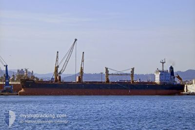
FRIEDERIKE
Cargo
Current Trip
| Time Travelled | 30 days |
|---|---|
| Remaining Time | --- |
| Distance Travelled | 2196.54 nm |
| Remaining Distance | --- |
| AVG Speed | 9.6 Knots |
| MAX Speed | 23.7 Knots |
| AVG Wind | 12.7 knots |
| MAX Wind | 28.6 knots |
| MIN Temp | 14.8°C / 58.64°F |
| MAX Temp | 36.1°C / 96.98°F |
| Draught | 12.3 m |
| Position Received | 22 d ago |
Current Position
| Longitude | 35.31555° |
|---|---|
| Latitude | 25.95578° |
| Status | Under way using engine |
| Speed | 8.6 Knots |
| Course | 144° |
| Area | Red Sea |
| Station | T-AIS |
| Position Received | 22 d ago |
Info
Information
The current position of FRIEDERIKE is in Red Sea with coordinates 25.95578° / 35.31555° as reported on 2024-05-28 16:44 by AIS to our vessel tracker app. The vessel's current speed is 8.6 Knots and is heading at the port of YANBU.
The vessel FRIEDERIKE (IMO: 9436769, MMSI: 538004370) is a Cargo It's sailing under the flag of [MH] Marshall Is.
In this page you can find informations about the vessels current position, last detected port calls, and current voyage information. If the vessels is not in coverage by AIS you will find the latest position.
The current position of FRIEDERIKE is detected by our AIS receivers and we are not responsible for the reliability of the data. The last position was recorded while the vessel was in Coverage by the Ais receivers of our vessel tracking app.
The current draught of FRIEDERIKE as reported by AIS is 12.3 meters
Weather
| Temperature | 29.8°C / 85.64°F |
|---|---|
| Wind Speed | 15 knots |
| Direction | 333° NNW |
| Pressure | 1002.4 hPa |
| Humidity | 78.3 % |
| Cloud Coverage | 5 % |
Featured Company
Last Port Calls
| Port | Arrival | Departure | Time In Port |
|---|---|---|---|
| 2024-05-27 03:07 | 2024-05-27 13:44 | 10 h | |
| 2024-05-16 22:52 | 2024-05-20 13:48 | 3 d | |
| 2024-04-20 05:45 | 2024-04-26 09:26 | 6 d | |
| 2024-04-01 08:45 | 2024-04-06 15:05 | 5 d |
Most Visited Ports (Last year)
| Port | Arrivals | |
|---|---|---|
| 3 | ||
| 2 | ||
| 2 | ||
| 1 | ||
| 1 | ||
| 1 |
Last Trips
Events
| Time | Event | Details | Position / Dest | Info |
|---|---|---|---|---|
| 2024-06-19 20:08 | STOP Moving |
23.83027 / 37.46105
SA YNB
|
Speed: 0.2 kn Course: 308° |
|
| 2024-06-19 18:32 | START Moving |
23.72113 / 37.58333
SA YNB
|
Speed: 3.7 kn Course: 5° |
|
| 2024-06-17 13:01 | STOP Moving |
23.94755 / 37.27855
SA YNB
|
Speed: 0.3 kn Course: 27° |
|
| 2024-06-17 04:41 | START Moving |
23.67822 / 37.56515
SA YNB
|
Speed: 5.2 kn Course: 326° |
|
| 2024-06-13 06:57 | STOP Moving |
23.95060 / 37.37550
SA YNB
|
Speed: 0.3 kn Course: 246° |
|
| 2024-06-13 04:13 | START Moving |
23.65675 / 37.39923
SA YNB
|
Speed: 3.8 kn Course: 355° |
|
| 2024-06-12 07:20 | STOP Moving |
23.84635 / 37.37830
SA YNB
|
Speed: 0.3 kn Course: 242° |
|
| 2024-06-12 04:12 | START Moving |
23.55943 / 37.35354
SA YNB
|
Speed: 3.6 kn Course: 10° |
|
| 2024-06-11 01:54 | STOP Moving |
23.74923 / 37.15208
SA YNB
|
Speed: 0.3 kn Course: 11° |
|
| 2024-06-10 22:57 | START Moving |
23.51810 / 37.48863
SA YNB
|
Speed: 3.9 kn Course: 299° |