
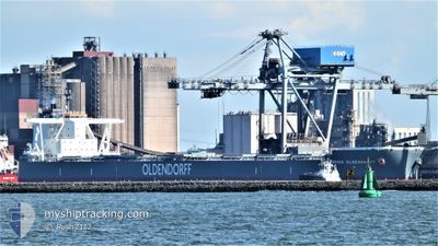
FRIEDRICH OLDENDORFF
Cargo
Current Trip
| Time Travelled | 6 days |
|---|---|
| Remaining Time | --- |
| Distance Travelled | 1625.25 nm |
| Remaining Distance | --- |
| AVG Speed | 10.8 Knots |
| MAX Speed | 13.2 Knots |
| AVG Wind | 14.7 knots |
| MAX Wind | 26.1 knots |
| MIN Temp | 6.7°C / 44.06°F |
| MAX Temp | 13.8°C / 56.84°F |
| Draught | 18.3 m |
| Position Received | 1 d ago |
Current Position
| Longitude | -5.51403° |
|---|---|
| Latitude | 52.74426° |
| Status | Under way using engine |
| Speed | 11.5 Knots |
| Course | 186.1° |
| Area | Irish Sea and St. George's Channel |
| Station | T-AIS |
| Position Received | 1 d ago |
Info
Information
The current position of FRIEDRICH OLDENDORFF is in Irish Sea and St. George's Channel with coordinates 52.74426° / -5.51403° as reported on 2024-05-30 22:49 by AIS to our vessel tracker app. The vessel's current speed is 11.5 Knots and is heading at the port of ABU DHABI. The estimated time of arrival as calculated by vessel tracking app is 2024-07-12 12:00 LT
The vessel FRIEDRICH OLDENDORFF (IMO: 9889265, MMSI: 374052000) is a Cargo It's sailing under the flag of [PA] Panama.
In this page you can find informations about the vessels current position, last detected port calls, and current voyage information. If the vessels is not in coverage by AIS you will find the latest position.
The current position of FRIEDRICH OLDENDORFF is detected by our AIS receivers and we are not responsible for the reliability of the data. The last position was recorded while the vessel was in Coverage by the Ais receivers of our vessel tracking app.
The current draught of FRIEDRICH OLDENDORFF as reported by AIS is 18.3 meters
Weather
| Temperature | 13.5°C / 56.3°F |
|---|---|
| Wind Speed | 17 knots |
| Direction | 32° NNE |
| Pressure | 1025.1 hPa |
| Humidity | 81.7 % |
| Cloud Coverage | 14 % |
Featured Company
Most Visited Ports (Last year)
| Port | Arrivals | |
|---|---|---|
| 2 | ||
| 1 | ||
| 1 | ||
| 1 | ||
| 1 |
Events
| Time | Event | Details | Position / Dest | Info |
|---|---|---|---|---|
| 2024-05-30 22:56 | Status Changed | Default Under way using engine |
52.72286 / -5.51766
AE MZD
|
Speed: 11.5 kn Course: 186.1° |
| 2024-05-30 22:49 | OUT of Coverage |
52.74426 / -5.51403
Irish Sea and St. George's Channel
|
Speed: 11.5 kn Course: 186.1° |
|
| 2024-05-30 22:45 | Status Changed | Under way using engine Default |
52.75639 / -5.51131
AE MZD
|
Speed: 11.8 kn Course: 197° |
| 2024-05-30 22:40 | Status Changed | Default Under way using engine |
52.77375 / -5.50321
AE MZD
|
Speed: 12 kn Course: 197.6° |
| 2024-05-30 22:35 | Status Changed | Under way using engine Default |
52.79015 / -5.49484
AE MZD
|
Speed: 12.1 kn Course: 194° |
| 2024-05-30 22:32 | Status Changed | Default Under way using engine |
52.79921 / -5.49032
AE MZD
|
Speed: 12.1 kn Course: 192.7° |
| 2024-05-30 22:22 | Status Changed | Under way using engine Default |
52.83313 / -5.47719
AE MZD
|
Speed: 12.2 kn Course: 192° |
| 2024-05-30 22:20 | Status Changed | Default Under way using engine |
52.83863 / -5.47515
AE MZD
|
Speed: 12.1 kn Course: 192.3° |
| 2024-05-30 19:38 | Change Sea Area | Irish part of the Irish Sea and St. George's Channel United Kingdom part of the Irish Sea and St. George's Channel |
53.39319 / -5.31257
Irish Sea and St. George's Channel
|
Speed: 12.8 kn Course: 189.5° |
| 2024-05-30 18:38 | Status Changed | Under way using engine Default |
53.59812 / -5.25951
AE MZD
|
Speed: 12.1 kn Course: 190° |