
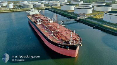
FRONT CORAL
Tanker
Current Trip
| Time Travelled | 14 days |
|---|---|
| Remaining Time | --- |
| Distance Travelled | 3535.66 nm |
| Remaining Distance | --- |
| AVG Speed | 12.4 Knots |
| MAX Speed | 18 Knots |
| AVG Wind | 11.6 knots |
| MAX Wind | 21.9 knots |
| MIN Temp | 7.5°C / 45.5°F |
| MAX Temp | 28.6°C / 83.48°F |
| Draught | 13.5 m |
| Position Received | 5 d ago |
Current Position
| Longitude | -66.93128° |
|---|---|
| Latitude | 44.21227° |
| Status | Under way using engine |
| Speed | 9.7 Knots |
| Course | 183.7° |
| Area | North Atlantic Ocean |
| Station | T-AIS |
| Position Received | 5 d ago |
Info
Information
The current position of FRONT CORAL is in North Atlantic Ocean with coordinates 44.21227° / -66.93128° as reported on 2024-05-27 11:51 by AIS to our vessel tracker app. The vessel's current speed is 9.7 Knots and is heading at the port of CANAPORT LNG. The estimated time of arrival as calculated by vessel tracking app is 2024-05-26 02:00 LT
The vessel FRONT CORAL (IMO: 9743203, MMSI: 538007339) is a Tanker It's sailing under the flag of [MH] Marshall Is.
In this page you can find informations about the vessels current position, last detected port calls, and current voyage information. If the vessels is not in coverage by AIS you will find the latest position.
The current position of FRONT CORAL is detected by our AIS receivers and we are not responsible for the reliability of the data. The last position was recorded while the vessel was in Coverage by the Ais receivers of our vessel tracking app.
The current draught of FRONT CORAL as reported by AIS is 13.5 meters
Weather
| Temperature | 22.3°C / 72.14°F |
|---|---|
| Wind Speed | 12 knots |
| Direction | 44° NE |
| Pressure | 1020.8 hPa |
| Humidity | 59.2 % |
| Cloud Coverage | 100 % |
Featured Company
Most Visited Ports (Last year)
| Port | Arrivals | |
|---|---|---|
| 2 | ||
| 1 | ||
| 1 | ||
| 1 | ||
| 1 | ||
| 1 |
Last Trips
| Origin | Departure | Destination | Arrival | Distance | |
|---|---|---|---|---|---|
| 2024-03-11 11:45 | 2024-05-16 09:27 | 7597.85 nm |
Events
| Time | Event | Details | Position / Dest | Info |
|---|---|---|---|---|
| 2024-05-31 01:11 | STOP Moving |
29.82333 / -67.68500
CACPT
|
Speed: Course: -1° |
|
| 2024-05-27 11:53 | Status Changed | Default Under way using engine |
44.20500 / -66.93166
CACPT
|
Speed: 9.7 kn Course: 183.7° |
| 2024-05-27 11:51 | Status Changed | Under way using engine Default |
44.21227 / -66.93128
CACPT
|
Speed: 9 kn Course: 189° |
| 2024-05-27 11:51 | OUT of Coverage |
44.21227 / -66.93128
North Atlantic Ocean
|
Speed: 9.7 kn Course: 183.7° |
|
| 2024-05-27 11:35 | Status Changed | Default Under way using engine |
44.25167 / -66.91833
CACPT
|
Speed: 9.8 kn Course: 235.2° |
| 2024-05-27 11:06 | Status Changed | Under way using engine Default |
44.30085 / -66.83168
CACPT
|
Speed: 10 kn Course: 233° |
| 2024-05-27 11:02 | Status Changed | Default Under way using engine |
44.30667 / -66.81834
CACPT
|
Speed: 10.8 kn Course: 233.3° |
| 2024-05-27 10:54 | Change Sea Area | Canadian part of the North Atlantic Ocean Canadian part of the Bay of Fundy |
44.32099 / -66.79404
North Atlantic Ocean
|
Speed: 10.8 kn Course: 233.8° |
| 2024-05-27 10:54 | Status Changed | Under way using engine Default |
44.32099 / -66.79404
CACPT
|
Speed: 10 kn Course: 232° |
| 2024-05-27 10:54 | IN Coverage |
44.32099 / -66.79404
North Atlantic Ocean
|
Speed: 10.8 kn Course: 233.8° |