
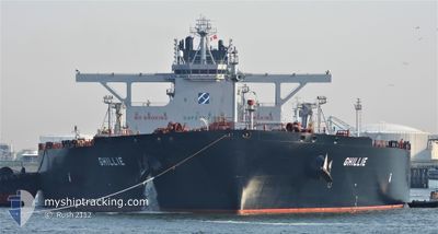
FRONT EIRA
Tanker
Current Trip
SG SIN PEBGC
| Time Travelled | --- |
|---|---|
| Remaining Time | --- |
| Distance Travelled | 12107.97 nm |
| Remaining Distance | --- |
| AVG Speed | 11.6 Knots |
| MAX Speed | 14.8 Knots |
| AVG Wind | 12.5 knots |
| MAX Wind | 27 knots |
| MIN Temp | 14°C / 57.2°F |
| MAX Temp | 29.4°C / 84.92°F |
| Draught | 11.3 m |
| Position Received | Now |
Current Position
| Longitude | 103.92208° |
|---|---|
| Latitude | 1.26898° |
| Status | At anchor |
| Speed | |
| Course | 217° |
| Area | Singapore Strait |
| Station | T-AIS |
| Position Received | Now |
Info
Information
The current position of FRONT EIRA is in Singapore Strait with coordinates 1.26898° / 103.92208° as reported on 2024-05-19 20:12 by AIS to our vessel tracker app. The vessel's current speed is 0 Knots
The vessel FRONT EIRA (IMO: 9855331, MMSI: 636021816) is a Tanker It's sailing under the flag of [LR] Liberia.
In this page you can find informations about the vessels current position, last detected port calls, and current voyage information. If the vessels is not in coverage by AIS you will find the latest position.
The current position of FRONT EIRA is detected by our AIS receivers and we are not responsible for the reliability of the data. The last position was recorded while the vessel was in Coverage by the Ais receivers of our vessel tracking app.
The current draught of FRONT EIRA as reported by AIS is 11.3 meters
Weather
| Temperature | 28.6°C / 83.48°F |
|---|---|
| Wind Speed | 8 knots |
| Direction | 158° SSE |
| Pressure | 1005.1 hPa |
| Humidity | 80.9 % |
| Cloud Coverage | 100 % |
Featured Company
Last Port Calls
Most Visited Ports (Last year)
| Port | Arrivals | |
|---|---|---|
| 2 | ||
| 1 | ||
| 1 |
Last Trips
| Origin | Departure | Destination | Arrival | Distance |
|---|
Events
| Time | Event | Details | Position / Dest | Info |
|---|---|---|---|---|
| 2024-05-19 14:42 | Status Changed | At anchor Default |
1.26885 / 103.91887
SG SIN PEBGC
|
Speed: Course: 137° |
| 2024-05-19 14:36 | Status Changed | Default At anchor |
1.26866 / 103.91872
SG SIN PEBGC
|
Speed: Course: 129° |
| 2024-05-19 14:21 | Status Changed | At anchor Default |
1.26830 / 103.91864
SG SIN PEBGC
|
Speed: Course: 125° |
| 2024-05-19 14:09 | Status Changed | Default At anchor |
1.26828 / 103.91850
SG SIN PEBGC
|
Speed: Course: 128° |
| 2024-05-19 13:09 | Status Changed | At anchor Default |
1.26837 / 103.91840
SG SIN PEBGC
|
Speed: Course: 123° |
| 2024-05-19 13:03 | Status Changed | Default At anchor |
1.26822 / 103.91833
SG SIN PEBGC
|
Speed: Course: 118° |
| 2024-05-19 10:24 | STOP Moving | 3.96 nm, East of SINGAPORE |
1.26454 / 103.92009
SG SIN PEBGC
|
Speed: 0.1 kn Course: 26° |
| 2024-05-19 10:18 | Status Changed | At anchor Under way using engine |
1.26447 / 103.92211
SG SIN PEBGC
|
Speed: 0.9 kn Course: 7° |
| 2024-05-19 08:56 | Change Sea Area | Singaporean part of the Singapore Strait Malaysian part of the Singapore Strait |
1.27354 / 104.05297
Singapore Strait
SG SIN PEBGC
|
Speed: 11 kn Course: 260.8° |
| 2024-05-19 08:12 | Destination Changed | SG SIN PEBGC KR USN>SG SIN |
1.29555 / 104.21031
SG SIN PEBGC
|
Speed: 11.9 kn Course: 257.5° |