
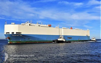
FRONTIER ACE
Vehicles Carrier
Current Trip
| Trip Time | 7 days |
|---|---|
| Trip Distance | 2090.82 nm |
| AVG Speed | 11.5 Knots |
| MAX Speed | 17.7 Knots |
| Draught | 8.2 m |
| AVG Wind | 13.4 knots |
| MAX Wind | 20 knots |
| MIN Temp | 9.6°C / 49.28°F |
| MAX Temp | 31.3°C / 88.34°F |
| Position Received | 3 d ago |
Current Position
| Longitude | -95.76775° |
|---|---|
| Latitude | 19.59744° |
| Status | Under way using engine |
| Speed | 11.5 Knots |
| Course | 231.3° |
| Area | Gulf of Mexico |
| Station | T-AIS |
| Position Received | 3 d ago |
Info
Information
The current position of FRONTIER ACE is in Gulf of Mexico with coordinates 19.59744° / -95.76775° as reported on 2024-05-17 05:47 by AIS to our vessel tracker app. The vessel's current speed is 11.5 Knots and is currently inside the port of VERACRUZ.
The vessel FRONTIER ACE (IMO: 9209271, MMSI: 352283000) is a Vehicles Carrier that was built in 2000 ( 24 years old ). It's sailing under the flag of [PA] Panama.
In this page you can find informations about the vessels current position, last detected port calls, and current voyage information. If the vessels is not in coverage by AIS you will find the latest position.
The current position of FRONTIER ACE is detected by our AIS receivers and we are not responsible for the reliability of the data. The last position was recorded while the vessel was in Coverage by the Ais receivers of our vessel tracking app.
The current draught of FRONTIER ACE as reported by AIS is 8.2 meters
Weather
| Temperature | 27.9°C / 82.22°F |
|---|---|
| Wind Speed | 3 knots |
| Direction | 223° SW |
| Pressure | 1010.5 hPa |
| Humidity | 88 % |
| Cloud Coverage | 2 % |
Featured Company
Last Port Calls
| Port | Arrival | Departure | Time In Port |
|---|---|---|---|
| 2024-05-18 11:57 | |||
| 2024-05-09 21:11 | 2024-05-10 21:45 | 1 d | |
| 2024-05-08 08:50 | 2024-05-08 18:32 | 9 h | |
| 2024-05-04 02:52 | 2024-05-04 22:48 | 19 h | |
| 2024-05-02 23:50 | 2024-05-03 17:31 | 17 h | |
| 2024-04-26 06:06 | 2024-04-28 12:57 | 2 d | |
| 2024-04-21 08:31 | 2024-04-21 23:58 | 15 h | |
| 2024-04-19 23:45 | 2024-04-20 21:46 | 22 h | |
| 2024-04-13 17:31 | 2024-04-15 20:46 | 2 d | |
| 2024-04-07 23:10 | 2024-04-08 22:07 | 22 h |
Last Trips
| Origin | Departure | Destination | Arrival | Distance | |
|---|---|---|---|---|---|
| 2024-05-10 17:45 | 2024-05-18 06:57 | 2090.82 nm | |||
| 2024-05-08 14:32 | 2024-05-09 17:11 | 279.52 nm | |||
| 2024-05-04 18:48 | 2024-05-08 04:50 | 761.45 nm | |||
| 2024-05-03 13:31 | 2024-05-03 22:52 | 107.41 nm | |||
| 2024-04-28 07:57 | 2024-05-02 19:50 | 1444.14 nm | |||
| 2024-04-21 19:58 | 2024-04-26 01:06 | 1505.74 nm | |||
| 2024-04-20 17:46 | 2024-04-21 04:31 | 108.89 nm | |||
| 2024-04-15 15:46 | 2024-04-19 19:45 | 1447.94 nm | |||
| 2024-04-08 18:07 | 2024-04-13 12:31 | 1467.18 nm | |||
| 2024-04-04 17:27 | 2024-04-07 19:10 | 216.86 nm |
Events
| Time | Event | Details | Position / Dest | Info |
|---|---|---|---|---|
| 2024-05-18 12:30 | STOP Moving |
19.20379 / -96.13467
[MX] VERACRUZ
|
Speed: 0.1 kn Course: 58° |
|
| 2024-05-18 11:57 | PORT ARRIVAL |
|
19.20305 / -96.12373
[MX] VERACRUZ
|
Speed: 10.1 kn Course: 276° |
| 2024-05-18 09:34 | START Moving | 17.45 nm, North East of VERACRUZ |
19.45956 / -95.97903
MX VER
|
Speed: 3.8 kn Course: 157° |
| 2024-05-18 08:50 | STOP Moving | 17.38 nm, North East of VERACRUZ |
19.45922 / -95.98101
MX VER
|
Speed: 0.3 kn Course: 47° |
| 2024-05-17 06:00 | Status Changed | Default Under way using engine |
19.57239 / -95.80130
MX VER
|
Speed: 11.5 kn Course: 231.3° |
| 2024-05-17 05:47 | OUT of Coverage |
19.59744 / -95.76775
Gulf of Mexico
MX VER
|
Speed: 11.5 kn Course: 231.3° |
|
| 2024-05-17 05:18 | Status Changed | Under way using engine Default |
19.65875 / -95.69123
MX VER
|
Speed: 11.6 kn Course: 229° |
| 2024-05-17 05:12 | Status Changed | Default Under way using engine |
19.67197 / -95.67563
MX VER
|
Speed: 11.5 kn Course: 224° |
| 2024-05-17 05:03 | Status Changed | Under way using engine Default |
19.69184 / -95.65434
MX VER
|
Speed: 11.5 kn Course: 226° |
| 2024-05-17 03:48 | OUT of Coverage |
19.84462 / -95.45465
Gulf of Mexico
MX VER
|
Speed: 11.9 kn Course: 230.5° |