
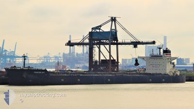
FRONTIER SKY
Bulk Carrier
Current Trip
| Time Travelled | 22 days |
|---|---|
| Remaining Time | --- |
| Distance Travelled | 4491.42 nm |
| Remaining Distance | 2.95 nm |
| AVG Speed | 11.4 Knots |
| MAX Speed | 14.7 Knots |
| AVG Wind | 11 knots |
| MAX Wind | 31 knots |
| MIN Temp | 4.5°C / 40.1°F |
| MAX Temp | 21.3°C / 70.34°F |
| Draught | 9.9 m |
| Position Received | 3 m ago |
Current Position
| Longitude | -123.20889° |
|---|---|
| Latitude | 49.30217° |
| Status | At anchor |
| Speed | |
| Course | 299° |
| Area | The Coastal Waters of Southeast Alaska and British Columbia |
| Station | T-AIS |
| Position Received | 3 m ago |
Info
Information
The current position of FRONTIER SKY is in The Coastal Waters of Southeast Alaska and British Columbia with coordinates 49.30217° / -123.20889° as reported on 2024-06-27 06:47 by AIS to our vessel tracker app. The vessel's current speed is 0 Knots and is heading at the port of VANCOUVER. The estimated time of arrival as calculated by vessel tracking app is 2024-06-20 12:30 LT
The vessel FRONTIER SKY (IMO: 9488009, MMSI: 431148000) is a Bulk Carrier that was built in 2012 ( 12 years old ). It's sailing under the flag of [JP] Japan.
In this page you can find informations about the vessels current position, last detected port calls, and current voyage information. If the vessels is not in coverage by AIS you will find the latest position.
The current position of FRONTIER SKY is detected by our AIS receivers and we are not responsible for the reliability of the data. The last position was recorded while the vessel was in Coverage by the Ais receivers of our vessel tracking app.
The current draught of FRONTIER SKY as reported by AIS is 9.9 meters
Weather
| Temperature | 13.5°C / 56.3°F |
|---|---|
| Wind Speed | 10 knots |
| Direction | 106° ESE |
| Pressure | 1014.3 hPa |
| Humidity | 91 % |
| Cloud Coverage | 100 % |
Featured Company
Events
| Time | Event | Details | Position / Dest | Info |
|---|---|---|---|---|
| 2024-06-21 10:28 | Status Changed | At anchor Default |
49.30145 / -123.21020
CA VAN
|
Speed: 0.1 kn Course: 339° |
| 2024-06-21 10:25 | Status Changed | Default At anchor |
49.30149 / -123.21007
CA VAN
|
Speed: 0.1 kn Course: 339° |
| 2024-06-20 19:47 | STOP Moving | 4.72 nm, West of VANCOUVER |
49.30433 / -123.21462
CA VAN
|
Speed: 0.3 kn Course: 118° |
| 2024-06-20 19:46 | Status Changed | At anchor Under way using engine |
49.30429 / -123.21464
CA VAN
|
Speed: 0.4 kn Course: 118° |
| 2024-06-20 17:31 | Detected in Sea | Canadian part of the The Coastal Waters of Southeast Alaska and British Columbia |
49.00227 / -123.22751
The Coastal Waters of Southeast Alaska and British Columbia
|
Speed: 12.5 kn Course: 315.4° |
| 2024-06-20 16:10 | Change Sea Area | United States part of the The Coastal Waters of Southeast Alaska and British Columbia Canadian part of the The Coastal Waters of Southeast Alaska and British Columbia |
48.78856 / -123.00823
The Coastal Waters of Southeast Alaska and British Columbia
CA VAN
|
Speed: 11.1 kn Course: 43.6° |
| 2024-06-20 15:41 | Change Sea Area | Canadian part of the The Coastal Waters of Southeast Alaska and British Columbia United States part of the The Coastal Waters of Southeast Alaska and British Columbia |
48.73765 / -123.11106
The Coastal Waters of Southeast Alaska and British Columbia
CA VAN
|
Speed: 10.3 kn Course: 61.7° |
| 2024-06-20 15:14 | Change Sea Area | United States part of the The Coastal Waters of Southeast Alaska and British Columbia Canadian part of the The Coastal Waters of Southeast Alaska and British Columbia |
48.70636 / -123.21925
The Coastal Waters of Southeast Alaska and British Columbia
CA VAN
|
Speed: 9.5 kn Course: 70.4° |
| 2024-06-20 15:11 | Change Sea Area | Canadian part of the The Coastal Waters of Southeast Alaska and British Columbia United States part of the The Coastal Waters of Southeast Alaska and British Columbia |
48.70361 / -123.23027
The Coastal Waters of Southeast Alaska and British Columbia
CA VAN
|
Speed: 8.9 kn Course: 65.3° |
| 2024-06-20 13:41 | Change Sea Area | United States part of the The Coastal Waters of Southeast Alaska and British Columbia Canadian part of the The Coastal Waters of Southeast Alaska and British Columbia |
48.46386 / -123.16341
The Coastal Waters of Southeast Alaska and British Columbia
CA VAN
|
Speed: 10.4 kn Course: 356.1° |