
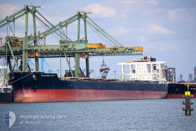
FRONTIER UNITY
Bulk Carrier
Current Trip
MAJISHAN CN
| Time Travelled | 18 days |
|---|---|
| Remaining Time | --- |
| Distance Travelled | 3404.11 nm |
| Remaining Distance | --- |
| AVG Speed | 10.7 Knots |
| MAX Speed | 14.8 Knots |
| AVG Wind | 9.4 knots |
| MAX Wind | 27.9 knots |
| MIN Temp | 19°C / 66.2°F |
| MAX Temp | 30.5°C / 86.9°F |
| Draught | 18.3 m |
| Position Received | 10 d ago |
Current Position
| Longitude | 119.56976° |
|---|---|
| Latitude | 14.54748° |
| Status | Under way using engine |
| Speed | 10.8 Knots |
| Course | 355.2° |
| Area | South China Sea |
| Station | T-AIS |
| Position Received | 10 d ago |
Info
Information
The current position of FRONTIER UNITY is in South China Sea with coordinates 14.54748° / 119.56976° as reported on 2024-05-15 05:25 by AIS to our vessel tracker app. The vessel's current speed is 10.8 Knots
The vessel FRONTIER UNITY (IMO: 9604976, MMSI: 373075000) is a Bulk Carrier that was built in 2012 ( 12 years old ). It's sailing under the flag of [PA] Panama.
In this page you can find informations about the vessels current position, last detected port calls, and current voyage information. If the vessels is not in coverage by AIS you will find the latest position.
The current position of FRONTIER UNITY is detected by our AIS receivers and we are not responsible for the reliability of the data. The last position was recorded while the vessel was in Coverage by the Ais receivers of our vessel tracking app.
The current draught of FRONTIER UNITY as reported by AIS is 18.3 meters
Weather
| Temperature | 25.8°C / 78.44°F |
|---|---|
| Wind Speed | 14 knots |
| Direction | 127° SE |
| Pressure | 1008.6 hPa |
| Humidity | 66.7 % |
| Cloud Coverage | 64 % |
Featured Company
Last Port Calls
| Port | Arrival | Departure | Time In Port |
|---|---|---|---|
| 2024-05-05 01:55 | 2024-05-07 01:25 | 1 d | |
| 2024-04-15 13:34 | 2024-04-18 04:50 | 2 d | |
| 2024-03-01 18:38 | 2024-03-01 23:30 | 4 h |
Most Visited Ports (Last year)
| Port | Arrivals | |
|---|---|---|
| 1 | ||
| 1 | ||
| 1 | ||
| 1 | ||
| 1 | ||
| 1 |
Last Trips
| Origin | Departure | Destination | Arrival | Distance | |
|---|---|---|---|---|---|
| 2024-04-18 12:50 | 2024-05-05 09:55 | 3712.21 nm | |||
| 2024-03-01 20:30 | 2024-04-15 21:34 | 10464.39 nm | |||
| 2024-01-25 13:41 | 2024-03-01 15:38 | 8840.66 nm |
Events
| Time | Event | Details | Position / Dest | Info |
|---|---|---|---|---|
| 2024-05-25 07:08 | STOP Moving | 7.76 nm, South East of TAICANG |
31.58760 / 121.31827
MAJISHAN CN
|
Speed: Course: 141° |
| 2024-05-24 21:40 | START Moving |
31.21413 / 122.72252
MAJISHAN CN
|
Speed: 4.5 kn Course: 82° |
|
| 2024-05-22 02:25 | STOP Moving |
31.21585 / 122.71335
MAJISHAN CN
|
Speed: 0.1 kn Course: 148° |
|
| 2024-05-21 16:17 | START Moving | 4.73 nm, South of SHENGSI |
30.66152 / 122.41593
MAJISHAN CN
|
Speed: 4.7 kn Course: 117° |
| 2024-05-20 14:39 | STOP Moving | 4.3 nm, South of SHENGSI |
30.66884 / 122.41650
MAJISHAN CN
|
Speed: 0.1 kn Course: 267° |
| 2024-05-20 10:24 | START Moving |
30.45694 / 122.73122
MAJISHAN CN
|
Speed: 4.4 kn Course: 11° |
|
| 2024-05-18 19:40 | STOP Moving |
30.44488 / 122.73072
MAJISHAN CN
|
Speed: Course: 36° |