
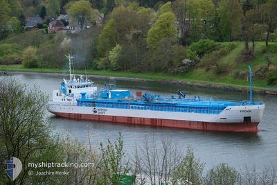
FROYA
Co2 Tanker
Current Trip
| Time Travelled | 11 h, 52 mins |
|---|---|
| Remaining Time | 9 h, 56 mins |
| Distance Travelled | 88.10 nm |
| Remaining Distance | 78.58 nm |
| AVG Speed | 8.5 Knots |
| MAX Speed | 11.7 Knots |
| AVG Wind | 19.1 knots |
| MAX Wind | 22 knots |
| MIN Temp | 12.4°C / 54.32°F |
| MAX Temp | 14.5°C / 58.1°F |
| Draught | 5.5 m |
| Position Received | 9 m ago |
Current Position
| Longitude | 2.24433° |
|---|---|
| Latitude | 51.75406° |
| Status | Under way using engine |
| Speed | 7.5 Knots |
| Course | 235.5° |
| Area | North Sea |
| Station | T-AIS |
| Position Received | 9 m ago |
Info
Information
The current position of FROYA is in North Sea with coordinates 51.75406° / 2.24433° as reported on 2024-06-02 04:26 by AIS to our vessel tracker app. The vessel's current speed is 7.5 Knots and is heading at the port of TILBURY. The estimated time of arrival as calculated by vessel tracking app is 2024-06-02 14:31 LT
The vessel FROYA (IMO: 9345350, MMSI: 257081000) is a Co2 Tanker that was built in 2005 ( 19 years old ). It's sailing under the flag of [NO] Norway.
In this page you can find informations about the vessels current position, last detected port calls, and current voyage information. If the vessels is not in coverage by AIS you will find the latest position.
The current position of FROYA is detected by our AIS receivers and we are not responsible for the reliability of the data. The last position was recorded while the vessel was in Coverage by the Ais receivers of our vessel tracking app.
The current draught of FROYA as reported by AIS is 5.5 meters
Weather
| Temperature | 12.6°C / 54.68°F |
|---|---|
| Wind Speed | 18 knots |
| Direction | 2° N |
| Pressure | 1025.1 hPa |
| Humidity | 84.5 % |
| Cloud Coverage | 31 % |
Featured Company
Last Port Calls
| Port | Arrival | Departure | Time In Port |
|---|---|---|---|
| 2024-05-31 23:21 | 2024-06-01 16:43 | 17 h | |
| 2024-05-30 03:50 | 2024-05-30 20:01 | 16 h | |
| 2024-05-28 20:45 | 2024-05-28 22:31 | 1 h | |
| 2024-05-28 00:25 | 2024-05-28 20:08 | 19 h | |
| 2024-05-25 13:20 | 2024-05-28 00:16 | 2 d | |
| 2024-05-22 08:01 | 2024-05-22 13:15 | 5 h | |
| 2024-05-20 06:28 | 2024-05-20 21:17 | 14 h | |
| 2024-05-17 21:52 | 2024-05-18 13:55 | 16 h | |
| 2024-05-16 06:07 | 2024-05-16 21:10 | 15 h | |
| 2024-05-14 08:41 | 2024-05-14 16:31 | 7 h |
Last Trips
| Origin | Departure | Destination | Arrival | Distance | |
|---|---|---|---|---|---|
| 2024-05-30 21:01 | 2024-06-01 01:21 | 283.74 nm | |||
| 2024-05-29 00:31 | 2024-05-30 04:50 | 281.07 nm | |||
| 2024-05-28 22:08 | 2024-05-28 22:45 | 1.82 nm | |||
| 2024-05-28 02:16 | 2024-05-28 02:25 | 0.86 nm | |||
| 2024-05-22 15:15 | 2024-05-25 15:20 | 539.51 nm | |||
| 2024-05-20 23:17 | 2024-05-22 10:01 | 403.79 nm | |||
| 2024-05-18 15:55 | 2024-05-20 08:28 | 175.12 nm | |||
| 2024-05-16 23:10 | 2024-05-17 23:52 | 249.71 nm | |||
| 2024-05-14 18:31 | 2024-05-16 08:07 | 402.06 nm | |||
| 2024-05-13 13:00 | 2024-05-14 10:41 | 173.68 nm |
Events
| Time | Event | Details | Position / Dest | Info |
|---|---|---|---|---|
| 2024-06-02 02:24 | Status Changed | Under way using engine Default |
51.93257 / 2.56185
GBTIL
|
Speed: 7.9 kn Course: 229° |
| 2024-06-02 02:18 | Status Changed | Default Under way using engine |
51.94142 / 2.57807
GBTIL
|
Speed: 7.7 kn Course: 232.4° |
| 2024-06-02 02:09 | Change Sea Area | United Kingdom part of the North Sea Dutch part of the North Sea |
51.95472 / 2.60416
North Sea
GBTIL
|
Speed: 7.8 kn Course: 235° |
| 2024-06-01 18:33 | START Moving | 0.65 nm, North West of TERNEUZEN |
51.32917 / 3.81637
GBTIL
|
Speed: 3.8 kn Course: 332° |
| 2024-06-01 17:55 | STOP Moving | 0.54 nm, North West of TERNEUZEN |
51.32747 / 3.81764
GBTIL
|
Speed: 0.3 kn Course: 331° |
| 2024-06-01 16:43 | PORT DEPARTURE |
|
51.28461 / 3.83901
GBTIL
|
Speed: 7.1 kn Course: 345° |
| 2024-06-01 16:38 | Draught Changed | 5.5 4.3 |
51.27508 / 3.84306
[NL] SLUISKIL
|
Speed: 6 kn Course: 338° |
| 2024-06-01 16:38 | Destination Changed | GBTIL NLSLU |
51.27508 / 3.84306
[NL] SLUISKIL
|
Speed: 6 kn Course: 338° |
| 2024-06-01 16:38 | ETA Changed | 2024/06/02 08:00 2025/05/31 23:00 |
51.27508 / 3.84306
[NL] SLUISKIL
|
Speed: 6 kn Course: 338° |
| 2024-06-01 16:38 | Status Changed | Under way using engine Moored |
51.27508 / 3.84306
[NL] SLUISKIL
|
Speed: 5.9 kn Course: 338° |