
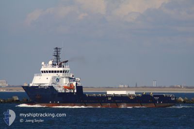
FS BALMORAL
Offshore Supply Ship
Current Trip
MAGNUS
| Time Travelled | 17 h, 27 mins |
|---|---|
| Remaining Time | --- |
| Distance Travelled | 22.72 nm |
| Remaining Distance | --- |
| AVG Speed | 12.8 Knots |
| MAX Speed | 13.6 Knots |
| AVG Wind | 23.6 knots |
| MAX Wind | 26.3 knots |
| MIN Temp | 12.3°C / 54.14°F |
| MAX Temp | 12.5°C / 54.5°F |
| Draught | 5.3 m |
| Position Received | 15 h, 39 m ago |
Current Position
| Longitude | -1.49355° |
|---|---|
| Latitude | 57.83945° |
| Status | Under way using engine |
| Speed | 12.6 Knots |
| Course | 26.6° |
| Area | North Sea |
| Station | T-AIS |
| Position Received | 15 h, 39 m ago |
Info
Information
The current position of FS BALMORAL is in North Sea with coordinates 57.83945° / -1.49355° as reported on 2024-06-27 23:47 by AIS to our vessel tracker app. The vessel's current speed is 12.6 Knots
The vessel FS BALMORAL (IMO: 9402330, MMSI: 232007020) is a Offshore Supply Ship that was built in 2008 ( 16 years old ). It's sailing under the flag of [GB] United Kingdom.
In this page you can find informations about the vessels current position, last detected port calls, and current voyage information. If the vessels is not in coverage by AIS you will find the latest position.
The current position of FS BALMORAL is detected by our AIS receivers and we are not responsible for the reliability of the data. The last position was recorded while the vessel was in Coverage by the Ais receivers of our vessel tracking app.
The current draught of FS BALMORAL as reported by AIS is 5.3 meters
Weather
| Temperature | 12.5°C / 54.5°F |
|---|---|
| Wind Speed | 26 knots |
| Direction | 184° S |
| Pressure | 994 hPa |
| Humidity | 89.6 % |
| Cloud Coverage | 56 % |
Featured Company
Last Port Calls
| Port | Arrival | Departure | Time In Port |
|---|---|---|---|
| 2024-06-27 14:01 | 2024-06-27 22:00 | 7 h | |
| 2024-06-22 13:22 | 2024-06-22 19:27 | 6 h | |
| 2024-06-18 11:37 | 2024-06-18 17:13 | 5 h | |
| 2024-06-13 09:19 | 2024-06-13 19:19 | 10 h | |
| 2024-06-08 12:03 | 2024-06-08 19:33 | 7 h | |
| 2024-05-31 09:58 | 2024-05-31 19:40 | 9 h | |
| 2024-05-25 14:17 | 2024-05-29 08:03 | 3 d | |
| 2024-05-25 06:28 | 2024-05-25 12:17 | 5 h | |
| 2024-05-14 08:53 | 2024-05-16 18:14 | 2 d | |
| 2024-05-07 09:25 | 2024-05-08 20:03 | 1 d |
Most Visited Ports (Last year)
| Port | Arrivals | |
|---|---|---|
| 32 | ||
| 23 | ||
| 19 | ||
| 10 | ||
| 4 | ||
| 1 |
Last Trips
| Origin | Departure | Destination | Arrival | Distance | |
|---|---|---|---|---|---|
| 2024-06-22 20:27 | 2024-06-27 15:01 | 550.82 nm | |||
| 2024-06-18 18:13 | 2024-06-22 14:22 | 551.74 nm | |||
| 2024-06-13 20:19 | 2024-06-18 12:37 | 575.66 nm | |||
| 2024-06-08 20:33 | 2024-06-13 10:19 | 547.64 nm | |||
| 2024-05-31 20:40 | 2024-06-08 13:03 | 549.58 nm | |||
| 2024-05-29 09:03 | 2024-05-31 10:58 | 74.77 nm | |||
| 2024-05-25 13:17 | 2024-05-25 15:17 | 19.91 nm | |||
| 2024-05-16 19:14 | 2024-05-25 07:28 | 667.06 nm | |||
| 2024-05-08 21:03 | 2024-05-14 09:53 | 573.37 nm | |||
| 2024-05-02 16:14 | 2024-05-07 10:25 | 648.92 nm |
Events
| Time | Event | Details | Position / Dest | Info |
|---|---|---|---|---|
| 2024-06-27 23:47 | OUT of Coverage |
57.83945 / -1.49355
North Sea
MAGNUS
|
Speed: 12.6 kn Course: 26.6° |
|
| 2024-06-27 22:00 | PORT DEPARTURE |
|
57.49647 / -1.76920
MAGNUS
|
Speed: 6.8 kn Course: 64° |
| 2024-06-27 21:55 | START Moving |
57.49451 / -1.78348
[GB] PETERHEAD
|
Speed: 3.8 kn Course: 37° |
|
| 2024-06-27 21:53 | Status Changed | Under way using engine Moored |
57.49365 / -1.78417
[GB] PETERHEAD
|
Speed: 0.9 kn Course: 48° |
| 2024-06-27 21:52 | Draught Changed | 5.3 5.2 |
57.49359 / -1.78416
[GB] PETERHEAD
|
Speed: 0.9 kn Course: 48° |
| 2024-06-27 21:52 | Destination Changed | MAGNUS PETERHEAD |
57.49359 / -1.78416
[GB] PETERHEAD
|
Speed: 0.9 kn Course: 48° |
| 2024-06-27 21:52 | ETA Changed | 2024/06/28 20:30 2024/06/27 15:00 |
57.49359 / -1.78416
[GB] PETERHEAD
|
Speed: 0.9 kn Course: 48° |
| 2024-06-27 20:59 | IN Coverage |
57.49279 / -1.78486
North Sea
[GB] PETERHEAD
|
Speed: Course: 202.1° |
|
| 2024-06-27 14:13 | OUT of Coverage |
57.49299 / -1.78461
North Sea
[GB] PETERHEAD
|
Speed: 0.6 kn Course: 194.8° |
|
| 2024-06-27 14:01 | PORT ARRIVAL |
|
57.49632 / -1.77230
[GB] PETERHEAD
|
Speed: 9 kn Course: 312.9° |