
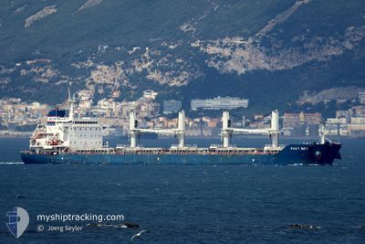
FUAT BEY
Cargo
Current Trip
| Time Travelled | 18 days |
|---|---|
| Remaining Time | --- |
| Distance Travelled | 2757.47 nm |
| Remaining Distance | --- |
| AVG Speed | 11.3 Knots |
| MAX Speed | 11.3 Knots |
| AVG Wind | 10.3 knots |
| MAX Wind | 26.3 knots |
| MIN Temp | 11.8°C / 53.24°F |
| MAX Temp | 33.9°C / 93.02°F |
| Draught | 6 m |
| Position Received | 2 d ago |
Current Position
| Longitude | 29.24861° |
|---|---|
| Latitude | 41.45020° |
| Status | Under way using engine |
| Speed | 13 Knots |
| Course | 10.6° |
| Area | Black Sea |
| Station | T-AIS |
| Position Received | 2 d ago |
Info
Information
The current position of FUAT BEY is in Black Sea with coordinates 41.45020° / 29.24861° as reported on 2024-05-21 05:00 by AIS to our vessel tracker app. The vessel's current speed is 13 Knots and is heading at the port of SULINA. The estimated time of arrival as calculated by vessel tracking app is 2024-05-21 21:01 LT
The vessel FUAT BEY (IMO: 9663817, MMSI: 538009101) is a Cargo It's sailing under the flag of [MH] Marshall Is.
In this page you can find informations about the vessels current position, last detected port calls, and current voyage information. If the vessels is not in coverage by AIS you will find the latest position.
The current position of FUAT BEY is detected by our AIS receivers and we are not responsible for the reliability of the data. The last position was recorded while the vessel was in Coverage by the Ais receivers of our vessel tracking app.
The current draught of FUAT BEY as reported by AIS is 6 meters
Weather
| Temperature | 24.8°C / 76.64°F |
|---|---|
| Wind Speed | 15 knots |
| Direction | 75° ENE |
| Pressure | 1011.7 hPa |
| Humidity | 31.9 % |
| Cloud Coverage | 7 % |
Featured Company
Last Port Calls
| Port | Arrival | Departure | Time In Port |
|---|---|---|---|
| 2024-05-09 02:33 | 2024-05-09 11:49 | 9 h | |
| 2024-04-28 10:39 | 2024-05-04 10:16 | 5 d | |
| 2024-04-24 08:08 | 2024-04-24 12:00 | 3 h | |
| 2024-04-15 04:18 | 2024-04-15 12:49 | 8 h | |
| 2024-04-14 12:21 | 2024-04-14 22:46 | 10 h | |
| 2024-04-06 04:11 | 2024-04-06 13:57 | 9 h | |
| 2024-04-06 03:41 | |||
| 2024-03-26 07:40 |
Most Visited Ports (Last year)
| Port | Arrivals | |
|---|---|---|
| 5 | ||
| 2 | ||
| 2 | ||
| 2 | ||
| 2 | ||
| 1 |
Last Trips
| Origin | Departure | Destination | Arrival | Distance | |
|---|---|---|---|---|---|
| 2024-05-04 13:16 | 2024-05-09 04:33 | 1092.69 nm | |||
| 2024-04-24 15:00 | 2024-04-28 13:39 | 258.79 nm | |||
| 2024-04-15 00:46 | 2024-04-24 11:08 | 1420.79 nm | |||
| 2024-04-15 00:46 | 2024-04-15 06:18 | 21.38 nm | |||
| 2024-04-06 16:57 | 2024-04-14 14:21 | 1358.18 nm | |||
| 2024-04-06 06:41 | 2024-04-06 07:11 | 2.76 nm |
Events
| Time | Event | Details | Position / Dest | Info |
|---|---|---|---|---|
| 2024-05-23 07:29 | START Moving |
45.03742 / 33.97251
RO SUL
|
Speed: 36.6 kn Course: 94° |
|
| 2024-05-23 07:21 | STOP Moving |
45.07471 / 33.97870
RO SUL
|
Speed: Course: 62° |
|
| 2024-05-23 02:44 | START Moving |
45.06072 / 33.95372
RO SUL
|
Speed: 46.9 kn Course: 77° |
|
| 2024-05-23 02:31 | STOP Moving |
45.03518 / 33.97015
RO SUL
|
Speed: 0.2 kn Course: 51° |
|
| 2024-05-22 22:36 | STOP Moving |
45.03746 / 33.96614
RO SUL
|
Speed: 0.2 kn Course: 103° |
|
| 2024-05-22 18:42 | START Moving |
45.07439 / 33.97849
RO SUL
|
Speed: 7.1 kn Course: 179° |
|
| 2024-05-22 18:40 | STOP Moving |
45.07621 / 33.98745
RO SUL
|
Speed: Course: 67° |
|
| 2024-05-22 14:16 | STOP Moving |
45.03737 / 33.97055
RO SUL
|
Speed: 0.3 kn Course: 43° |
|
| 2024-05-22 11:13 | START Moving |
45.04339 / 33.97371
RO SUL
|
Speed: 53.9 kn Course: 185° |
|
| 2024-05-22 10:31 | STOP Moving |
45.07481 / 33.97757
RO SUL
|
Speed: 0.3 kn Course: 47° |