
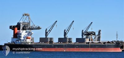
FUGA
Bulk Carrier
Current Trip
| Time Travelled | 25 days |
|---|---|
| Remaining Time | --- |
| Distance Travelled | 6573.20 nm |
| Remaining Distance | --- |
| AVG Speed | 12.4 Knots |
| MAX Speed | 16.3 Knots |
| AVG Wind | 8.4 knots |
| MAX Wind | 21.8 knots |
| MIN Temp | 5.3°C / 41.54°F |
| MAX Temp | 31.2°C / 88.16°F |
| Draught | 7 m |
| Position Received | 5 d ago |
Current Position
| Longitude | 141.79696° |
|---|---|
| Latitude | 41.62119° |
| Status | Under way using engine |
| Speed | 12.7 Knots |
| Course | 96.7° |
| Area | North Pacific Ocean |
| Station | T-AIS |
| Position Received | 5 d ago |
Info
Information
The current position of FUGA is in North Pacific Ocean with coordinates 41.62119° / 141.79696° as reported on 2024-06-16 02:47 by AIS to our vessel tracker app. The vessel's current speed is 12.7 Knots and is heading at the port of PORTLAND. The estimated time of arrival as calculated by vessel tracking app is 2024-06-28 06:00 LT
The vessel FUGA (IMO: 9624615, MMSI: 373680000) is a Bulk Carrier that was built in 2012 ( 12 years old ). It's sailing under the flag of [PA] Panama.
In this page you can find informations about the vessels current position, last detected port calls, and current voyage information. If the vessels is not in coverage by AIS you will find the latest position.
The current position of FUGA is detected by our AIS receivers and we are not responsible for the reliability of the data. The last position was recorded while the vessel was in Coverage by the Ais receivers of our vessel tracking app.
The current draught of FUGA as reported by AIS is 7 meters
Weather
| Temperature | 7.6°C / 45.68°F |
|---|---|
| Wind Speed | 19 knots |
| Direction | 90° E |
| Pressure | 1014.7 hPa |
| Humidity | 93.9 % |
| Cloud Coverage | 100 % |
Featured Company
Last Port Calls
| Port | Arrival | Departure | Time In Port |
|---|---|---|---|
| 2024-05-21 15:15 | 2024-05-27 00:37 | 5 d | |
| 2024-04-24 23:55 | 2024-04-27 07:35 | 2 d | |
| 2024-04-19 23:12 | 2024-04-21 01:00 | 1 d | |
| 2024-04-08 10:24 | 2024-04-12 21:39 | 4 d | |
| 2024-04-06 17:10 | 2024-04-07 18:06 | 1 d | |
| 2024-04-01 23:13 | 2024-04-04 05:05 | 2 d |
Most Visited Ports (Last year)
| Port | Arrivals | |
|---|---|---|
| 2 | ||
| 2 | ||
| 1 | ||
| 1 | ||
| 1 | ||
| 1 |
Last Trips
| Origin | Departure | Destination | Arrival | Distance | |
|---|---|---|---|---|---|
| 2024-04-27 14:35 | 2024-05-21 23:15 | 1417.56 nm | |||
| 2024-04-21 08:00 | 2024-04-25 06:55 | 1033.02 nm | |||
| 2024-04-13 06:39 | 2024-04-20 06:12 | 2076.86 nm | |||
| 2024-04-08 03:06 | 2024-04-08 19:24 | 135.40 nm | |||
| 2024-04-04 14:05 | 2024-04-07 02:10 | 687.58 nm | |||
| 2024-03-29 16:23 | 2024-04-02 08:13 | 914.07 nm |
Events
| Time | Event | Details | Position / Dest | Info |
|---|---|---|---|---|
| 2024-06-16 02:53 | Status Changed | Default Under way using engine |
41.61823 / 141.82762
USPDX
|
Speed: 12.7 kn Course: 96.7° |
| 2024-06-16 02:47 | OUT of Coverage |
41.62119 / 141.79696
North Pacific Ocean
USPDX
|
Speed: 12.7 kn Course: 96.7° |
|
| 2024-06-16 01:08 | Change Sea Area | Japanese part of the North Pacific Ocean Japanese part of the Japan Sea |
41.64359 / 141.29437
North Pacific Ocean
USPDX
|
Speed: 13.6 kn Course: 86.8° |
| 2024-06-15 21:38 | Status Changed | Under way using engine Default |
41.31106 / 140.24847
USPDX
|
Speed: 14.6 kn Course: 54° |
| 2024-06-15 21:37 | Status Changed | Default Under way using engine |
41.30896 / 140.24464
USPDX
|
Speed: 14.1 kn Course: 52.6° |
| 2024-06-15 19:41 | Change Sea Area | Japanese part of the Japan Sea Japan - South Korea Conflict Zone part of the Japan Sea |
41.09681 / 139.73520
Japan Sea
USPDX
|
Speed: 13.5 kn Course: 60.7° |
| 2024-06-15 19:41 | Status Changed | Under way using engine Default |
41.09681 / 139.73520
USPDX
|
Speed: 13.6 kn Course: 71° |
| 2024-06-15 19:25 | IN Coverage |
41.09681 / 139.73520
Japan Sea
USPDX
|
Speed: 13.5 kn Course: 60.7° |
|
| 2024-06-14 08:00 | Status Changed | Default Under way using engine |
36.20163 / 131.62788
USPDX
|
Speed: 14.6 kn Course: 40.1° |
| 2024-06-14 07:55 | OUT of Coverage |
36.18443 / 131.60963
Japan Sea
USPDX
|
Speed: 14.6 kn Course: 40.1° |