
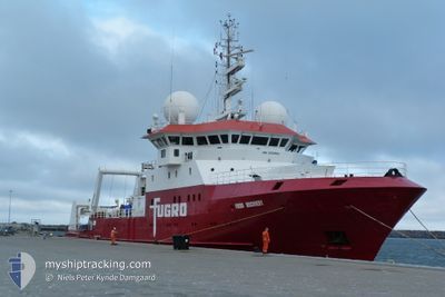
FUGRO DISCOVERY
Research/Survey Vessel
Current Trip
SEISMIC SURVEY
| Time Travelled | 5 days |
|---|---|
| Remaining Time | --- |
| Distance Travelled | 377.69 nm |
| Remaining Distance | --- |
| AVG Speed | 4.9 Knots |
| MAX Speed | 15.4 Knots |
| AVG Wind | 15 knots |
| MAX Wind | 27.8 knots |
| MIN Temp | 12.4°C / 54.32°F |
| MAX Temp | 16.1°C / 60.98°F |
| Draught | 5.7 m |
| Position Received | 1 d ago |
Current Position
| Longitude | 6.05756° |
|---|---|
| Latitude | 54.28715° |
| Status | Under way using engine |
| Speed | 1.2 Knots |
| Course | 164° |
| Area | North Sea |
| Station | T-AIS |
| Position Received | 1 d ago |
Info
Information
The current position of FUGRO DISCOVERY is in North Sea with coordinates 54.28715° / 6.05756° as reported on 2024-05-21 22:35 by AIS to our vessel tracker app. The vessel's current speed is 1.2 Knots
The vessel FUGRO DISCOVERY (IMO: 9152882, MMSI: 372698000) is a Research/Survey Vessel that was built in 1997 ( 27 years old ). It's sailing under the flag of [PA] Panama.
In this page you can find informations about the vessels current position, last detected port calls, and current voyage information. If the vessels is not in coverage by AIS you will find the latest position.
The current position of FUGRO DISCOVERY is detected by our AIS receivers and we are not responsible for the reliability of the data. The last position was recorded while the vessel was in Coverage by the Ais receivers of our vessel tracking app.
The current draught of FUGRO DISCOVERY as reported by AIS is 5.7 meters
Weather
| Temperature | 13.2°C / 55.76°F |
|---|---|
| Wind Speed | 13 knots |
| Direction | 204° SSW |
| Pressure | 1010 hPa |
| Humidity | 94.4 % |
| Cloud Coverage | 63 % |
Featured Company
Last Port Calls
| Port | Arrival | Departure | Time In Port |
|---|---|---|---|
| 2024-05-13 14:59 | 2024-05-17 20:41 | 4 d | |
| 2024-04-29 03:12 | 2024-04-30 17:05 | 1 d | |
| 2024-04-15 12:30 | 2024-04-22 12:38 | 7 d | |
| 2024-04-03 04:13 | 2024-04-04 08:37 | 1 d | |
| 2024-03-12 09:06 | |||
| 2024-03-12 08:34 | |||
| 2024-03-12 08:34 |
Last Trips
| Origin | Departure | Destination | Arrival | Distance | |
|---|---|---|---|---|---|
| 2024-04-30 19:05 | 2024-05-13 16:59 | 1104.05 nm | |||
| 2024-04-22 14:38 | 2024-04-29 05:12 | 591.38 nm | |||
| 2024-04-04 10:37 | 2024-04-15 14:30 | 2643.43 nm | |||
| 2024-03-12 10:06 | 2024-04-03 06:13 | 2896.38 nm | |||
| 2024-03-12 09:34 | 2024-03-12 09:34 | 0.55 nm |
Events
| Time | Event | Details | Position / Dest | Info |
|---|---|---|---|---|
| 2024-05-22 19:36 | START Moving |
54.32500 / 6.13167
SEISMIC SURVEY
|
Speed: 4 kn Course: -1° |
|
| 2024-05-22 13:27 | STOP Moving |
54.28667 / 6.07167
SEISMIC SURVEY
|
Speed: Course: -1° |
|
| 2024-05-22 07:03 | START Moving |
54.27300 / 6.11497
SEISMIC SURVEY
|
Speed: 3.1 kn Course: 60° |
|
| 2024-05-21 22:37 | Status Changed | Default Under way using engine |
54.28677 / 6.05602
SEISMIC SURVEY
|
Speed: 1.2 kn Course: 164° |
| 2024-05-21 22:35 | Status Changed | Under way using engine Default |
54.28715 / 6.05756
SEISMIC SURVEY
|
Speed: 1 kn Course: -1° |
| 2024-05-21 22:35 | IN Coverage |
54.28715 / 6.05756
North Sea
|
Speed: 1.2 kn Course: 248.8° |
|
| 2024-05-21 22:35 | OUT of Coverage |
54.28715 / 6.05756
North Sea
|
Speed: 1.2 kn Course: 248.8° |
|
| 2024-05-21 11:48 | STOP Moving |
54.27148 / 6.05944
SEISMIC SURVEY
|
Speed: 0.3 kn Course: 86° |
|
| 2024-05-20 19:02 | Status Changed | Default Restricted manoeuverability |
54.30558 / 6.03455
SEISMIC SURVEY
|
Speed: 4.1 kn Course: 103° |
| 2024-05-20 18:59 | OUT of Coverage |
54.30585 / 6.02877
North Sea
|
Speed: 4.1 kn Course: 111.3° |