
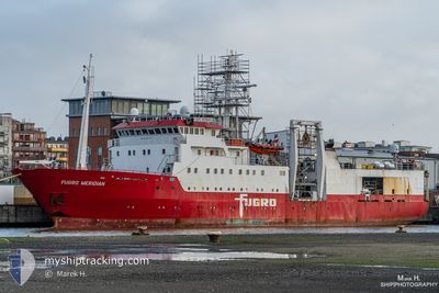
FUGRO MERIDIAN
Research/Survey Vessel
Aktuelle Reise
| Bisherige Reisezeit | 20 Tage |
|---|---|
| Verbleibende Reisezeit | --- |
| Zurückgelegte Distanz | 942.08 nm |
| Verbleibende Distanz | --- |
| Durchschnittliche Geschwindigkeit | 7.2 Knoten |
| Maximale Geschwindigkeit | 11.7 Knoten |
| Durchschnittliche Windgeschwindigkeit | 13.6 Knoten |
| Maximale Windgeschwindigkeit | 33.3 Knoten |
| Minimale Temperatur | 10.3°C / 50.54°F |
| Maximale Temperatur | 17.3°C / 63.14°F |
| Tiefgang | 6.6 m |
| Position erhalten | 14 h, 0 m alt |
Aktuelle Position
| Länge | --- |
|---|---|
| Breite | --- |
| Zustand | Under way using engine |
| Geschwindigkeit | 8.1 Knoten |
| Kurs | 254.9° |
| Gebiet | North Sea |
| Station | T-AIS |
| Position erhalten | 14 h, 0 m alt |
Schiffsdetails
Information
Die FUGRO MERIDIAN befindet sich derzeit in North Sea mit den Koordinaten 55.72997° / 2.98735°, Diese Position wurde am 2024-10-31 10:04 von unserer Schiffsverfolgungs-App über AIS erfasst. Das Schiff fährt momentan mit einer Geschwindigkeit von 8.1 Knoten
Das Schiff FUGRO MERIDIAN (IMO: 8101331, MMSI: 308036000) ist Research/Survey Vessel das wurde im Jahr 1982 ( 42 Jahre alt ) gebaut. und fährt unter der Flagge von [BS] Bahamas.
Auf dieser Seite erhalten Sie Informationen zur aktuellen Position des Schiffes, zu den letzten bekannten Hafenanläufen und zu den aktuellen Reiseinformationen. Sollte das Schiff nicht durch AIS abgedeckt sein, wird die zuletzt erfasste Position angezeigt.
Die FUGRO MERIDIAN wird durch unsere AIS-Empfänger ermittelt. Wir übernehmen keine Gewähr für die Richtigkeit der Daten. Die letzte Position wurde von unseren AIS-Empfängern aufgezeichnet, während das Schiff in Reichweite war.
Der aktuelle Entwurf von FUGRO MERIDIAN, wie von AIS gemeldet, betragt 6.6 meter
Wetter
| Temperatur | 11.9°C / 53.42°F |
|---|---|
| Windgeschwindigkeit | 18 Knoten |
| Windrichtung | 255° WSW |
| Luftdruck | 1020.7 hPa |
| Luftfeuchtigkeit | 88.7 % |
| Wolken | --- |
Featured Company
Letzte Hafenanläufe
| Hafen | Ankunft | Abfahrt | Time In Port |
|---|---|---|---|
| 2024-10-09 12:05 | 2024-10-11 10:50 | 1 d | |
| 2024-10-04 08:00 | 2024-10-05 06:08 | 22 h | |
| 2024-09-30 08:23 | 2024-10-01 14:59 | 1 d | |
| 2024-09-17 08:05 | 2024-09-24 14:00 | 7 d | |
| 2024-09-11 06:50 | 2024-09-12 06:00 | 23 h | |
| 2024-09-03 14:18 | 2024-09-07 11:06 | 3 d | |
| 2024-08-29 06:49 | 2024-08-29 14:34 | 7 h | |
| 2024-08-22 15:21 | 2024-08-23 21:18 | 1 d | |
| 2024-08-15 06:38 | 2024-08-16 06:31 | 23 h |
Letzte Reisen
| Herkunft | Abfahrt | Ziel | Ankunft | Distanz | |
|---|---|---|---|---|---|
| 2024-10-05 08:08 | 2024-10-09 14:05 | 459.12 nm | |||
| 2024-10-01 16:59 | 2024-10-04 10:00 | 393.25 nm | |||
| 2024-09-24 16:00 | 2024-09-30 10:23 | 869.36 nm | |||
| 2024-09-12 08:00 | 2024-09-17 10:05 | 405.22 nm | |||
| 2024-09-07 13:06 | 2024-09-11 08:50 | 445.81 nm | |||
| 2024-08-29 15:34 | 2024-09-03 16:18 | 1079.68 nm | |||
| 2024-08-23 22:18 | 2024-08-29 07:49 | 396.03 nm | |||
| 2024-08-16 08:31 | 2024-08-22 16:21 | 680.46 nm | |||
| 2024-07-15 18:04 | 2024-08-15 08:38 | 2026.47 nm |
Events
| Zeit | Ereignis | Details | Position / Ziel | Information |
|---|---|---|---|---|
| 2024-10-31 10:20 | geänderter Status | Default Under way using engine |
55.71989 / 2.92815
SUNDERLAND
|
Geschwindigkeit: 8.1 kn Kurs: 254.9° |
| 2024-10-31 10:04 | außerhalb Abdeckung |
55.72997 / 2.98735
North Sea
SUNDERLAND
|
Geschwindigkeit: 8.1 kn Kurs: 254.9° |
|
| 2024-10-31 09:51 | geänderter Status | Under way using engine Default |
55.73761 / 3.03355
SUNDERLAND
|
Geschwindigkeit: 7.7 kn Kurs: 250° |
| 2024-10-31 09:40 | geänderter Status | Default Under way using engine |
55.74393 / 3.07097
SUNDERLAND
|
Geschwindigkeit: 7.4 kn Kurs: 251.4° |
| 2024-10-31 09:11 | geändertes Ziel | SUNDERLAND SURVEY CPA 0.5NM |
55.76168 / 3.17213
SUNDERLAND
|
Geschwindigkeit: 7.7 kn Kurs: 253.6° |
| 2024-10-31 09:11 | geänderte voraussichtliche Ankunftszeit | 2024/11/01 12:00 2024/10/12 01:00 |
55.76168 / 3.17213
SUNDERLAND
|
Geschwindigkeit: 7.7 kn Kurs: 253.6° |
| 2024-10-31 09:11 | geänderter Status | Under way using engine Default |
55.76168 / 3.17213
SURVEY CPA 0.5NM
|
Geschwindigkeit: 6.9 kn Kurs: 256° |
| 2024-10-31 09:11 | in Abdeckung |
55.76168 / 3.17213
North Sea
SUNDERLAND
|
Geschwindigkeit: 7.7 kn Kurs: 253.6° |
|
| 2024-10-31 08:18 | geänderter Status | Default Under way using engine |
55.79265 / 3.34510
SURVEY CPA 0.5NM
|
Geschwindigkeit: 1.8 kn Kurs: 237° |
| 2024-10-31 08:11 | außerhalb Abdeckung |
55.79649 / 3.35419
North Sea
|
Geschwindigkeit: 1.8 kn Kurs: 210.7° |