
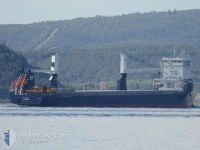
FWN ARCTIC
Cargo
Current Trip
| Time Travelled | 18 h, 7 mins |
|---|---|
| Remaining Time | 1 day |
| Distance Travelled | 196.55 nm |
| Remaining Distance | 511.68 nm |
| AVG Speed | 13.4 Knots |
| MAX Speed | 14.2 Knots |
| AVG Wind | 11.2 knots |
| MAX Wind | 15.5 knots |
| MIN Temp | 23.6°C / 74.48°F |
| MAX Temp | 25.3°C / 77.54°F |
| Draught | 5.9 m |
| Position Received | 3 h, 27 m ago |
Current Position
| Longitude | 18.52686° |
|---|---|
| Latitude | 36.03084° |
| Status | Under way using engine |
| Speed | 13.5 Knots |
| Course | 89.1° |
| Area | Mediterranean Sea - Eastern Basin |
| Station | T-AIS |
| Position Received | 3 h, 27 m ago |
Info
Information
The current position of FWN ARCTIC is in Mediterranean Sea - Eastern Basin with coordinates 36.03084° / 18.52686° as reported on 2024-06-27 08:35 by AIS to our vessel tracker app. The vessel's current speed is 13.5 Knots and is heading at the port of MARMARIS. The estimated time of arrival as calculated by vessel tracking app is 2024-06-28 22:43 LT
The vessel FWN ARCTIC (IMO: 9931484, MMSI: 244130525) is a Cargo It's sailing under the flag of [NL] Netherlands.
In this page you can find informations about the vessels current position, last detected port calls, and current voyage information. If the vessels is not in coverage by AIS you will find the latest position.
The current position of FWN ARCTIC is detected by our AIS receivers and we are not responsible for the reliability of the data. The last position was recorded while the vessel was in Coverage by the Ais receivers of our vessel tracking app.
The current draught of FWN ARCTIC as reported by AIS is 5.9 meters
Weather
| Temperature | 25.6°C / 78.08°F |
|---|---|
| Wind Speed | 7 knots |
| Direction | 286° WNW |
| Pressure | 1012.6 hPa |
| Humidity | 78.6 % |
| Cloud Coverage | --- |
Featured Company
Last Port Calls
| Port | Arrival | Departure | Time In Port |
|---|---|---|---|
| 2024-06-26 04:29 | 2024-06-26 17:55 | 13 h | |
| 2024-06-22 22:08 | 2024-06-23 23:07 | 1 d | |
| 2024-06-11 18:55 | 2024-06-17 18:09 | 5 d | |
| 2024-06-09 15:32 | 2024-06-10 22:32 | 1 d | |
| 2024-06-08 06:36 | 2024-06-08 07:55 | 1 h | |
| 2024-06-06 20:09 | 2024-06-06 20:11 | 2 m | |
| 2024-06-03 05:08 | 2024-06-05 17:19 | 2 d | |
| 2024-05-30 05:15 | 2024-05-31 16:12 | 1 d | |
| 2024-05-29 09:39 | 2024-05-29 09:51 | 11 m | |
| 2024-05-15 22:45 | 2024-05-16 04:23 | 5 h |
Last Trips
| Origin | Departure | Destination | Arrival | Distance | |
|---|---|---|---|---|---|
| 2024-06-24 01:07 | 2024-06-26 06:29 | 650.29 nm | |||
| 2024-06-17 19:09 | 2024-06-23 00:08 | 1669.96 nm | |||
| 2024-06-11 00:32 | 2024-06-11 19:55 | 249.63 nm | |||
| 2024-06-08 09:55 | 2024-06-09 17:32 | 352.12 nm | |||
| 2024-06-06 22:11 | 2024-06-08 08:36 | 54.94 nm | |||
| 2024-06-05 19:19 | 2024-06-06 22:09 | 221.48 nm | |||
| 2024-05-31 18:12 | 2024-06-03 07:08 | 777.81 nm | |||
| 2024-05-29 11:51 | 2024-05-30 07:15 | 223.57 nm | |||
| 2024-05-16 06:23 | 2024-05-29 11:39 | 1035.84 nm | |||
| 2024-05-10 06:38 | 2024-05-16 00:45 | 1682.95 nm |
Events
| Time | Event | Details | Position / Dest | Info |
|---|---|---|---|---|
| 2024-06-27 08:40 | Status Changed | Default Under way using engine |
36.03113 / 18.55091
TR MRM
|
Speed: 13.5 kn Course: 89.1° |
| 2024-06-27 08:35 | Detected in Sea | Greek part of the Mediterranean Sea - Eastern Basin |
36.03084 / 18.52686
Mediterranean Sea - Eastern Basin
TR MRM
|
Speed: 13.5 kn Course: 89.1° |
| 2024-06-27 08:35 | Status Changed | Under way using engine Default |
36.03084 / 18.52686
TR MRM
|
Speed: 13.3 kn Course: 89° |
| 2024-06-27 08:35 | IN Coverage |
36.03084 / 18.52686
Mediterranean Sea - Eastern Basin
TR MRM
|
Speed: 13.5 kn Course: 89.1° |
|
| 2024-06-27 08:35 | OUT of Coverage |
36.03084 / 18.52686
Mediterranean Sea - Eastern Basin
TR MRM
|
Speed: 13.5 kn Course: 89.1° |
|
| 2024-06-27 07:08 | Status Changed | Default Under way using engine |
36.02624 / 18.13201
TR MRM
|
Speed: 13.1 kn Course: 90.1° |
| 2024-06-27 07:07 | OUT of Coverage |
36.02625 / 18.12668
Mediterranean Sea - Eastern Basin
TR MRM
|
Speed: 13.1 kn Course: 90.1° |
|
| 2024-06-27 07:05 | Status Changed | Under way using engine Default |
36.02632 / 18.11776
TR MRM
|
Speed: 13.2 kn Course: 91° |
| 2024-06-27 06:55 | Status Changed | Default Under way using engine |
36.02712 / 18.06999
TR MRM
|
Speed: 13.2 kn Course: 90.7° |
| 2024-06-27 06:39 | Status Changed | Under way using engine Default |
36.02779 / 17.99974
TR MRM
|
Speed: 13 kn Course: 90° |