
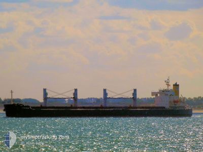
G TAISHAN
Bulk Carrier
Current Trip
| Time Travelled | 4 days |
|---|---|
| Remaining Time | 11 h, 35 mins |
| Distance Travelled | 1111.81 nm |
| Remaining Distance | 195.04 nm |
| AVG Speed | 11.1 Knots |
| MAX Speed | 13.4 Knots |
| AVG Wind | 10.8 knots |
| MAX Wind | 25.2 knots |
| MIN Temp | 17.9°C / 64.22°F |
| MAX Temp | 23.3°C / 73.94°F |
| Draught | 6.4 m |
| Position Received | 4 h, 7 m ago |
Current Position
| Longitude | -6.23530° |
|---|---|
| Latitude | 35.64665° |
| Status | Under way using engine |
| Speed | 13.4 Knots |
| Course | 215.6° |
| Area | North Atlantic Ocean |
| Station | T-AIS |
| Position Received | 4 h, 7 m ago |
Info
Information
The current position of G TAISHAN is in North Atlantic Ocean with coordinates 35.64665° / -6.23530° as reported on 2024-06-13 02:43 by AIS to our vessel tracker app. The vessel's current speed is 13.4 Knots and is heading at the port of JORF LASFAR. The estimated time of arrival as calculated by vessel tracking app is 2024-06-13 18:26 LT
The vessel G TAISHAN (IMO: 9440992, MMSI: 371238000) is a Bulk Carrier that was built in 2008 ( 16 years old ). It's sailing under the flag of [PA] Panama.
In this page you can find informations about the vessels current position, last detected port calls, and current voyage information. If the vessels is not in coverage by AIS you will find the latest position.
The current position of G TAISHAN is detected by our AIS receivers and we are not responsible for the reliability of the data. The last position was recorded while the vessel was in Coverage by the Ais receivers of our vessel tracking app.
The current draught of G TAISHAN as reported by AIS is 6.4 meters
Weather
| Temperature | 19.3°C / 66.74°F |
|---|---|
| Wind Speed | 3 knots |
| Direction | 44° NE |
| Pressure | 1018.3 hPa |
| Humidity | 76.1 % |
| Cloud Coverage | 71 % |
Featured Company
Last Port Calls
| Port | Arrival | Departure | Time In Port |
|---|---|---|---|
| 2024-06-07 20:05 | 2024-06-08 19:13 | 23 h | |
| 2024-05-26 06:16 | 2024-06-04 12:28 | 9 d | |
| 2024-05-16 10:11 | 2024-05-19 09:48 | 2 d | |
| 2024-05-11 06:59 | 2024-05-11 16:09 | 9 h | |
| 2024-04-17 12:04 | 2024-04-20 07:04 | 2 d | |
| 2024-04-10 22:20 | 2024-04-13 08:39 | 2 d | |
| 2024-04-05 20:57 | 2024-04-07 16:29 | 1 d | |
| 2024-04-02 14:34 |
Last Trips
| Origin | Departure | Destination | Arrival | Distance | |
|---|---|---|---|---|---|
| 2024-06-04 14:28 | 2024-06-07 22:05 | 843.64 nm | |||
| 2024-05-19 11:48 | 2024-05-26 08:16 | 80.45 nm | |||
| 2024-04-20 14:04 | 2024-05-16 12:11 | 7118.15 nm | |||
| 2024-04-20 14:04 | 2024-05-11 08:59 | 5670.13 nm | |||
| 2024-04-13 16:39 | 2024-04-17 19:04 | 1184.08 nm | |||
| 2024-04-08 01:29 | 2024-04-11 06:20 | 891.77 nm | |||
| 2024-04-02 23:34 | 2024-04-06 05:57 | 437.68 nm |
Events
| Time | Event | Details | Position / Dest | Info |
|---|---|---|---|---|
| 2024-06-13 02:51 | Status Changed | Default Under way using engine |
35.62223 / -6.25680
MA JFL
|
Speed: 13.4 kn Course: 215.6° |
| 2024-06-13 02:43 | Status Changed | Under way using engine Default |
35.64665 / -6.23530
MA JFL
|
Speed: 13.4 kn Course: 213° |
| 2024-06-13 02:43 | OUT of Coverage |
35.64665 / -6.23530
North Atlantic Ocean
MA JFL
|
Speed: 13.4 kn Course: 215.6° |
|
| 2024-06-13 02:23 | Status Changed | Default Under way using engine |
35.71191 / -6.18360
MA JFL
|
Speed: 13.4 kn Course: 213° |
| 2024-06-13 02:17 | Status Changed | Under way using engine Default |
35.73026 / -6.16893
MA JFL
|
Speed: 13.4 kn Course: 213° |
| 2024-06-13 01:31 | Status Changed | Default Under way using engine |
35.84997 / -6.02810
MA JFL
|
Speed: 12.3 kn Course: 228.8° |
| 2024-06-13 01:20 | Status Changed | Under way using engine Default |
35.87524 / -5.99415
MA JFL
|
Speed: 12.1 kn Course: 231° |
| 2024-06-13 01:15 | Status Changed | Default Under way using engine |
35.88568 / -5.97865
MA JFL
|
Speed: 12.1 kn Course: 222.5° |
| 2024-06-13 01:08 | Change Sea Area | Moroccan part of the North Atlantic Ocean Moroccan part of the Strait of Gibraltar |
35.90237 / -5.95701
North Atlantic Ocean
MA JFL
|
Speed: 12.1 kn Course: 222.5° |
| 2024-06-13 00:58 | Change Sea Area | Moroccan part of the Strait of Gibraltar Spanish part of the Strait of Gibraltar |
35.92881 / -5.93136
Strait of Gibraltar
MA JFL
|
Speed: 11.9 kn Course: 214.6° |