
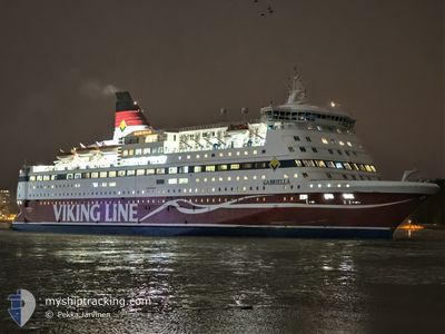
GABRIELLA
Ro-Ro/Passenger Ship
Current Trip
| Time Travelled | 14 h, 20 mins |
|---|---|
| Remaining Time | 1 h, 53 mins |
| Distance Travelled | 233.61 nm |
| Remaining Distance | 34.60 nm |
| AVG Speed | 16.5 Knots |
| MAX Speed | 16.9 Knots |
| AVG Wind | 5.6 knots |
| MAX Wind | 10.2 knots |
| MIN Temp | 9°C / 48.2°F |
| MAX Temp | 17.3°C / 63.14°F |
| Draught | 6.3 m |
| Position Received | 18 m ago |
Current Position
| Longitude | 18.97651° |
|---|---|
| Latitude | 58.05427° |
| Status | Under way using engine |
| Speed | 16.5 Knots |
| Course | 248° |
| Area | Baltic Sea |
| Station | T-AIS |
| Position Received | 18 m ago |
Info
Information
The current position of GABRIELLA is in Baltic Sea with coordinates 58.05427° / 18.97651° as reported on 2024-05-18 03:11 by AIS to our vessel tracker app. The vessel's current speed is 16.5 Knots and is heading at the port of VISBY. The estimated time of arrival as calculated by vessel tracking app is 2024-05-18 05:23 LT
The vessel GABRIELLA (IMO: 8917601, MMSI: 230361000) is a Ro-Ro/Passenger Ship that was built in 1992 ( 32 years old ). It's sailing under the flag of [FI] Finland.
In this page you can find informations about the vessels current position, last detected port calls, and current voyage information. If the vessels is not in coverage by AIS you will find the latest position.
The current position of GABRIELLA is detected by our AIS receivers and we are not responsible for the reliability of the data. The last position was recorded while the vessel was in Coverage by the Ais receivers of our vessel tracking app.
The current draught of GABRIELLA as reported by AIS is 6.3 meters
Weather
| Temperature | 9.4°C / 48.92°F |
|---|---|
| Wind Speed | 8 knots |
| Direction | 93° E |
| Pressure | 1020 hPa |
| Humidity | 77.6 % |
| Cloud Coverage | 7 % |
Featured Company
Last Port Calls
| Port | Arrival | Departure | Time In Port |
|---|---|---|---|
| 2024-05-17 06:54 | 2024-05-17 13:10 | 6 h | |
| 2024-05-16 20:24 | 2024-05-16 20:50 | 25 m | |
| 2024-05-16 07:34 | 2024-05-16 14:42 | 7 h | |
| 2024-05-16 01:12 | 2024-05-16 01:32 | 19 m | |
| 2024-05-15 07:03 | 2024-05-15 14:17 | 7 h | |
| 2024-05-14 20:25 | 2024-05-14 20:45 | 19 m | |
| 2024-05-14 07:32 | 2024-05-14 14:42 | 7 h | |
| 2024-05-14 01:14 | 2024-05-14 01:36 | 21 m | |
| 2024-05-13 07:02 | 2024-05-13 14:19 | 7 h | |
| 2024-05-12 20:25 | 2024-05-12 20:45 | 20 m |
Most Visited Ports (Last year)
| Port | Arrivals | |
|---|---|---|
| 261 | ||
| 203 | ||
| 176 | ||
| 23 | ||
| 4 |
Last Trips
| Origin | Departure | Destination | Arrival | Distance | |
|---|---|---|---|---|---|
| 2024-05-16 23:50 | 2024-05-17 09:54 | 184.21 nm | |||
| 2024-05-16 16:42 | 2024-05-16 23:24 | 77.17 nm | |||
| 2024-05-16 04:32 | 2024-05-16 09:34 | 78.92 nm | |||
| 2024-05-15 17:17 | 2024-05-16 04:12 | 184.14 nm | |||
| 2024-05-14 23:45 | 2024-05-15 10:03 | 184.85 nm | |||
| 2024-05-14 16:42 | 2024-05-14 23:25 | 78.15 nm | |||
| 2024-05-14 04:36 | 2024-05-14 09:32 | 78.37 nm | |||
| 2024-05-13 17:19 | 2024-05-14 04:14 | 183.95 nm | |||
| 2024-05-12 23:45 | 2024-05-13 10:02 | 185.04 nm | |||
| 2024-05-12 16:41 | 2024-05-12 23:25 | 78.08 nm |
Events
| Time | Event | Details | Position / Dest | Info |
|---|---|---|---|---|
| 2024-05-18 03:17 | Status Changed | Default Under way using engine |
58.04489 / 18.93320
SEVBY
|
Speed: 16.5 kn Course: 248° |
| 2024-05-18 03:10 | Change Sea Area | Swedish part of the Baltic Sea Estonian part of the Baltic Sea |
58.05567 / 18.98300
Baltic Sea
SEVBY
|
Speed: 16.6 kn Course: 248° |
| 2024-05-18 03:08 | Status Changed | Under way using engine Default |
58.06017 / 19.00400
SEVBY
|
Speed: 16.4 kn Course: 248° |
| 2024-05-18 02:57 | IN Coverage |
58.05567 / 18.98300
Baltic Sea
SEVBY
|
Speed: 16.6 kn Course: 248° |
|
| 2024-05-17 20:24 | Status Changed | Default Under way using engine |
59.21084 / 21.75183
SEVBY
|
Speed: 16.4 kn Course: 230.1° |
| 2024-05-17 20:06 | OUT of Coverage |
59.26517 / 21.87800
Baltic Sea
SEVBY
|
Speed: 16.4 kn Course: 230.1° |
|
| 2024-05-17 19:56 | Change Sea Area | Estonian part of the Baltic Sea Finnish part of the Baltic Sea |
59.29308 / 21.94458
Baltic Sea
SEVBY
|
Speed: 16.3 kn Course: 230.6° |
| 2024-05-17 19:56 | Status Changed | Under way using engine Default |
59.29480 / 21.94870
SEVBY
|
Speed: 16.5 kn Course: 231° |
| 2024-05-17 19:34 | Status Changed | Default Under way using engine |
59.35693 / 22.09836
SEVBY
|
Speed: 16.6 kn Course: 230.5° |
| 2024-05-17 19:02 | Status Changed | Under way using engine Default |
59.45100 / 22.32567
SEVBY
|
Speed: 16.5 kn Course: 231° |