
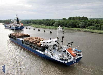
GAHURA
General Cargo
Current Trip
| Time Travelled | 2 days |
|---|---|
| Remaining Time | --- |
| Distance Travelled | 190.70 nm |
| Remaining Distance | --- |
| AVG Speed | 10.4 Knots |
| MAX Speed | 11.3 Knots |
| AVG Wind | 7 knots |
| MAX Wind | 12.8 knots |
| MIN Temp | 18.3°C / 64.94°F |
| MAX Temp | 21.7°C / 71.06°F |
| Draught | 3.6 m |
| Position Received | 18 h, 54 m ago |
Current Position
| Longitude | 15.95728° |
|---|---|
| Latitude | 41.59262° |
| Status | At anchor |
| Speed | |
| Course | 58° |
| Area | Adriatic Sea |
| Station | T-AIS |
| Position Received | 18 h, 54 m ago |
Info
Information
The current position of GAHURA is in Adriatic Sea with coordinates 41.59262° / 15.95728° as reported on 2024-05-24 16:41 by AIS to our vessel tracker app. The vessel's current speed is 0 Knots
The vessel GAHURA (IMO: 9053907, MMSI: 352624000) is a General Cargo that was built in 1992 ( 32 years old ). It's sailing under the flag of [PA] Panama.
In this page you can find informations about the vessels current position, last detected port calls, and current voyage information. If the vessels is not in coverage by AIS you will find the latest position.
The current position of GAHURA is detected by our AIS receivers and we are not responsible for the reliability of the data. The last position was recorded while the vessel was in Coverage by the Ais receivers of our vessel tracking app.
The current draught of GAHURA as reported by AIS is 3.6 meters
Weather
| Temperature | 20.7°C / 69.26°F |
|---|---|
| Wind Speed | 2 knots |
| Direction | 179° S |
| Pressure | 1015.7 hPa |
| Humidity | 60.9 % |
| Cloud Coverage | 100 % |
Featured Company
Events
| Time | Event | Details | Position / Dest | Info |
|---|---|---|---|---|
| 2024-05-24 16:53 | Status Changed | Default At anchor |
41.59262 / 15.95728
IT MFR
|
Speed: Course: 58° |
| 2024-05-24 16:41 | OUT of Coverage |
41.59262 / 15.95728
Adriatic Sea
|
Speed: Course: 154.7° |
|
| 2024-05-24 16:38 | Status Changed | At anchor Default |
41.59262 / 15.95728
IT MFR
|
Speed: Course: 84° |
| 2024-05-24 16:38 | IN Coverage |
41.59262 / 15.95728
Adriatic Sea
|
Speed: Course: 154.7° |
|
| 2024-05-24 12:53 | Status Changed | Default At anchor |
41.59262 / 15.95728
IT MFR
|
Speed: Course: 73° |
| 2024-05-24 12:29 | OUT of Coverage |
41.59262 / 15.95728
Adriatic Sea
|
Speed: Course: 154.7° |
|
| 2024-05-24 11:44 | Status Changed | At anchor Default |
41.59262 / 15.95728
IT MFR
|
Speed: Course: 68° |
| 2024-05-24 11:44 | IN Coverage |
41.59262 / 15.95728
Adriatic Sea
|
Speed: Course: 154.7° |
|
| 2024-05-23 09:27 | Status Changed | Default Under way using engine |
41.82440 / 16.26224
IT MFR
|
Speed: 10.3 kn Course: 177° |
| 2024-05-23 09:14 | OUT of Coverage |
41.86261 / 16.26114
Adriatic Sea
IT MFR
|
Speed: 10.3 kn Course: 177° |