
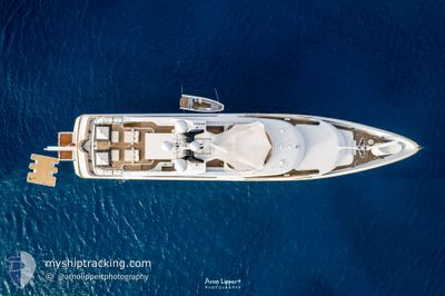
GALAXY
Yacht
Current Trip
| Trip Time | 3 days |
|---|---|
| Trip Distance | 264.77 nm |
| AVG Speed | 10.6 Knots |
| MAX Speed | 13.5 Knots |
| Draught | 3.3 m |
| AVG Wind | 3.4 knots |
| MAX Wind | 6.8 knots |
| MIN Temp | 14.8°C / 58.64°F |
| MAX Temp | 20.1°C / 68.18°F |
| Position Received | 1 m ago |
Current Position
| Longitude | 7.13096° |
|---|---|
| Latitude | 43.58716° |
| Status | Under way using engine |
| Speed | 0.1 Knots |
| Course | 303° |
| Area | Mediterranean Sea - Western Basin |
| Station | T-AIS |
| Position Received | 1 m ago |
Info
Information
The current position of GALAXY is in Mediterranean Sea - Western Basin with coordinates 43.58716° / 7.13096° as reported on 2024-05-29 06:34 by AIS to our vessel tracker app. The vessel's current speed is 0.1 Knots and is currently inside the port of ANTIBES.
The vessel GALAXY (IMO: 1008231, MMSI: 319055900) is a Yacht that was built in 2005 ( 19 years old ). It's sailing under the flag of [KY] Cayman Is.
In this page you can find informations about the vessels current position, last detected port calls, and current voyage information. If the vessels is not in coverage by AIS you will find the latest position.
The current position of GALAXY is detected by our AIS receivers and we are not responsible for the reliability of the data. The last position was recorded while the vessel was in Coverage by the Ais receivers of our vessel tracking app.
The current draught of GALAXY as reported by AIS is 3.3 meters
Weather
| Temperature | 19.8°C / 67.64°F |
|---|---|
| Wind Speed | 2 knots |
| Direction | 51° NE |
| Pressure | 1014.7 hPa |
| Humidity | 77.2 % |
| Cloud Coverage | 100 % |
Featured Company
Last Port Calls
| Port | Arrival | Departure | Time In Port |
|---|---|---|---|
| 2024-05-29 06:14 | |||
| 2024-05-25 17:19 | 2024-05-26 05:11 | 11 h | |
| 2024-05-24 16:02 | 2024-05-25 07:57 | 15 h | |
| 2024-05-19 11:51 | 2024-05-22 10:56 | 2 d | |
| 2024-04-17 12:02 | 2024-05-17 07:21 | 29 d | |
| 2024-03-16 13:33 | 2024-03-31 16:29 | 15 d |
Most Visited Ports (Last year)
| Port | Arrivals | |
|---|---|---|
| 4 | ||
| 3 | ||
| 3 | ||
| 2 | ||
| 2 | ||
| 1 |
Last Trips
| Origin | Departure | Destination | Arrival | Distance | |
|---|---|---|---|---|---|
| 2024-05-26 07:11 | 2024-05-29 08:14 | 264.77 nm | |||
| 2024-05-25 09:57 | 2024-05-25 19:19 | 16.16 nm | |||
| 2024-05-22 12:56 | 2024-05-24 18:02 | 41.51 nm | |||
| 2024-05-17 09:21 | 2024-05-19 13:51 | 367.51 nm | |||
| 2024-03-31 12:29 | 2024-04-17 14:02 | 4406.34 nm | |||
| 2024-02-24 09:09 | 2024-03-16 09:33 | 1439.34 nm |
Events
| Time | Event | Details | Position / Dest | Info |
|---|---|---|---|---|
| 2024-05-29 06:19 | STOP Moving |
43.58767 / 7.12992
[FR] ANTIBES
|
Speed: 0.3 kn Course: 278° |
|
| 2024-05-29 06:15 | START Moving |
43.59053 / 7.13125
[FR] ANTIBES
|
Speed: 3.1 kn Course: 175° |
|
| 2024-05-29 06:14 | PORT ARRIVAL |
|
43.59081 / 7.13125
[FR] ANTIBES
|
Speed: 3.2 kn Course: 180° |
| 2024-05-29 06:08 | STOP Moving | 0.39 nm, North East of ANTIBES |
43.59239 / 7.13186
IT SPE
|
Speed: 0.3 kn Course: 219° |
| 2024-05-29 04:56 | Detected in Sea | French part of the Mediterranean Sea - Western Basin |
43.64899 / 7.43161
Mediterranean Sea - Western Basin
|
Speed: 12.5 kn Course: 257° |
| 2024-05-29 04:47 | Change Sea Area | Mon�gasque part of the Mediterranean Sea - Western Basin French part of the Mediterranean Sea - Western Basin |
43.65621 / 7.47330
Mediterranean Sea - Western Basin
|
Speed: 12.4 kn Course: 256.4° |
| 2024-05-29 04:23 | Change Sea Area | French part of the Mediterranean Sea - Western Basin Italian part of the Mediterranean Sea - Western Basin |
43.67541 / 7.58487
Mediterranean Sea - Western Basin
|
Speed: 12.4 kn Course: 256.4° |
| 2024-05-29 03:53 | Change Sea Area | Italian part of the Mediterranean Sea - Western Basin Italian part of the Ligurian Sea |
43.69777 / 7.72443
Mediterranean Sea - Western Basin
|
Speed: 12.4 kn Course: 258.8° |
| 2024-05-28 21:25 | IN Coverage |
44.18180 / 9.51844
Ligurian Sea
|
Speed: 12.6 kn Course: 246.2° |
|
| 2024-05-28 14:41 | OUT of Coverage |
44.15812 / 9.58567
Ligurian Sea
|
Speed: 12.9 kn Course: 324.1° |