
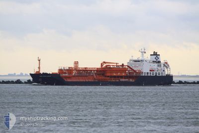
GAZ EXPLORER
Lpg Tanker
Current Trip
ES HUV
| Time Travelled | 1 day |
|---|---|
| Remaining Time | --- |
| Distance Travelled | 1.39 nm |
| Remaining Distance | --- |
| AVG Speed | 4.2 Knots |
| MAX Speed | 4.3 Knots |
| AVG Wind | 4.7 knots |
| MAX Wind | 4.9 knots |
| MIN Temp | 16.6°C / 61.88°F |
| MAX Temp | 16.9°C / 62.42°F |
| Draught | 5.9 m |
| Position Received | 1 d ago |
Current Position
| Longitude | -6.93919° |
|---|---|
| Latitude | 37.20293° |
| Status | Under way using engine |
| Speed | 0.1 Knots |
| Course | 163° |
| Area | North Atlantic Ocean |
| Station | T-AIS |
| Position Received | 1 d ago |
Info
Information
The current position of GAZ EXPLORER is in North Atlantic Ocean with coordinates 37.20293° / -6.93919° as reported on 2024-05-28 05:42 by AIS to our vessel tracker app. The vessel's current speed is 0.1 Knots
The vessel GAZ EXPLORER (IMO: 9506150, MMSI: 354588000) is a Lpg Tanker that was built in 2010 ( 14 years old ). It's sailing under the flag of [PA] Panama.
In this page you can find informations about the vessels current position, last detected port calls, and current voyage information. If the vessels is not in coverage by AIS you will find the latest position.
The current position of GAZ EXPLORER is detected by our AIS receivers and we are not responsible for the reliability of the data. The last position was recorded while the vessel was in Coverage by the Ais receivers of our vessel tracking app.
The current draught of GAZ EXPLORER as reported by AIS is 5.9 meters
Weather
| Temperature | 21.5°C / 70.7°F |
|---|---|
| Wind Speed | 4 knots |
| Direction | 66° ENE |
| Pressure | 1015.8 hPa |
| Humidity | 62.2 % |
| Cloud Coverage | --- |
Featured Company
Last Port Calls
| Port | Arrival | Departure | Time In Port |
|---|---|---|---|
| 2024-05-28 04:35 | 2024-05-28 05:12 | 37 m | |
| 2024-04-18 10:10 | 2024-04-19 08:13 | 22 h | |
| 2024-04-14 07:03 | 2024-04-15 11:32 | 1 d | |
| 2024-04-03 16:57 | 2024-04-05 06:43 | 1 d | |
| 2024-03-29 07:44 | 2024-03-30 06:45 | 23 h | |
| 2024-03-18 15:50 | 2024-03-20 08:03 | 1 d |
Last Trips
| Origin | Departure | Destination | Arrival | Distance | |
|---|---|---|---|---|---|
| 2024-04-19 09:13 | 2024-05-28 06:35 | 2126.74 nm | |||
| 2024-04-15 13:32 | 2024-04-18 11:10 | 793.11 nm | |||
| 2024-04-05 07:43 | 2024-04-14 09:03 | 682.70 nm | |||
| 2024-03-30 07:45 | 2024-04-03 17:57 | 975.40 nm | |||
| 2024-03-20 09:03 | 2024-03-29 08:44 | 1452.42 nm |
Events
| Time | Event | Details | Position / Dest | Info |
|---|---|---|---|---|
| 2024-05-28 05:43 | Status Changed | Default Under way using engine |
37.20293 / -6.93914
ES HUV
|
Speed: 0.1 kn Course: 163° |
| 2024-05-28 05:42 | OUT of Coverage |
37.20293 / -6.93919
North Atlantic Ocean
|
Speed: 0.1 kn Course: 4.8° |
|
| 2024-05-28 05:40 | STOP Moving | 4.58 nm, North West of HUELVA |
37.20287 / -6.93921
ES HUV
|
Speed: 0.3 kn Course: 164° |
| 2024-05-28 05:12 | PORT DEPARTURE |
|
37.18256 / -6.93198
ES HUV
|
Speed: 6.7 kn Course: 324° |
| 2024-05-28 04:35 | PORT ARRIVAL |
|
37.12418 / -6.83583
[ES] HUELVA
|
Speed: 11.5 kn Course: 337.6° |
| 2024-05-28 04:05 | START Moving | 3.24 nm, South of HUELVA |
37.09333 / -6.86174
ES HUV
|
Speed: 4.1 kn Course: 77° |
| 2024-05-28 04:02 | Status Changed | Under way using engine At anchor |
37.09140 / -6.86112
ES HUV
|
Speed: 0.4 kn Course: 315° |
| 2024-05-28 02:52 | Status Changed | At anchor Default |
37.09162 / -6.86188
ES HUV
|
Speed: 0.1 kn Course: 59° |
| 2024-05-28 02:43 | Status Changed | Default At anchor |
37.09135 / -6.86181
ES HUV
|
Speed: 0.1 kn Course: 53° |
| 2024-05-27 22:52 | Status Changed | At anchor Default |
37.09181 / -6.85951
ES HUV
|
Speed: 0.1 kn Course: 258° |