
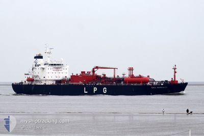
GAZ SERENITY
Tanker
Current Trip
GRKLX
| Time Travelled | 31 days |
|---|---|
| Remaining Time | --- |
| Distance Travelled | 1777.13 nm |
| Remaining Distance | --- |
| AVG Speed | 9.8 Knots |
| MAX Speed | 16.3 Knots |
| AVG Wind | 9 knots |
| MAX Wind | 27.1 knots |
| MIN Temp | 16.3°C / 61.34°F |
| MAX Temp | 31.9°C / 89.42°F |
| Draught | 6.4 m |
| Position Received | 1 m ago |
Current Position
| Longitude | 22.49826° |
|---|---|
| Latitude | 36.09875° |
| Status | Under way using engine |
| Speed | 1.4 Knots |
| Course | 15° |
| Area | Mediterranean Sea - Eastern Basin |
| Station | T-AIS |
| Position Received | 1 m ago |
Info
Information
The current position of GAZ SERENITY is in Mediterranean Sea - Eastern Basin with coordinates 36.09875° / 22.49826° as reported on 2024-06-24 13:39 by AIS to our vessel tracker app. The vessel's current speed is 1.4 Knots
The vessel GAZ SERENITY (IMO: 9448499, MMSI: 372961000) is a Tanker It's sailing under the flag of [PA] Panama.
In this page you can find informations about the vessels current position, last detected port calls, and current voyage information. If the vessels is not in coverage by AIS you will find the latest position.
The current position of GAZ SERENITY is detected by our AIS receivers and we are not responsible for the reliability of the data. The last position was recorded while the vessel was in Coverage by the Ais receivers of our vessel tracking app.
The current draught of GAZ SERENITY as reported by AIS is 6.4 meters
Weather
| Temperature | 25.4°C / 77.72°F |
|---|---|
| Wind Speed | 11 knots |
| Direction | 298° WNW |
| Pressure | 1009.5 hPa |
| Humidity | 81.6 % |
| Cloud Coverage | --- |
Featured Company
Last Port Calls
| Port | Arrival | Departure | Time In Port |
|---|---|---|---|
| 2024-05-22 19:58 | 2024-05-24 10:21 | 1 d | |
| 2024-05-10 06:31 | 2024-05-11 21:00 | 1 d | |
| 2024-05-07 06:25 | 2024-05-08 08:21 | 1 d | |
| 2024-04-19 01:09 | 2024-04-19 18:10 | 17 h |
Most Visited Ports (Last year)
| Port | Arrivals | |
|---|---|---|
| 5 | ||
| 3 | ||
| 3 | ||
| 3 | ||
| 2 | ||
| 2 |
Last Trips
| Origin | Departure | Destination | Arrival | Distance | |
|---|---|---|---|---|---|
| 2024-05-11 23:00 | 2024-05-22 21:58 | 88.18 nm | |||
| 2024-05-08 10:21 | 2024-05-10 08:31 | 356.68 nm | |||
| 2024-04-19 14:10 | 2024-05-07 08:25 | 4888.89 nm | |||
| 2024-03-24 09:42 | 2024-04-18 21:09 | 5990.81 nm |
Events
| Time | Event | Details | Position / Dest | Info |
|---|---|---|---|---|
| 2024-06-24 10:40 | Status Changed | Under way using engine Default |
36.11948 / 22.41985
GRKLX
|
Speed: 0.8 kn Course: 9° |
| 2024-06-24 10:25 | Status Changed | Default Under way using engine |
36.11959 / 22.41445
GRKLX
|
Speed: 0.8 kn Course: 13° |
| 2024-06-24 07:35 | Status Changed | Under way using engine Default |
36.12374 / 22.39695
GRKLX
|
Speed: 0.3 kn Course: 26° |
| 2024-06-24 07:25 | Status Changed | Default Under way using engine |
36.12390 / 22.39658
GRKLX
|
Speed: 0.2 kn Course: 25° |
| 2024-06-24 07:15 | Status Changed | Under way using engine Default |
36.12392 / 22.39620
GRKLX
|
Speed: 0.1 kn Course: 24° |
| 2024-06-24 06:46 | Status Changed | Default Under way using engine |
36.12306 / 22.39463
GRKLX
|
Speed: 0.3 kn Course: 37° |
| 2024-06-24 06:41 | Status Changed | Under way using engine Default |
36.12304 / 22.39424
GRKLX
|
Speed: 0.2 kn Course: 39° |
| 2024-06-24 06:23 | IN Coverage |
36.12304 / 22.39424
Mediterranean Sea - Eastern Basin
|
Speed: 0.3 kn Course: 90.7° |
|
| 2024-06-21 11:50 | STOP Moving |
36.19405 / 22.11771
GRKLX
|
Speed: 0.3 kn Course: 186° |
|
| 2024-06-21 10:25 | START Moving |
36.14924 / 22.16783
GRKLX
|
Speed: 3.6 kn Course: 214° |