
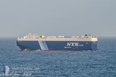
GEMINI LEADER
Vehicles Carrier
Current Trip
TH LCH
| Time Travelled | 1 day |
|---|---|
| Remaining Time | --- |
| Distance Travelled | 47.59 nm |
| Remaining Distance | --- |
| AVG Speed | 15.1 Knots |
| MAX Speed | 16.5 Knots |
| AVG Wind | 17.2 knots |
| MAX Wind | 18.9 knots |
| MIN Temp | 27.1°C / 80.78°F |
| MAX Temp | 27.9°C / 82.22°F |
| Draught | 7.5 m |
| Position Received | 5 d ago |
Current Position
| Longitude | 104.33885° |
|---|---|
| Latitude | 1.28607° |
| Status | Under way using engine |
| Speed | 16.1 Knots |
| Course | 60° |
| Area | Singapore Strait |
| Station | T-AIS |
| Position Received | 5 d ago |
Info
Information
The current position of GEMINI LEADER is in Singapore Strait with coordinates 1.28607° / 104.33885° as reported on 2024-06-20 18:27 by AIS to our vessel tracker app. The vessel's current speed is 16.1 Knots
The vessel GEMINI LEADER (IMO: 9519121, MMSI: 371862000) is a Vehicles Carrier that was built in 2009 ( 15 years old ). It's sailing under the flag of [PA] Panama.
In this page you can find informations about the vessels current position, last detected port calls, and current voyage information. If the vessels is not in coverage by AIS you will find the latest position.
The current position of GEMINI LEADER is detected by our AIS receivers and we are not responsible for the reliability of the data. The last position was recorded while the vessel was in Coverage by the Ais receivers of our vessel tracking app.
The current draught of GEMINI LEADER as reported by AIS is 7.5 meters
Weather
| Temperature | 28.2°C / 82.76°F |
|---|---|
| Wind Speed | 10 knots |
| Direction | 291° WNW |
| Pressure | 1008.3 hPa |
| Humidity | 75.8 % |
| Cloud Coverage | 100 % |
Featured Company
Last Port Calls
| Port | Arrival | Departure | Time In Port |
|---|---|---|---|
| 2024-06-23 01:13 | 2024-06-24 08:40 | 1 d | |
| 2024-06-05 00:23 | 2024-06-11 20:23 | 6 d | |
| 2024-05-10 23:20 | 2024-05-11 10:24 | 11 h | |
| 2024-05-07 22:48 | 2024-05-08 11:11 | 12 h | |
| 2024-04-27 21:29 | 2024-04-30 04:38 | 2 d | |
| 2024-04-26 22:27 | 2024-04-27 04:10 | 5 h | |
| 2024-04-06 02:12 | 2024-04-10 21:12 | 4 d |
Most Visited Ports (Last year)
| Port | Arrivals | |
|---|---|---|
| 4 | ||
| 4 | ||
| 3 | ||
| 3 | ||
| 3 | ||
| 2 |
Last Trips
| Origin | Departure | Destination | Arrival | Distance | |
|---|---|---|---|---|---|
| 2024-06-11 23:23 | 2024-06-23 08:13 | 4698.32 nm | |||
| 2024-05-11 18:24 | 2024-06-05 03:23 | 3900.40 nm | |||
| 2024-05-08 18:11 | 2024-05-11 07:20 | 852.50 nm | |||
| 2024-04-30 13:38 | 2024-05-08 05:48 | 2965.31 nm | |||
| 2024-04-27 13:10 | 2024-04-28 06:29 | 217.42 nm | |||
| 2024-04-11 00:12 | 2024-04-27 07:27 | 6731.01 nm | |||
| 2024-03-19 13:21 | 2024-04-06 05:12 | 3823.92 nm |
Events
| Time | Event | Details | Position / Dest | Info |
|---|---|---|---|---|
| 2024-06-24 08:40 | PORT DEPARTURE |
|
13.07582 / 100.86218
TH LCH
|
Speed: 6.5 kn Course: 289° |
| 2024-06-24 08:33 | START Moving |
13.06962 / 100.87375
[TH] LAEM CHABANG
|
Speed: 3.9 kn Course: 288° |
|
| 2024-06-23 01:28 | STOP Moving |
13.06725 / 100.88004
[TH] LAEM CHABANG
|
Speed: 0.3 kn Course: 329° |
|
| 2024-06-23 01:13 | PORT ARRIVAL |
|
13.06698 / 100.87448
[TH] LAEM CHABANG
|
Speed: 8.6 kn Course: 121° |
| 2024-06-20 18:34 | Status Changed | Default Under way using engine |
1.30428 / 104.36366
TH LCH
|
Speed: 16.1 kn Course: 60° |
| 2024-06-20 18:27 | OUT of Coverage |
1.28607 / 104.33885
Singapore Strait
TH LCH
|
Speed: 16.1 kn Course: 60° |
|
| 2024-06-20 18:02 | Change Sea Area | Malaysian part of the Singapore Strait Indonesian part of the Singapore Strait |
1.25857 / 104.23048
Singapore Strait
TH LCH
|
Speed: 16.3 kn Course: 79° |
| 2024-06-20 14:49 | Change Sea Area | Indonesian part of the Singapore Strait Indonesian part of the Malacca Strait |
1.17788 / 103.42842
Singapore Strait
TH LCH
|
Speed: 18.9 kn Course: 119° |
| 2024-06-20 14:40 | Change Sea Area | Indonesian part of the Malacca Strait Indian part of the Laccadive Sea |
1.20132 / 103.38695
Malacca Strait
TH LCH
|
Speed: 18.4 kn Course: 121° |
| 2024-06-20 14:40 | Status Changed | Under way using engine Default |
1.20132 / 103.38695
TH LCH
|
Speed: 18.6 kn Course: 132° |