
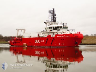
GEO OCEAN VI
Research/Survey Vessel
Current Trip
| Trip Time | 8 days |
|---|---|
| Trip Distance | 612.70 nm |
| AVG Speed | 4.8 Knots |
| MAX Speed | 9.3 Knots |
| Draught | 4.7 m |
| AVG Wind | 13.6 knots |
| MAX Wind | 23.9 knots |
| MIN Temp | 8.8°C / 47.84°F |
| MAX Temp | 13.6°C / 56.48°F |
| Position Received | 1 m ago |
Current Position
| Longitude | 1.73359° |
|---|---|
| Latitude | 52.47487° |
| Status | Moored |
| Speed | |
| Course | 107° |
| Area | North Sea |
| Station | T-AIS |
| Position Received | 1 m ago |
Info
Information
The current position of GEO OCEAN VI is in North Sea with coordinates 52.47487° / 1.73359° as reported on 2024-06-10 12:25 by AIS to our vessel tracker app. The vessel's current speed is 0 Knots and is currently inside the port of LOWESTOFT.
The vessel GEO OCEAN VI (IMO: 9666716, MMSI: 253816000) is a Research/Survey Vessel that was built in 2014 ( 10 years old ). It's sailing under the flag of [LU] Luxembourg.
In this page you can find informations about the vessels current position, last detected port calls, and current voyage information. If the vessels is not in coverage by AIS you will find the latest position.
The current position of GEO OCEAN VI is detected by our AIS receivers and we are not responsible for the reliability of the data. The last position was recorded while the vessel was in Coverage by the Ais receivers of our vessel tracking app.
The current draught of GEO OCEAN VI as reported by AIS is 4.7 meters
Weather
| Temperature | 10.9°C / 51.62°F |
|---|---|
| Wind Speed | 20 knots |
| Direction | 339° NNW |
| Pressure | 1007.7 hPa |
| Humidity | 84.2 % |
| Cloud Coverage | 100 % |
Featured Company
Last Port Calls
| Port | Arrival | Departure | Time In Port |
|---|---|---|---|
| 2024-06-10 11:12 | |||
| 2024-05-31 05:10 | 2024-06-02 10:16 | 2 d | |
| 2024-05-28 04:40 | 2024-05-28 15:31 | 10 h | |
| 2024-05-02 04:22 | 2024-05-02 16:22 | 11 h | |
| 2024-04-23 20:34 | 2024-04-24 20:17 | 23 h | |
| 2024-04-19 13:56 | 2024-04-21 15:32 | 2 d | |
| 2024-04-15 21:44 | 2024-04-17 01:45 | 1 d | |
| 2024-04-06 20:30 |
Last Trips
| Origin | Departure | Destination | Arrival | Distance | |
|---|---|---|---|---|---|
| 2024-06-02 12:16 | 2024-06-10 12:12 | 612.70 nm | |||
| 2024-05-28 17:31 | 2024-05-31 07:10 | 312.60 nm | |||
| 2024-05-02 18:22 | 2024-05-28 06:40 | 2600.47 nm | |||
| 2024-04-24 22:17 | 2024-05-02 06:22 | 793.50 nm | |||
| 2024-04-21 16:32 | 2024-04-23 22:34 | 314.22 nm | |||
| 2024-04-17 02:45 | 2024-04-19 14:56 | 239.84 nm | |||
| 2024-04-06 22:30 | 2024-04-15 22:44 | 849.29 nm |
Events
| Time | Event | Details | Position / Dest | Info |
|---|---|---|---|---|
| 2024-06-10 11:49 | Status Changed | Moored Under way using engine |
52.47483 / 1.73353
[GB] LOWESTOFT
|
Speed: Course: 105° |
| 2024-06-10 11:28 | STOP Moving |
52.47440 / 1.73333
[GB] LOWESTOFT
|
Speed: 0.2 kn Course: 311° |
|
| 2024-06-10 11:12 | PORT ARRIVAL |
|
52.47206 / 1.75553
[GB] LOWESTOFT
|
Speed: 4.3 kn Course: 292° |
| 2024-06-10 09:44 | Status Changed | Under way using engine Default |
52.42576 / 1.80644
LOWESTOFT UK
|
Speed: 1.2 kn Course: 8° |
| 2024-06-10 09:25 | Status Changed | Default Under way using engine |
52.41994 / 1.80804
LOWESTOFT UK
|
Speed: 0.9 kn Course: 17° |
| 2024-06-10 08:32 | START Moving | 5.24 nm, South East of LOWESTOFT |
52.39914 / 1.81385
LOWESTOFT UK
|
Speed: 3.2 kn Course: 40° |
| 2024-06-10 07:37 | Status Changed | Under way using engine Default |
52.39054 / 1.80916
LOWESTOFT UK
|
Speed: 1.7 kn Course: 209° |
| 2024-06-10 07:17 | IN Coverage |
52.39040 / 1.80887
North Sea
|
Speed: 1.6 kn Course: 237.9° |
|
| 2024-06-10 05:33 | Status Changed | Default Under way using engine |
52.41851 / 1.81285
LOWESTOFT UK
|
Speed: 0.4 kn Course: 210° |
| 2024-06-10 05:27 | OUT of Coverage |
52.41927 / 1.81346
North Sea
|
Speed: 0.4 kn Course: 210.1° |