
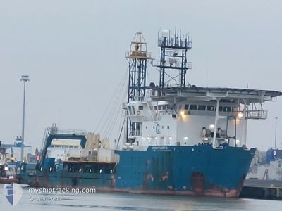
GEOQUIP SAENTIS
Multi Purpose Offshore Vessel
Current Trip
SCEIRDE ROCKS
| Time Travelled | 2 days |
|---|---|
| Remaining Time | --- |
| Distance Travelled | 151.86 nm |
| Remaining Distance | --- |
| AVG Speed | 9.7 Knots |
| MAX Speed | 13 Knots |
| AVG Wind | 16.9 knots |
| MAX Wind | 20.8 knots |
| MIN Temp | 11.6°C / 52.88°F |
| MAX Temp | 13.2°C / 55.76°F |
| Draught | 5.6 m |
| Position Received | 7 d ago |
Current Position
| Longitude | -9.96791° |
|---|---|
| Latitude | 53.23580° |
| Status | Restricted manoeuverability |
| Speed | 0.3 Knots |
| Course | 333° |
| Area | North Atlantic Ocean |
| Station | T-AIS |
| Position Received | 7 d ago |
Info
Information
The current position of GEOQUIP SAENTIS is in North Atlantic Ocean with coordinates 53.23580° / -9.96791° as reported on 2024-06-02 18:05 by AIS to our vessel tracker app. The vessel's current speed is 0.3 Knots
The vessel GEOQUIP SAENTIS (IMO: 9282132, MMSI: 210508000) is a Multi Purpose Offshore Vessel that was built in 2005 ( 19 years old ). It's sailing under the flag of [CY] Cyprus.
In this page you can find informations about the vessels current position, last detected port calls, and current voyage information. If the vessels is not in coverage by AIS you will find the latest position.
The current position of GEOQUIP SAENTIS is detected by our AIS receivers and we are not responsible for the reliability of the data. The last position was recorded while the vessel was in Coverage by the Ais receivers of our vessel tracking app.
The current draught of GEOQUIP SAENTIS as reported by AIS is 5.6 meters
Weather
| Temperature | 11.9°C / 53.42°F |
|---|---|
| Wind Speed | 13 knots |
| Direction | 279° W |
| Pressure | 1014.3 hPa |
| Humidity | 95.7 % |
| Cloud Coverage | 100 % |
Featured Company
Events
| Time | Event | Details | Position / Dest | Info |
|---|---|---|---|---|
| 2024-06-09 12:31 | START Moving | 11.64 nm, West of INISHMORE |
53.18833 / -9.96500
SCEIRDE ROCKS
|
Speed: 10 kn Course: 201° |
| 2024-06-09 08:04 | START Moving | 15.21 nm, North West of INISHMORE |
53.24833 / -10.02500
SCEIRDE ROCKS
|
Speed: 6 kn Course: 125° |
| 2024-06-08 03:34 | STOP Moving | 16.11 nm, North West of INISHMORE |
53.26833 / -10.03333
SCEIRDE ROCKS
|
Speed: Course: -1° |
| 2024-06-07 19:04 | START Moving | 2.17 nm, West of FOYNES |
52.61167 / -9.16500
SCEIRDE ROCKS
|
Speed: 10 kn Course: -1° |
| 2024-06-07 18:51 | PORT DEPARTURE |
|
52.61167 / -9.16500
SCEIRDE ROCKS
|
Speed: Course: -1° |
| 2024-06-07 18:04 | STOP Moving |
52.61333 / -9.10833
[IE] FOYNES
|
Speed: Course: -1° |
|
| 2024-06-07 18:04 | PORT ARRIVAL |
|
52.61333 / -9.10833
[IE] FOYNES
|
Speed: 4 kn Course: -1° |
| 2024-06-07 10:36 | START Moving | 14.93 nm, West of INISHMORE |
53.17333 / -10.06833
SCEIRDE ROCKS
|
Speed: 9 kn Course: 184° |
| 2024-06-05 06:24 | STOP Moving | 12.6 nm, North West of INISHMORE |
53.24833 / -9.93667
SCEIRDE ROCKS
|
Speed: Course: -1° |
| 2024-06-02 18:05 | OUT of Coverage |
53.23580 / -9.96791
North Atlantic Ocean
|
Speed: 0.3 kn Course: 129.2° |