
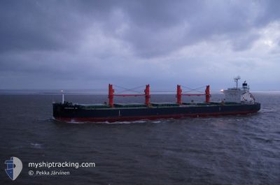
GEORGIA M
Bulk Carrier
Current Trip
| Time Travelled | 7 days |
|---|---|
| Remaining Time | --- |
| Distance Travelled | 1949.84 nm |
| Remaining Distance | --- |
| AVG Speed | 10.1 Knots |
| MAX Speed | 10.1 Knots |
| AVG Wind | 7.2 knots |
| MAX Wind | 20.3 knots |
| MIN Temp | 25.8°C / 78.44°F |
| MAX Temp | 32°C / 89.6°F |
| Draught | 12.2 m |
| Position Received | 5 d ago |
Current Position
| Longitude | 57.54634° |
|---|---|
| Latitude | 24.58034° |
| Status | Under way using engine |
| Speed | 10.6 Knots |
| Course | 123.2° |
| Area | Gulf of Oman |
| Station | T-AIS |
| Position Received | 5 d ago |
Info
Information
The current position of GEORGIA M is in Gulf of Oman with coordinates 24.58034° / 57.54634° as reported on 2024-05-13 16:14 by AIS to our vessel tracker app. The vessel's current speed is 10.6 Knots and is heading at the port of TAMPA. The estimated time of arrival as calculated by vessel tracking app is 2024-05-12 14:00 LT
The vessel GEORGIA M (IMO: 9616618, MMSI: 538004498) is a Bulk Carrier that was built in 2012 ( 12 years old ). It's sailing under the flag of [MH] Marshall Is.
In this page you can find informations about the vessels current position, last detected port calls, and current voyage information. If the vessels is not in coverage by AIS you will find the latest position.
The current position of GEORGIA M is detected by our AIS receivers and we are not responsible for the reliability of the data. The last position was recorded while the vessel was in Coverage by the Ais receivers of our vessel tracking app.
The current draught of GEORGIA M as reported by AIS is 12.2 meters
Weather
| Temperature | 29.7°C / 85.46°F |
|---|---|
| Wind Speed | 13 knots |
| Direction | 226° SW |
| Pressure | 1009.2 hPa |
| Humidity | 73.1 % |
| Cloud Coverage | 85 % |
Featured Company
Most Visited Ports (Last year)
| Port | Arrivals | |
|---|---|---|
| 2 | ||
| 2 | ||
| 1 | ||
| 1 | ||
| 1 | ||
| 1 |
Events
| Time | Event | Details | Position / Dest | Info |
|---|---|---|---|---|
| 2024-05-13 16:20 | Status Changed | Default Under way using engine |
24.57021 / 57.56310
US TPA
|
Speed: 10.6 kn Course: 123.2° |
| 2024-05-13 16:14 | OUT of Coverage |
24.58034 / 57.54634
Gulf of Oman
|
Speed: 10.6 kn Course: 123.2° |
|
| 2024-05-13 16:14 | Status Changed | Under way using engine Default |
24.58085 / 57.54548
US TPA
|
Speed: 10.6 kn Course: 124° |
| 2024-05-13 15:56 | IN Coverage |
24.58034 / 57.54634
Gulf of Oman
|
Speed: 10.6 kn Course: 123.2° |
|
| 2024-05-13 14:32 | Status Changed | Default Under way using engine |
24.75515 / 57.27891
US TPA
|
Speed: 10.2 kn Course: 126.5° |
| 2024-05-13 14:26 | OUT of Coverage |
24.76562 / 57.26343
Gulf of Oman
|
Speed: 10.2 kn Course: 126.5° |
|
| 2024-05-13 13:37 | START Moving |
24.84645 / 57.13719
US TPA
|
Speed: 10.2 kn Course: 124° |
|
| 2024-05-13 13:36 | STOP Moving |
24.84733 / 57.13533
US TPA
|
Speed: Course: 124° |
|
| 2024-05-13 13:05 | START Moving |
24.89982 / 57.05792
US TPA
|
Speed: 10.1 kn Course: 136.2° |
|
| 2024-05-13 13:04 | STOP Moving |
24.90094 / 57.05615
US TPA
|
Speed: Course: 127° |