
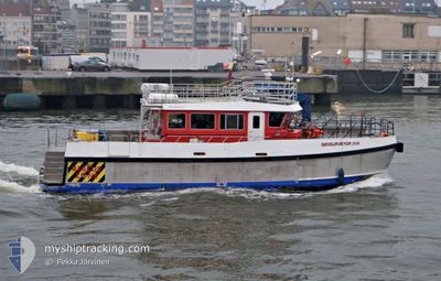
GEOSURVEYOR XVII
Other Type
Current Trip
| Time Travelled | 7 days |
|---|---|
| Remaining Time | --- |
| Distance Travelled | 265.24 nm |
| Remaining Distance | --- |
| AVG Speed | 9.8 Knots |
| MAX Speed | 15.3 Knots |
| AVG Wind | 9 knots |
| MAX Wind | 18.3 knots |
| MIN Temp | 11.3°C / 52.34°F |
| MAX Temp | 19.2°C / 66.56°F |
| Draught | 1.8 m |
| Position Received | 2 d ago |
Current Position
| Longitude | 13.65269° |
|---|---|
| Latitude | 54.20430° |
| Status | Under way using engine |
| Speed | 13.1 Knots |
| Course | 201.7° |
| Area | Baltic Sea |
| Station | T-AIS |
| Position Received | 2 d ago |
Info
Information
The current position of GEOSURVEYOR XVII is in Baltic Sea with coordinates 54.20430° / 13.65269° as reported on 2024-06-01 16:38 by AIS to our vessel tracker app. The vessel's current speed is 13.1 Knots
The vessel GEOSURVEYOR XVII (MMSI: 235096003) is a Other Type It's sailing under the flag of [GB] United Kingdom.
In this page you can find informations about the vessels current position, last detected port calls, and current voyage information. If the vessels is not in coverage by AIS you will find the latest position.
The current position of GEOSURVEYOR XVII is detected by our AIS receivers and we are not responsible for the reliability of the data. The last position was recorded while the vessel was in Coverage by the Ais receivers of our vessel tracking app.
The current draught of GEOSURVEYOR XVII as reported by AIS is 1.8 meters
Weather
| Temperature | 16.7°C / 62.06°F |
|---|---|
| Wind Speed | 11 knots |
| Direction | 10° N |
| Pressure | 1011.8 hPa |
| Humidity | 88 % |
| Cloud Coverage | 47 % |
Featured Company
Last Port Calls
| Port | Arrival | Departure | Time In Port |
|---|---|---|---|
| 2024-05-26 18:05 | 2024-05-27 09:09 | 15 h | |
| 2024-05-25 18:44 | 2024-05-26 03:31 | 8 h | |
| 2024-05-13 11:36 | 2024-05-25 12:05 | 12 d | |
| 2024-05-13 06:53 | 2024-05-13 07:32 | 39 m | |
| 2024-05-13 05:16 | |||
| 2024-05-11 16:45 | 2024-05-12 05:07 | 12 h | |
| 2024-05-10 16:38 | 2024-05-11 05:16 | 12 h | |
| 2024-05-09 16:42 | 2024-05-10 05:25 | 12 h | |
| 2024-05-07 16:42 | 2024-05-09 05:17 | 1 d | |
| 2024-05-06 16:27 | 2024-05-07 05:12 | 12 h |
Most Visited Ports (Last year)
| Port | Arrivals | |
|---|---|---|
| 25 | ||
| 21 | ||
| 21 | ||
| 14 | ||
| 14 | ||
| 11 |
Last Trips
| Origin | Departure | Destination | Arrival | Distance | |
|---|---|---|---|---|---|
| 2024-05-26 05:31 | 2024-05-26 20:05 | 206.88 nm | |||
| 2024-05-25 14:05 | 2024-05-25 20:44 | 97.32 nm | |||
| 2024-05-13 09:32 | 2024-05-13 13:36 | 74.13 nm | |||
| 2024-05-13 07:16 | 2024-05-13 08:53 | 24.97 nm | |||
| 2024-05-11 07:16 | 2024-05-11 18:45 | 85.89 nm | |||
| 2024-05-10 07:25 | 2024-05-10 18:38 | 87.72 nm | |||
| 2024-05-09 07:17 | 2024-05-09 18:42 | 70.24 nm | |||
| 2024-05-07 07:12 | 2024-05-07 18:42 | 91.27 nm | |||
| 2024-05-06 07:13 | 2024-05-06 18:27 | 85.10 nm | |||
| 2024-05-05 07:23 | 2024-05-05 18:53 | 66.72 nm |
Events
| Time | Event | Details | Position / Dest | Info |
|---|---|---|---|---|
| 2024-06-01 16:38 | OUT of Coverage |
54.20430 / 13.65269
Baltic Sea
SASSNITZ GERMANY
|
Speed: 13.1 kn Course: 201.7° |
|
| 2024-06-01 15:15 | IN Coverage |
54.47937 / 13.66192
Baltic Sea
SASSNITZ GERMANY
|
Speed: 14.2 kn Course: 146.7° |
|
| 2024-06-01 12:58 | OUT of Coverage |
54.60271 / 13.65676
Baltic Sea
SASSNITZ GERMANY
|
Speed: 14.7 kn Course: 141.7° |
|
| 2024-06-01 08:26 | Change Sea Area | German part of the Baltic Sea Danish part of the Baltic Sea |
54.38942 / 12.04017
Baltic Sea
SASSNITZ GERMANY
|
Speed: 10.5 kn Course: 90.9° |
| 2024-06-01 06:56 | Change Sea Area | Danish part of the Baltic Sea German part of the Baltic Sea |
54.48936 / 11.46399
Baltic Sea
SASSNITZ GERMANY
|
Speed: 13.9 kn Course: 114.4° |
| 2024-06-01 03:13 | Destination Changed | SASSNITZ GERMANY KIELCANAL |
54.36835 / 10.15437
SASSNITZ GERMANY
|
Speed: 5.4 kn Course: 100.6° |
| 2024-06-01 03:13 | ETA Changed | 2024/06/01 16:00 2025/05/28 16:00 |
54.36835 / 10.15437
SASSNITZ GERMANY
|
Speed: 5.4 kn Course: 100.6° |
| 2024-06-01 03:13 | START Moving | 1 nm, South West of STICKENHΟRN SPORT |
54.36840 / 10.15396
KIELCANAL
|
Speed: 5.8 kn Course: 100° |
| 2024-06-01 03:06 | Status Changed | Under way using engine Moored |
54.36890 / 10.15082
KIELCANAL
|
Speed: Course: 88° |
| 2024-06-01 00:04 | ETA Changed | 2025/05/28 16:00 2024/05/28 16:00 |
54.36890 / 10.15081
KIELCANAL
|
Speed: Course: 89° |