
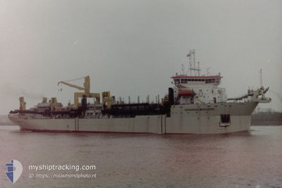
GERARDUS MERCATOR
Trailing Suction Hopper Dredger
Current Trip
DWF
| Time Travelled | --- |
|---|---|
| Remaining Time | --- |
| Distance Travelled | 6246.34 nm |
| Remaining Distance | --- |
| AVG Speed | 10.4 Knots |
| MAX Speed | 10.4 Knots |
| AVG Wind | 7.5 knots |
| MAX Wind | 20.5 knots |
| MIN Temp | 30°C / 86°F |
| MAX Temp | 35.7°C / 96.26°F |
| Draught | 12.5 m |
| Position Received | 1 m ago |
Current Position
| Longitude | 54.91446° |
|---|---|
| Latitude | 24.98009° |
| Status | At anchor |
| Speed | 0.1 Knots |
| Course | 310° |
| Area | Persian Gulf |
| Station | T-AIS |
| Position Received | 1 m ago |
Info
Information
The current position of GERARDUS MERCATOR is in Persian Gulf with coordinates 24.98009° / 54.91446° as reported on 2024-06-03 04:40 by AIS to our vessel tracker app. The vessel's current speed is 0.1 Knots
The vessel GERARDUS MERCATOR (IMO: 9119335, MMSI: 645309000) is a Trailing Suction Hopper Dredger that was built in 1997 ( 27 years old ). It's sailing under the flag of [MU] Mauritius.
In this page you can find informations about the vessels current position, last detected port calls, and current voyage information. If the vessels is not in coverage by AIS you will find the latest position.
The current position of GERARDUS MERCATOR is detected by our AIS receivers and we are not responsible for the reliability of the data. The last position was recorded while the vessel was in Coverage by the Ais receivers of our vessel tracking app.
The current draught of GERARDUS MERCATOR as reported by AIS is 12.5 meters
Weather
| Temperature | 31.5°C / 88.7°F |
|---|---|
| Wind Speed | 6 knots |
| Direction | 195° SSW |
| Pressure | 1003 hPa |
| Humidity | 64.1 % |
| Cloud Coverage | --- |
Featured Company
Last Port Calls
Most Visited Ports (Last year)
| Port | Arrivals | |
|---|---|---|
| 1 |
Last Trips
| Origin | Departure | Destination | Arrival | Distance |
|---|
Events
| Time | Event | Details | Position / Dest | Info |
|---|---|---|---|---|
| 2024-06-02 12:23 | Status Changed | At anchor Default |
24.98016 / 54.91441
DWF
|
Speed: Course: 296° |
| 2024-06-02 12:14 | Status Changed | Default At anchor |
24.98009 / 54.91442
DWF
|
Speed: Course: 296° |
| 2024-06-02 05:53 | Status Changed | At anchor Default |
24.98034 / 54.91396
DWF
|
Speed: Course: 221° |
| 2024-06-02 05:47 | Status Changed | Default At anchor |
24.98034 / 54.91396
DWF
|
Speed: Course: 221° |
| 2024-05-30 09:28 | Status Changed | At anchor Default |
24.97986 / 54.91438
DWF
|
Speed: Course: -1° |
| 2024-05-30 09:25 | Status Changed | Default At anchor |
24.97833 / 54.91333
DWF
|
Speed: 0.1 kn Course: 295° |
| 2024-05-30 08:14 | Status Changed | At anchor Under way using engine |
24.98019 / 54.91440
DWF
|
Speed: Course: 225° |
| 2024-05-30 08:10 | STOP Moving | 6.19 nm, North East of GHANTOOT |
24.98010 / 54.91431
DWF
|
Speed: 0.3 kn Course: 199° |
| 2024-05-30 05:20 | START Moving | 9.03 nm, West of KHALIFA |
24.85081 / 54.50919
DWF
|
Speed: 5.2 kn Course: 342.5° |
| 2024-05-30 04:34 | Destination Changed | DWF NMDC |
24.84896 / 54.51183
DWF
|
Speed: 0.1 kn Course: 230° |