
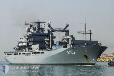
GERMAN WARSHIP A1412
Military ops
Current Trip
Unknown
| Time Travelled | 15 days |
|---|---|
| Remaining Time | --- |
| Distance Travelled | 3506.45 nm |
| Remaining Distance | --- |
| AVG Speed | 9.3 Knots |
| MAX Speed | 16.6 Knots |
| AVG Wind | 3.7 knots |
| MAX Wind | 11 knots |
| MIN Temp | 16°C / 60.8°F |
| MAX Temp | 25.3°C / 77.54°F |
| Draught | 8 m |
| Position Received | 1 m ago |
Current Position
| Longitude | -117.67124° |
|---|---|
| Latitude | 32.63901° |
| Status | Under way using engine |
| Speed | 5.3 Knots |
| Course | 91.7° |
| Area | North Pacific Ocean |
| Station | T-AIS |
| Position Received | 1 m ago |
Info
Information
The current position of GERMAN WARSHIP A1412 is in North Pacific Ocean with coordinates 32.63901° / -117.67124° as reported on 2024-06-11 11:14 by AIS to our vessel tracker app. The vessel's current speed is 5.3 Knots
The vessel GERMAN WARSHIP A1412 (MMSI: 211211760) is a Military ops It's sailing under the flag of [DE] Germany.
In this page you can find informations about the vessels current position, last detected port calls, and current voyage information. If the vessels is not in coverage by AIS you will find the latest position.
The current position of GERMAN WARSHIP A1412 is detected by our AIS receivers and we are not responsible for the reliability of the data. The last position was recorded while the vessel was in Coverage by the Ais receivers of our vessel tracking app.
The current draught of GERMAN WARSHIP A1412 as reported by AIS is 8 meters
Weather
| Temperature | 16.6°C / 61.88°F |
|---|---|
| Wind Speed | 2 knots |
| Direction | 216° SW |
| Pressure | 1012 hPa |
| Humidity | 79 % |
| Cloud Coverage | 100 % |
Featured Company
Last Port Calls
| Port | Arrival | Departure | Time In Port |
|---|---|---|---|
| 2024-05-22 14:38 | 2024-05-26 16:09 | 4 d | |
| 2024-05-17 15:05 | 2024-05-20 13:48 | 2 d | |
| 2024-04-16 15:33 | 2024-05-07 08:21 | 20 d | |
| 2024-04-15 16:21 |
Most Visited Ports (Last year)
| Port | Arrivals | |
|---|---|---|
| 4 | ||
| 4 | ||
| 3 | ||
| 2 | ||
| 1 | ||
| 1 |
Last Trips
| Origin | Departure | Destination | Arrival | Distance | |
|---|---|---|---|---|---|
| 2024-05-20 10:48 | 2024-05-22 10:38 | 575.54 nm | |||
| 2024-05-07 10:21 | 2024-05-17 12:05 | 3040.32 nm | |||
| 2024-04-15 18:21 | 2024-04-16 17:33 | 292.62 nm |
Events
| Time | Event | Details | Position / Dest | Info |
|---|---|---|---|---|
| 2024-06-11 00:13 | Change Sea Area | United States part of the North Pacific Ocean Mexican part of the North Pacific Ocean |
32.38423 / -117.98535
North Pacific Ocean
|
Speed: 8.5 kn Course: 264.7° |
| 2024-06-10 22:53 | Change Sea Area | Mexican part of the North Pacific Ocean United States part of the North Pacific Ocean |
32.46611 / -117.90095
North Pacific Ocean
|
Speed: 8.3 kn Course: 159.3° |
| 2024-06-10 21:02 | Status Changed | Under way using engine Restricted manoeuverability |
32.71270 / -117.93075
|
Speed: 9.2 kn Course: 188.3° |
| 2024-06-10 20:46 | Status Changed | Restricted manoeuverability Under way using engine |
32.75148 / -117.92377
|
Speed: 8 kn Course: 186° |
| 2024-06-10 20:05 | Status Changed | Under way using engine Restricted manoeuverability |
32.88900 / -117.89978
|
Speed: 8.8 kn Course: 198.7° |
| 2024-06-10 19:46 | Status Changed | Restricted manoeuverability Under way using engine |
32.93666 / -117.86868
|
Speed: 10.5 kn Course: 208.1° |
| 2024-06-10 19:17 | Status Changed | Under way using engine Restricted manoeuverability |
33.01731 / -117.83683
|
Speed: 10.6 kn Course: 192.4° |
| 2024-06-10 18:47 | Status Changed | Restricted manoeuverability Under way using engine |
33.10459 / -117.81560
|
Speed: 10.6 kn Course: 191.7° |
| 2024-06-10 18:28 | Status Changed | Under way using engine Restricted manoeuverability |
33.15474 / -117.80130
|
Speed: 7.8 kn Course: 260.8° |
| 2024-06-10 15:59 | Status Changed | Restricted manoeuverability Under way using engine |
32.67118 / -117.70553
|
Speed: 13.1 kn Course: 352.6° |