
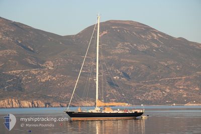
GERONIMO
Sailing
Current Trip
NAFPLIO
Unknown Port
ETA*
2024-06-02 17:00 UTC
| Time Travelled | 4 days |
|---|---|
| Remaining Time | --- |
| Distance Travelled | 153.89 nm |
| Remaining Distance | --- |
| AVG Speed | 6.4 Knots |
| MAX Speed | 9.3 Knots |
| AVG Wind | 4.6 knots |
| MAX Wind | 11.1 knots |
| MIN Temp | 23.7°C / 74.66°F |
| MAX Temp | 30.6°C / 87.08°F |
| Draught | 0 m |
| Position Received | 3 h, 43 m ago |
Current Position
| Longitude | 21.82711° |
|---|---|
| Latitude | 36.76090° |
| Status | Under way using engine |
| Speed | 5.8 Knots |
| Course | 341.8° |
| Area | Ionian Sea |
| Station | T-AIS |
| Position Received | 3 h, 43 m ago |
Info
info
Information
The current position of GERONIMO is in Ionian Sea with coordinates 36.76090° / 21.82711° as reported on 2024-06-10 10:15 by AIS to our vessel tracker app. The vessel's current speed is 5.8 Knots
The vessel GERONIMO (MMSI: 366757430) is a Sailing It's sailing under the flag of [US] USA.
In this page you can find informations about the vessels current position, last detected port calls, and current voyage information. If the vessels is not in coverage by AIS you will find the latest position.
The current position of GERONIMO is detected by our AIS receivers and we are not responsible for the reliability of the data. The last position was recorded while the vessel was in Coverage by the Ais receivers of our vessel tracking app.
Weather
| Temperature | 25.3°C / 77.54°F |
|---|---|
| Wind Speed | 11 knots |
| Direction | 293° WNW |
| Pressure | 1012.1 hPa |
| Humidity | 61.7 % |
| Cloud Coverage | 55 % |
Featured Company
Limited time offer - Install a base station receiver to your area and list your company on Free forever!
Last Port Calls
| Port | Arrival | Departure | Time In Port |
|---|---|---|---|
| 2024-05-29 06:53 | 2024-06-06 10:22 | 8 d | |
| 2024-05-28 03:21 | 2024-05-29 06:03 | 1 d | |
| 2024-05-23 05:59 | |||
| 2024-05-18 10:08 | 2024-05-21 05:46 | 2 d | |
| 2024-05-13 08:23 | 2024-05-18 08:36 | 5 d | |
| 2024-05-11 09:05 | 2024-05-12 05:55 | 20 h | |
| 2024-05-08 08:04 | 2024-05-09 00:43 | 16 h | |
| 2024-05-06 11:02 | 2024-05-07 05:35 | 18 h | |
| 2024-05-03 09:08 | 2024-05-06 05:46 | 2 d | |
| 2024-04-30 09:30 | 2024-05-01 05:27 | 19 h |
Last Trips
| Origin | Departure | Destination | Arrival | Distance | |
|---|---|---|---|---|---|
| 2024-05-29 09:03 | 2024-05-29 09:53 | 4.95 nm | |||
| 2024-05-23 08:59 | 2024-05-28 06:21 | 27.59 nm | |||
| 2024-05-18 11:36 | 2024-05-18 13:08 | 9.36 nm | |||
| 2024-05-12 08:55 | 2024-05-13 11:23 | 31.26 nm | |||
| 2024-05-09 03:43 | 2024-05-11 12:05 | 86.93 nm | |||
| 2024-05-07 08:35 | 2024-05-08 11:04 | 26.35 nm | |||
| 2024-05-06 08:46 | 2024-05-06 14:02 | 29.28 nm | |||
| 2024-05-01 08:27 | 2024-05-03 12:08 | 61.54 nm | |||
| 2024-04-29 10:54 | 2024-04-30 12:30 | 30.78 nm | |||
| 2024-04-27 10:04 | 2024-04-28 14:42 | 35.30 nm |
Events
| Time | Event | Details | Position / Dest | Info |
|---|---|---|---|---|
| 2024-06-10 10:15 | OUT of Coverage |
36.76090 / 21.82711
Ionian Sea
|
Speed: 5.8 kn Course: 341.8° |
|
| 2024-06-10 05:02 | ETA Changed | 2024/06/02 17:00 |
36.45633 / 22.33869
NAFPLIO
|
Speed: 6.2 kn Course: 300.9° |
| 2024-06-10 04:46 | Detected in Sea | Greek part of the Ionian Sea |
36.44265 / 22.36628
Ionian Sea
|
Speed: 6 kn Course: 302.5° |
| 2024-06-10 04:46 | IN Coverage |
36.44265 / 22.36628
Ionian Sea
|
Speed: 6 kn Course: 302.5° |
|
| 2024-06-09 11:55 | OUT of Coverage |
36.43297 / 22.48466
Mediterranean Sea - Eastern Basin
|
Speed: Course: 141° |
|
| 2024-06-09 10:54 | STOP Moving | 11.13 nm, South of KOTRONAS |
36.43261 / 22.48457
NAFPLIO
|
Speed: Course: 75° |
| 2024-06-09 10:47 | IN Coverage |
36.43196 / 22.48581
Mediterranean Sea - Eastern Basin
|
Speed: 3.1 kn Course: 337° |
|
| 2024-06-09 08:03 | OUT of Coverage |
36.46013 / 22.69202
Mediterranean Sea - Eastern Basin
|
Speed: 6 kn Course: 256.9° |
|
| 2024-06-09 07:34 | IN Coverage |
36.46640 / 22.75213
Mediterranean Sea - Eastern Basin
|
Speed: 6 kn Course: 264.3° |
|
| 2024-06-09 06:19 | OUT of Coverage |
36.49102 / 22.91691
Mediterranean Sea - Eastern Basin
|
Speed: 6.7 kn Course: 269.7° |