
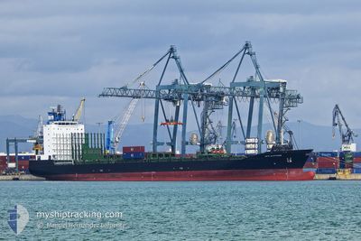
GFS SAPPHIRE
Container Ship
Current Trip
BELDEPORT
| Time Travelled | 6 days |
|---|---|
| Remaining Time | --- |
| Distance Travelled | 1503.34 nm |
| Remaining Distance | --- |
| AVG Speed | 10.8 Knots |
| MAX Speed | 15.3 Knots |
| AVG Wind | 11 knots |
| MAX Wind | 29.8 knots |
| MIN Temp | 13.5°C / 56.3°F |
| MAX Temp | 31.6°C / 88.88°F |
| Draught | 9 m |
| Position Received | 1 m ago |
Current Position
| Longitude | 28.45086° |
|---|---|
| Latitude | 40.70440° |
| Status | Under way using engine |
| Speed | 10.2 Knots |
| Course | 99.3° |
| Area | Sea of Marmara |
| Station | T-AIS |
| Position Received | 1 m ago |
Info
Information
The current position of GFS SAPPHIRE is in Sea of Marmara with coordinates 40.70440° / 28.45086° as reported on 2024-05-29 04:48 by AIS to our vessel tracker app. The vessel's current speed is 10.2 Knots
The vessel GFS SAPPHIRE (IMO: 9330927, MMSI: 565547000) is a Container Ship that was built in 2007 ( 17 years old ). It's sailing under the flag of [SG] Singapore.
In this page you can find informations about the vessels current position, last detected port calls, and current voyage information. If the vessels is not in coverage by AIS you will find the latest position.
The current position of GFS SAPPHIRE is detected by our AIS receivers and we are not responsible for the reliability of the data. The last position was recorded while the vessel was in Coverage by the Ais receivers of our vessel tracking app.
The current draught of GFS SAPPHIRE as reported by AIS is 9 meters
Weather
| Temperature | 16.9°C / 62.42°F |
|---|---|
| Wind Speed | 7 knots |
| Direction | 173° S |
| Pressure | 1013.5 hPa |
| Humidity | 71.1 % |
| Cloud Coverage | 3 % |
Featured Company
Last Port Calls
| Port | Arrival | Departure | Time In Port |
|---|---|---|---|
| 2024-05-26 02:23 | 2024-05-26 12:18 | 9 h | |
| 2024-05-22 16:00 | 2024-05-23 04:18 | 12 h | |
| 2024-05-13 16:32 | 2024-05-14 09:19 | 16 h | |
| 2024-05-11 13:52 | 2024-05-12 01:40 | 11 h | |
| 2024-05-02 16:58 | 2024-05-03 01:53 | 8 h | |
| 2024-04-30 00:36 | 2024-04-30 09:19 | 8 h | |
| 2024-04-21 04:10 | 2024-04-21 13:32 | 9 h | |
| 2024-04-18 03:26 | 2024-04-18 08:58 | 5 h | |
| 2024-04-09 14:31 | 2024-04-10 07:56 | 17 h | |
| 2024-04-07 07:05 | 2024-04-07 22:57 | 15 h |
Most Visited Ports (Last year)
| Port | Arrivals | |
|---|---|---|
| 21 | ||
| 21 | ||
| 9 | ||
| 9 | ||
| 4 | ||
| 2 |
Last Trips
| Origin | Departure | Destination | Arrival | Distance | |
|---|---|---|---|---|---|
| 2024-05-23 07:18 | 2024-05-26 04:23 | 632.48 nm | |||
| 2024-05-14 14:49 | 2024-05-22 19:00 | 2308.58 nm | |||
| 2024-05-12 07:10 | 2024-05-13 22:02 | 433.52 nm | |||
| 2024-05-03 04:53 | 2024-05-11 19:22 | 2412.51 nm | |||
| 2024-04-18 11:58 | 2024-05-02 19:58 | 3126.70 nm | |||
| 2024-04-18 11:58 | 2024-04-30 02:36 | 2410.41 nm | |||
| 2024-04-18 11:58 | 2024-04-21 06:10 | 636.27 nm | |||
| 2024-04-10 13:26 | 2024-04-18 06:26 | 2304.83 nm | |||
| 2024-04-08 04:27 | 2024-04-09 20:01 | 463.22 nm | |||
| 2024-03-30 21:28 | 2024-04-07 12:35 | 2412.68 nm |
Events
| Time | Event | Details | Position / Dest | Info |
|---|---|---|---|---|
| 2024-05-28 22:23 | Status Changed | Under way using engine Default |
40.50629 / 27.01074
BELDEPORT
|
Speed: 10.5 kn Course: 68° |
| 2024-05-28 22:23 | IN Coverage |
40.50629 / 27.01074
Sea of Marmara
BELDEPORT
|
Speed: 10.7 kn Course: 64.9° |
|
| 2024-05-28 20:33 | Status Changed | Default Under way using engine |
40.33806 / 26.63430
BELDEPORT
|
Speed: 12.3 kn Course: 44.4° |
| 2024-05-28 20:31 | OUT of Coverage |
40.33276 / 26.62749
Sea of Marmara
BELDEPORT
|
Speed: 12.3 kn Course: 44.4° |
|
| 2024-05-28 18:10 | Change Sea Area | Turkish part of the Sea of Marmara Turkish part of the Aegean Sea |
40.01724 / 26.19081
Sea of Marmara
BELDEPORT
|
Speed: 6.4 kn Course: 76.7° |
| 2024-05-28 17:53 | Status Changed | Under way using engine Default |
40.00116 / 26.11909
BELDEPORT
|
Speed: 13.4 kn Course: 67° |
| 2024-05-28 17:41 | Status Changed | Default Under way using engine |
39.98309 / 26.06127
BELDEPORT
|
Speed: 13.4 kn Course: 66.2° |
| 2024-05-28 17:38 | Detected in Sea | Turkish part of the Aegean Sea |
39.97906 / 26.04931
Aegean Sea
BELDEPORT
|
Speed: 13.4 kn Course: 66.2° |
| 2024-05-28 17:38 | Status Changed | Under way using engine Default |
39.97906 / 26.04931
BELDEPORT
|
Speed: 13.3 kn Course: 49° |
| 2024-05-28 16:50 | Status Changed | Default Under way using engine |
39.86422 / 25.89021
BELDEPORT
|
Speed: 11.8 kn Course: 38.5° |