
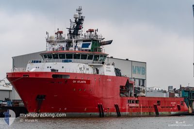
GH ATLANTIS
Anchor Handling Vessel
Current Trip
| Time Travelled | 21 days |
|---|---|
| Remaining Time | 4 days |
| Distance Travelled | 3292.42 nm |
| Remaining Distance | 999.25 nm |
| AVG Speed | 6.5 Knots |
| MAX Speed | 12.4 Knots |
| AVG Wind | 12.8 knots |
| MAX Wind | 20 knots |
| MIN Temp | 23.9°C / 75.02°F |
| MAX Temp | 29.9°C / 85.82°F |
| Draught | 7.5 m |
| Position Received | 20 d ago |
Current Position
| Longitude | -61.71912° |
|---|---|
| Latitude | 10.64341° |
| Status | Restricted manoeuverability |
| Speed | 5.3 Knots |
| Course | 268° |
| Area | Caribbean Sea |
| Station | T-AIS |
| Position Received | 20 d ago |
Info
Information
The current position of GH ATLANTIS is in Caribbean Sea with coordinates 10.64341° / -61.71912° as reported on 2024-04-30 13:01 by AIS to our vessel tracker app. The vessel's current speed is 5.3 Knots and is heading at the port of RECIFE. The estimated time of arrival as calculated by vessel tracking app is 2024-05-24 21:28 LT
The vessel GH ATLANTIS (IMO: 9455117, MMSI: 304280000) is a Anchor Handling Vessel that was built in 2010 ( 14 years old ). It's sailing under the flag of [AG] Antigua Barbuda.
In this page you can find informations about the vessels current position, last detected port calls, and current voyage information. If the vessels is not in coverage by AIS you will find the latest position.
The current position of GH ATLANTIS is detected by our AIS receivers and we are not responsible for the reliability of the data. The last position was recorded while the vessel was in Coverage by the Ais receivers of our vessel tracking app.
The current draught of GH ATLANTIS as reported by AIS is 7.5 meters
Weather
| Temperature | 23.9°C / 75.02°F |
|---|---|
| Wind Speed | 5 knots |
| Direction | 57° ENE |
| Pressure | 1016.5 hPa |
| Humidity | 85 % |
| Cloud Coverage | 68 % |
Featured Company
Last Port Calls
| Port | Arrival | Departure | Time In Port |
|---|---|---|---|
| 2024-04-29 00:02 | 2024-04-29 12:26 | 12 h | |
| 2024-04-09 18:54 | 2024-04-09 20:08 | 1 h | |
| 2024-04-01 21:16 | 2024-04-02 00:03 | 2 h | |
| 2024-03-28 21:16 | 2024-03-30 12:11 | 1 d | |
| 2024-03-28 04:47 | 2024-03-28 17:38 | 12 h | |
| 2024-03-23 21:27 | 2024-03-27 10:15 | 3 d | |
| 2024-03-23 02:59 | 2024-03-23 15:07 | 12 h | |
| 2024-03-22 16:09 | 2024-03-23 00:20 | 8 h | |
| 2024-03-22 11:15 | 2024-03-22 11:42 | 27 m | |
| 2024-03-19 02:40 | 2024-03-19 06:34 | 3 h |
Most Visited Ports (Last year)
| Port | Arrivals | |
|---|---|---|
| 56 | ||
| 32 | ||
| 2 | ||
| 1 |
Last Trips
| Origin | Departure | Destination | Arrival | Distance | |
|---|---|---|---|---|---|
| 2024-04-09 16:08 | 2024-04-28 20:02 | 235.02 nm | |||
| 2024-04-01 20:03 | 2024-04-09 14:54 | 404.40 nm | |||
| 2024-03-30 08:11 | 2024-04-01 17:16 | 56.54 nm | |||
| 2024-03-28 13:38 | 2024-03-28 17:16 | 1.48 nm | |||
| 2024-03-27 06:15 | 2024-03-28 00:47 | 21.49 nm | |||
| 2024-03-23 11:07 | 2024-03-23 17:27 | 13.56 nm | |||
| 2024-03-22 20:20 | 2024-03-22 22:59 | 24.50 nm | |||
| 2024-03-22 07:42 | 2024-03-22 12:09 | 25.84 nm | |||
| 2024-03-19 02:34 | 2024-03-22 07:15 | 341.79 nm | |||
| 2024-03-18 02:23 | 2024-03-18 22:40 | 63.77 nm |
Events
| Time | Event | Details | Position / Dest | Info |
|---|---|---|---|---|
| 2024-05-17 14:48 | START Moving |
-10.24167 / -34.66333
OFFSHORE RECIFE BR
|
Speed: 10 kn Course: 212° |
|
| 2024-05-17 10:48 | STOP Moving |
-10.17920 / -34.67141
OFFSHORE RECIFE BR
|
Speed: 0.2 kn Course: 185° |