
GH MAESTRO
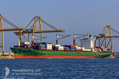
Container Ship
Current Trip
| Time Travelled | 7 h, 47 mins |
|---|---|
| Remaining Time | --- |
| Distance Travelled | 40.33 nm |
| Remaining Distance | --- |
| AVG Speed | 12.4 Knots |
| MAX Speed | 15.3 Knots |
| AVG Wind | 16.2 knots |
| MAX Wind | 24 knots |
| MIN Temp | 19.4°C / 66.92°F |
| MAX Temp | 24°C / 75.2°F |
| Draught | 12.5 m |
| Position Received | 32 m ago |
Current Position
| Longitude | -4.94507° |
|---|---|
| Latitude | 35.64579° |
| Status | Under way using engine |
| Speed | 1.5 Knots |
| Course | 39° |
| Area | Alboran Sea |
| Station | T-AIS |
| Position Received | 32 m ago |
Info
Information
The current position of GH MAESTRO is in Alboran Sea with coordinates 35.64579° / -4.94507° as reported on 2024-06-16 01:21 by AIS to our vessel tracker app. The vessel's current speed is 1.5 Knots and is heading at the port of TANGER MED. The estimated time of arrival as calculated by vessel tracking app is 2024-06-16 12:00 LT
The vessel GH MAESTRO (IMO: 9449118, MMSI: 538009277) is a Container Ship that was built in 2012 ( 12 years old ). It's sailing under the flag of [MH] Marshall Is.
In this page you can find informations about the vessels current position, last detected port calls, and current voyage information. If the vessels is not in coverage by AIS you will find the latest position.
The current position of GH MAESTRO is detected by our AIS receivers and we are not responsible for the reliability of the data. The last position was recorded while the vessel was in Coverage by the Ais receivers of our vessel tracking app.
The current draught of GH MAESTRO as reported by AIS is 12.5 meters
Weather
| Temperature | 19.6°C / 67.28°F |
|---|---|
| Wind Speed | 15 knots |
| Direction | 273° W |
| Pressure | 1013.8 hPa |
| Humidity | 78.7 % |
| Cloud Coverage | --- |
Featured Company
Last Port Calls
| Port | Arrival | Departure | Time In Port |
|---|---|---|---|
| 2024-06-15 04:55 | 2024-06-15 18:07 | 13 h | |
| 2024-06-10 13:10 | 2024-06-11 21:44 | 1 d | |
| 2024-05-29 08:14 | 2024-05-30 08:46 | 1 d | |
| 2024-05-25 16:28 | 2024-05-26 14:04 | 21 h | |
| 2024-05-22 17:40 | 2024-05-23 23:12 | 1 d | |
| 2024-05-18 10:37 | 2024-05-19 08:41 | 22 h | |
| 2024-05-12 11:32 | 2024-05-13 00:12 | 12 h | |
| 2024-05-08 06:54 | 2024-05-09 03:38 | 20 h | |
| 2024-05-05 08:17 | 2024-05-07 06:59 | 1 d | |
| 2024-04-19 22:40 |
Last Trips
| Origin | Departure | Destination | Arrival | Distance | |
|---|---|---|---|---|---|
| 2024-06-11 23:44 | 2024-06-15 06:55 | 414.33 nm | |||
| 2024-05-30 09:46 | 2024-06-10 15:10 | 4072.08 nm | |||
| 2024-05-26 15:04 | 2024-05-29 09:14 | 171.51 nm | |||
| 2024-05-23 23:12 | 2024-05-25 17:28 | 744.47 nm | |||
| 2024-05-19 08:41 | 2024-05-22 17:40 | 1115.96 nm | |||
| 2024-05-13 02:12 | 2024-05-18 10:37 | 2055.67 nm | |||
| 2024-05-09 04:38 | 2024-05-12 13:32 | 160.48 nm | |||
| 2024-05-07 08:59 | 2024-05-08 07:54 | 415.39 nm | |||
| 2024-04-19 23:40 | 2024-05-05 10:17 | 4132.92 nm | |||
| 2024-04-14 12:06 | 2024-04-16 11:57 | 744.48 nm |
Events
| Time | Event | Details | Position / Dest | Info |
|---|---|---|---|---|
| 2024-06-16 01:28 | Status Changed | Default Under way using engine |
35.64307 / -4.94433
MAPTM
|
Speed: 1.5 kn Course: 39° |
| 2024-06-16 01:21 | Status Changed | Under way using engine Default |
35.64579 / -4.94507
MAPTM
|
Speed: 1.5 kn Course: 37° |
| 2024-06-16 01:15 | Status Changed | Default Under way using engine |
35.64830 / -4.94558
MAPTM
|
Speed: 1.5 kn Course: 31° |
| 2024-06-16 01:03 | Status Changed | Under way using engine Default |
35.65359 / -4.94726
MAPTM
|
Speed: 1.4 kn Course: 21° |
| 2024-06-16 00:59 | Status Changed | Default Under way using engine |
35.65489 / -4.94778
MAPTM
|
Speed: 1.5 kn Course: 17° |
| 2024-06-16 00:49 | Status Changed | Under way using engine Default |
35.65913 / -4.95027
MAPTM
|
Speed: 1.5 kn Course: 17° |
| 2024-06-15 23:59 | Status Changed | Default Under way using engine |
35.67918 / -4.95841
MAPTM
|
Speed: 1.6 kn Course: 19° |
| 2024-06-15 23:41 | Status Changed | Under way using engine Default |
35.68756 / -4.95990
MAPTM
|
Speed: 1.8 kn Course: 23° |
| 2024-06-15 23:31 | Status Changed | Default Under way using engine |
35.69284 / -4.96089
MAPTM
|
Speed: 1.9 kn Course: 9° |
| 2024-06-15 23:22 | Status Changed | Under way using engine Default |
35.69782 / -4.96198
MAPTM
|
Speed: 1.9 kn Course: 7° |