
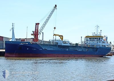
GHIBLI
Tanker
Current Trip
| Time Travelled | 16 h, 57 mins |
|---|---|
| Remaining Time | --- |
| Distance Travelled | 142.69 nm |
| Remaining Distance | --- |
| AVG Speed | 10 Knots |
| MAX Speed | 12.7 Knots |
| AVG Wind | 8.6 knots |
| MAX Wind | 11.2 knots |
| MIN Temp | 10.9°C / 51.62°F |
| MAX Temp | 12.3°C / 54.14°F |
| Draught | 4.4 m |
| Position Received | 2 m ago |
Current Position
| Longitude | -6.19294° |
|---|---|
| Latitude | 53.73038° |
| Status | At anchor |
| Speed | |
| Course | 113° |
| Area | Irish Sea and St. George's Channel |
| Station | T-AIS |
| Position Received | 2 m ago |
Info
Information
The current position of GHIBLI is in Irish Sea and St. George's Channel with coordinates 53.73038° / -6.19294° as reported on 2024-05-14 12:16 by AIS to our vessel tracker app. The vessel's current speed is 0 Knots
The vessel GHIBLI (IMO: 9876347, MMSI: 246301000) is a Tanker It's sailing under the flag of [NL] Netherlands.
In this page you can find informations about the vessels current position, last detected port calls, and current voyage information. If the vessels is not in coverage by AIS you will find the latest position.
The current position of GHIBLI is detected by our AIS receivers and we are not responsible for the reliability of the data. The last position was recorded while the vessel was in Coverage by the Ais receivers of our vessel tracking app.
The current draught of GHIBLI as reported by AIS is 4.4 meters
Weather
| Temperature | 12.4°C / 54.32°F |
|---|---|
| Wind Speed | 7 knots |
| Direction | 81° E |
| Pressure | 997.6 hPa |
| Humidity | 90.5 % |
| Cloud Coverage | 98 % |
Featured Company
Last Port Calls
| Port | Arrival | Departure | Time In Port |
|---|---|---|---|
| 2024-05-12 16:08 | 2024-05-13 19:21 | 1 d | |
| 2024-05-08 22:01 | 2024-05-10 00:33 | 1 d | |
| 2024-05-06 16:52 | 2024-05-07 10:05 | 17 h | |
| 2024-05-03 05:47 | 2024-05-04 07:33 | 1 d | |
| 2024-04-29 17:15 | 2024-04-30 17:54 | 1 d | |
| 2024-04-27 14:40 | 2024-04-29 17:13 | 2 d | |
| 2024-04-25 19:19 | 2024-04-26 09:18 | 13 h | |
| 2024-04-23 22:57 | 2024-04-24 12:36 | 13 h | |
| 2024-04-17 05:54 | 2024-04-23 09:32 | 6 d | |
| 2024-04-11 09:42 | 2024-04-11 10:21 | 39 m |
Last Trips
| Origin | Departure | Destination | Arrival | Distance | |
|---|---|---|---|---|---|
| 2024-05-10 02:33 | 2024-05-12 17:08 | 536.86 nm | |||
| 2024-05-07 11:05 | 2024-05-09 00:01 | 241.34 nm | |||
| 2024-05-04 09:33 | 2024-05-06 17:52 | 275.31 nm | |||
| 2024-04-30 18:54 | 2024-05-03 07:47 | 584.39 nm | |||
| 2024-04-29 18:13 | 2024-04-29 18:15 | 0.12 nm | |||
| 2024-04-26 10:18 | 2024-04-27 15:40 | 307.75 nm | |||
| 2024-04-24 14:36 | 2024-04-25 20:19 | 303.96 nm | |||
| 2024-04-23 11:32 | 2024-04-24 00:57 | 114.01 nm | |||
| 2024-04-11 11:21 | 2024-04-17 07:54 | 799.72 nm | |||
| 2024-04-11 10:22 | 2024-04-11 10:42 | 1.88 nm |
Events
| Time | Event | Details | Position / Dest | Info |
|---|---|---|---|---|
| 2024-05-14 09:40 | Status Changed | At anchor Default |
53.73000 / -6.19333
DROGHEDA
|
Speed: Course: 91° |
| 2024-05-14 09:37 | Status Changed | Default At anchor |
53.72997 / -6.19327
DROGHEDA
|
Speed: Course: 93° |
| 2024-05-14 09:16 | Status Changed | At anchor Default |
53.72981 / -6.19331
DROGHEDA
|
Speed: Course: 77° |
| 2024-05-14 09:13 | Status Changed | Default At anchor |
53.72974 / -6.19334
DROGHEDA
|
Speed: Course: 83° |
| 2024-05-14 08:46 | STOP Moving | 4.27 nm, South of CLOGHERHEAD |
53.72953 / -6.19291
DROGHEDA
|
Speed: Course: 52° |
| 2024-05-14 08:37 | Status Changed | At anchor Moored |
53.73002 / -6.19138
DROGHEDA
|
Speed: 3 kn Course: 40° |
| 2024-05-14 01:34 | Status Changed | Moored Default |
52.67806 / -5.56903
DROGHEDA
|
Speed: 11.7 kn Course: 356° |
| 2024-05-14 01:30 | Status Changed | Default Moored |
52.66667 / -5.56887
DROGHEDA
|
Speed: 11.7 kn Course: 359.6° |
| 2024-05-14 01:17 | Change Sea Area | Irish part of the Irish Sea and St. George's Channel United Kingdom part of the Celtic Sea |
52.62369 / -5.56728
Irish Sea and St. George's Channel
|
Speed: 11.7 kn Course: 357.3° |
| 2024-05-14 01:17 | Status Changed | Moored Default |
52.62369 / -5.56728
DROGHEDA
|
Speed: 11.8 kn Course: 358° |