
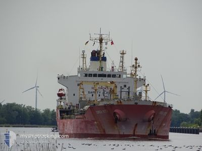
GINGA KITE
Oil/Chemical Tanker
Current Trip
| Time Travelled | 17 days |
|---|---|
| Remaining Time | 1 day |
| Distance Travelled | 4506.56 nm |
| Remaining Distance | 471.63 nm |
| AVG Speed | 11.9 Knots |
| MAX Speed | 14.8 Knots |
| AVG Wind | 13.7 knots |
| MAX Wind | 25 knots |
| MIN Temp | 19°C / 66.2°F |
| MAX Temp | 30.6°C / 87.08°F |
| Draught | 10 m |
| Position Received | 3 d ago |
Current Position
| Longitude | 36.09720° |
|---|---|
| Latitude | -24.99210° |
| Status | Under way using engine |
| Speed | 15 Knots |
| Course | 206° |
| Area | Mozambique Channel |
| Station | T-AIS |
| Position Received | 3 d ago |
Info
Information
The current position of GINGA KITE is in Mozambique Channel with coordinates -24.99210° / 36.09720° as reported on 2024-06-06 15:01 by AIS to our vessel tracker app. The vessel's current speed is 15 Knots and is heading at the port of MAPUTO. The estimated time of arrival as calculated by vessel tracking app is 2024-06-11 10:55 LT
The vessel GINGA KITE (IMO: 9228291, MMSI: 563095900) is a Oil/Chemical Tanker that was built in 2001 ( 23 years old ). It's sailing under the flag of [SG] Singapore.
In this page you can find informations about the vessels current position, last detected port calls, and current voyage information. If the vessels is not in coverage by AIS you will find the latest position.
The current position of GINGA KITE is detected by our AIS receivers and we are not responsible for the reliability of the data. The last position was recorded while the vessel was in Coverage by the Ais receivers of our vessel tracking app.
The current draught of GINGA KITE as reported by AIS is 10 meters
Weather
| Temperature | 21.5°C / 70.7°F |
|---|---|
| Wind Speed | 17 knots |
| Direction | 17° NNE |
| Pressure | 1029.1 hPa |
| Humidity | 62.9 % |
| Cloud Coverage | --- |
Featured Company
Last Port Calls
| Port | Arrival | Departure | Time In Port |
|---|---|---|---|
| 2024-05-20 15:50 | 2024-05-23 04:58 | 2 d | |
| 2024-04-28 15:55 | 2024-04-29 17:54 | 1 d | |
| 2024-04-25 13:47 | 2024-04-28 00:42 | 2 d | |
| 2024-04-16 22:09 | 2024-04-17 21:45 | 23 h | |
| 2024-04-07 11:53 | 2024-04-08 12:05 | 1 d | |
| 2024-04-03 08:13 | 2024-04-04 07:29 | 23 h |
Most Visited Ports (Last year)
| Port | Arrivals | |
|---|---|---|
| 4 | ||
| 4 | ||
| 3 | ||
| 3 | ||
| 2 | ||
| 2 |
Last Trips
| Origin | Departure | Destination | Arrival | Distance | |
|---|---|---|---|---|---|
| 2024-04-29 20:54 | 2024-05-20 20:50 | 1624.32 nm | |||
| 2024-04-28 03:42 | 2024-04-28 18:55 | 14.76 nm | |||
| 2024-04-18 03:15 | 2024-04-25 16:47 | 1314.72 nm | |||
| 2024-04-08 17:35 | 2024-04-17 03:39 | 707.23 nm | |||
| 2024-04-04 12:59 | 2024-04-07 17:23 | 929.45 nm | |||
| 2024-03-28 00:17 | 2024-04-03 13:43 | 1878.15 nm |
Events
| Time | Event | Details | Position / Dest | Info |
|---|---|---|---|---|
| 2024-06-08 07:24 | START Moving | 12.43 nm, East of MAPUTO |
-25.94380 / 32.79363
MZ MPM
|
Speed: 3.2 kn Course: 102° |
| 2024-06-07 10:08 | STOP Moving | 12.1 nm, East of MAPUTO |
-25.94328 / 32.78730
MZ MPM
|
Speed: 0.3 kn Course: 227° |
| 2024-06-06 15:01 | OUT of Coverage |
-24.99210 / 36.09720
Mozambique Channel
MZ MPM
|
Speed: 15 kn Course: 206° |
|
| 2024-06-06 14:38 | Draught Changed | 10 8.7 |
-24.90920 / 36.14318
MZ MPM
|
Speed: 14.7 kn Course: 206° |
| 2024-06-06 14:38 | Destination Changed | MZ MPM PK KHI |
-24.90920 / 36.14318
MZ MPM
|
Speed: 14.7 kn Course: 206° |
| 2024-06-06 14:38 | ETA Changed | 2024/06/07 12:00 2024/05/20 12:00 |
-24.90920 / 36.14318
MZ MPM
|
Speed: 14.7 kn Course: 206° |
| 2024-06-06 14:05 | Detected in Sea | Mozambican part of the Mozambique Channel |
-24.79027 / 36.21032
Mozambique Channel
|
Speed: 14.5 kn Course: 207° |
| 2024-06-06 14:02 | IN Coverage |
-24.79027 / 36.21032
Mozambique Channel
|
Speed: 14.5 kn Course: 207° |