
GIORGOS DRACOPOULOS
Cargo
Current Trip
| Time Travelled | 13 days |
|---|---|
| Remaining Time | 2 days |
| Distance Travelled | 4090.61 nm |
| Remaining Distance | 745.58 nm |
| AVG Speed | 12.6 Knots |
| MAX Speed | 23 Knots |
| AVG Wind | 13 knots |
| MAX Wind | 26.1 knots |
| MIN Temp | 17.6°C / 63.68°F |
| MAX Temp | 27.8°C / 82.04°F |
| Draught | 10 m |
| Position Received | 5 d ago |
Current Position
| Longitude | -13.65269° |
|---|---|
| Latitude | 28.09588° |
| Status | Under way using engine |
| Speed | 13.2 Knots |
| Course | 205.2° |
| Area | North Atlantic Ocean |
| Station | T-AIS |
| Position Received | 5 d ago |
Info
Information
The current position of GIORGOS DRACOPOULOS is in North Atlantic Ocean with coordinates 28.09588° / -13.65269° as reported on 2024-06-10 23:15 by AIS to our vessel tracker app. The vessel's current speed is 13.2 Knots and is heading at the port of TEMA. The estimated time of arrival as calculated by vessel tracking app is 2024-06-18 08:57 LT
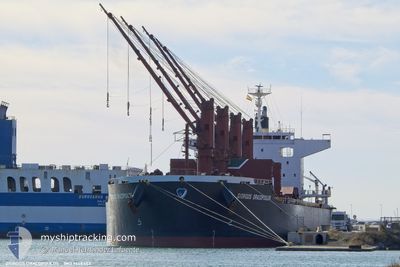
The vessel GIORGOS DRACOPOULOS (IMO: 9668403, MMSI: 229523000) is a Cargo It's sailing under the flag of [MT] Malta.
In this page you can find informations about the vessels current position, last detected port calls, and current voyage information. If the vessels is not in coverage by AIS you will find the latest position.
The current position of GIORGOS DRACOPOULOS is detected by our AIS receivers and we are not responsible for the reliability of the data. The last position was recorded while the vessel was in Coverage by the Ais receivers of our vessel tracking app.
The current draught of GIORGOS DRACOPOULOS as reported by AIS is 10 meters
Weather
| Temperature | 27.1°C / 80.78°F |
|---|---|
| Wind Speed | 15 knots |
| Direction | 213° SSW |
| Pressure | 1011.7 hPa |
| Humidity | 75.9 % |
| Cloud Coverage | 100 % |
Featured Company
Last Port Calls
| Port | Arrival | Departure | Time In Port |
|---|---|---|---|
| 2024-05-30 09:10 | 2024-06-02 19:42 | 3 d | |
| 2024-05-09 08:44 | 2024-05-22 07:48 | 12 d | |
| 2024-05-07 13:00 | 2024-05-08 12:32 | 23 h | |
| 2024-04-18 11:22 | 2024-04-24 04:52 | 5 d | |
| 2024-04-08 14:24 | 2024-04-15 18:06 | 7 d | |
| 2024-04-02 17:03 | 2024-04-08 11:59 | 5 d |
Most Visited Ports (Last year)
| Port | Arrivals | |
|---|---|---|
| 2 | ||
| 2 | ||
| 1 | ||
| 1 | ||
| 1 | ||
| 1 |
Last Trips
| Origin | Departure | Destination | Arrival | Distance | |
|---|---|---|---|---|---|
| 2024-05-22 09:48 | 2024-05-30 11:10 | 106.66 nm | |||
| 2024-05-08 14:32 | 2024-05-09 10:44 | 14.51 nm | |||
| 2024-04-24 06:52 | 2024-05-07 15:00 | 3263.71 nm | |||
| 2024-04-15 20:06 | 2024-04-18 13:22 | 759.74 nm | |||
| 2024-04-08 13:59 | 2024-04-08 16:24 | 23.05 nm | |||
| 2024-03-14 05:53 | 2024-04-02 19:03 | 4406.20 nm |
Events
| Time | Event | Details | Position / Dest | Info |
|---|---|---|---|---|
| 2024-06-10 23:23 | Status Changed | Default Under way using engine |
28.07109 / -13.66559
GHTEM
|
Speed: 13.2 kn Course: 205.2° |
| 2024-06-10 23:15 | OUT of Coverage |
28.09588 / -13.65269
North Atlantic Ocean
GHTEM
|
Speed: 13.2 kn Course: 205.2° |
|
| 2024-06-10 23:04 | Status Changed | Under way using engine Default |
28.13280 / -13.63372
GHTEM
|
Speed: 13 kn Course: 205° |
| 2024-06-10 22:46 | IN Coverage |
28.13280 / -13.63372
North Atlantic Ocean
GHTEM
|
Speed: 13.2 kn Course: 204.5° |
|
| 2024-06-10 21:25 | Status Changed | Default Under way using engine |
28.47500 / -13.45500
GHTEM
|
Speed: 13.4 kn Course: 203.4° |
| 2024-06-10 21:17 | Status Changed | Under way using engine Default |
28.50139 / -13.44360
GHTEM
|
Speed: 13 kn Course: 203° |
| 2024-06-10 21:17 | OUT of Coverage |
28.50139 / -13.44360
North Atlantic Ocean
GHTEM
|
Speed: 13.4 kn Course: 203.4° |
|
| 2024-06-10 21:13 | IN Coverage |
28.50139 / -13.44360
North Atlantic Ocean
GHTEM
|
Speed: 13.4 kn Course: 203.4° |
|
| 2024-06-10 20:07 | Status Changed | Default Under way using engine |
28.61513 / -13.31139
GHTEM
|
Speed: 9.9 kn Course: 305.1° |
| 2024-06-10 20:00 | OUT of Coverage |
28.62063 / -13.30338
North Atlantic Ocean
GHTEM
|
Speed: 9.9 kn Course: 305.1° |