
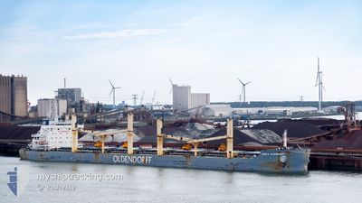
GISELA OLDENDORFF
Cargo
Aktuelle Reise
| Bisherige Reisezeit | 20 Tage |
|---|---|
| Verbleibende Reisezeit | --- |
| Zurückgelegte Distanz | 4253.21 nm |
| Verbleibende Distanz | --- |
| Durchschnittliche Geschwindigkeit | 9.9 Knoten |
| Maximale Geschwindigkeit | 14.8 Knoten |
| Durchschnittliche Windgeschwindigkeit | 10.9 Knoten |
| Maximale Windgeschwindigkeit | 29.9 Knoten |
| Minimale Temperatur | 16.2°C / 61.16°F |
| Maximale Temperatur | 27.6°C / 81.68°F |
| Tiefgang | 8.3 m |
| Position erhalten | 7 d alt |
Aktuelle Position
| Länge | --- |
|---|---|
| Breite | --- |
| Zustand | Under way using engine |
| Geschwindigkeit | 11.1 Knoten |
| Kurs | 271.2° |
| Gebiet | North Atlantic Ocean |
| Station | T-AIS |
| Position erhalten | 7 d alt |
Schiffsdetails
Information
Die GISELA OLDENDORFF befindet sich derzeit in North Atlantic Ocean mit den Koordinaten 36.45184° / -25.78776°, Diese Position wurde am 2024-10-24 17:13 von unserer Schiffsverfolgungs-App über AIS erfasst. Das Schiff fährt momentan mit einer Geschwindigkeit von 11.1 Knoten und fahrt in den Hafen von BALTIMORE. Die geschatzte Ankunftszeit, berechnet von der -App zur Schiffsverfolgung, ist 2024-11-03 13:00 LT
Das Schiff GISELA OLDENDORFF (IMO: 9702601, MMSI: 255805765) ist Cargo und fährt unter der Flagge von [PT] Portugal.
Auf dieser Seite erhalten Sie Informationen zur aktuellen Position des Schiffes, zu den letzten bekannten Hafenanläufen und zu den aktuellen Reiseinformationen. Sollte das Schiff nicht durch AIS abgedeckt sein, wird die zuletzt erfasste Position angezeigt.
Die GISELA OLDENDORFF wird durch unsere AIS-Empfänger ermittelt. Wir übernehmen keine Gewähr für die Richtigkeit der Daten. Die letzte Position wurde von unseren AIS-Empfängern aufgezeichnet, während das Schiff in Reichweite war.
Der aktuelle Entwurf von GISELA OLDENDORFF, wie von AIS gemeldet, betragt 8.3 meter
Wetter
| Temperatur | 22.4°C / 72.32°F |
|---|---|
| Windgeschwindigkeit | 15 Knoten |
| Windrichtung | 250° WSW |
| Luftdruck | 1024.5 hPa |
| Luftfeuchtigkeit | 74.1 % |
| Wolken | 100 % |
Featured Company
Letzte Reisen
Events
| Zeit | Ereignis | Details | Position / Ziel | Information |
|---|---|---|---|---|
| 2024-10-24 17:19 | geänderter Status | Default Under way using engine |
36.45205 / -25.81000
USBAL
|
Geschwindigkeit: 11.1 kn Kurs: 271.2° |
| 2024-10-24 17:13 | geänderter Status | Under way using engine Default |
36.45184 / -25.78776
USBAL
|
Geschwindigkeit: 11.1 kn Kurs: 271° |
| 2024-10-24 17:13 | außerhalb Abdeckung |
36.45184 / -25.78776
North Atlantic Ocean
USBAL
|
Geschwindigkeit: 11.1 kn Kurs: 271.2° |
|
| 2024-10-24 17:03 | geänderter Status | Default Under way using engine |
36.45126 / -25.75050
USBAL
|
Geschwindigkeit: 11.2 kn Kurs: 269.7° |
| 2024-10-24 08:46 | geänderte voraussichtliche Ankunftszeit | 2024/11/03 13:00 2024/10/27 18:00 |
36.41467 / -23.99402
USBAL
|
Geschwindigkeit: 10.9 kn Kurs: 269.4° |
| 2024-10-24 08:43 | Ändere Seegebiet | Portuguese (Azores) part of the North Atlantic Ocean Portuguese part of the North Atlantic Ocean |
36.41467 / -23.98588
North Atlantic Ocean
USBAL
|
Geschwindigkeit: 10.8 kn Kurs: 269.6° |
| 2024-10-24 08:43 | geänderter Status | Under way using engine Default |
36.41467 / -23.98588
USBAL
|
Geschwindigkeit: 10.8 kn Kurs: 270° |
| 2024-10-24 08:36 | in Abdeckung |
36.41467 / -23.98588
North Atlantic Ocean
USBAL
|
Geschwindigkeit: 10.8 kn Kurs: 269.6° |