
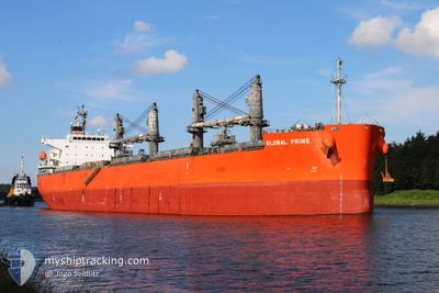
GLOBAL PRIME
Cargo
Aktuelle Reise
| Bisherige Reisezeit | 14 Tage |
|---|---|
| Verbleibende Reisezeit | --- |
| Zurückgelegte Distanz | 3724.61 nm |
| Verbleibende Distanz | 4.57 nm |
| Durchschnittliche Geschwindigkeit | 10.7 Knoten |
| Maximale Geschwindigkeit | 14.9 Knoten |
| Durchschnittliche Windgeschwindigkeit | 10.2 Knoten |
| Maximale Windgeschwindigkeit | 23 Knoten |
| Minimale Temperatur | 20.4°C / 68.72°F |
| Maximale Temperatur | 37.7°C / 99.86°F |
| Tiefgang | 11.3 m |
| Position erhalten | 1 m alt |
Aktuelle Position
| Länge | -5.41244° |
|---|---|
| Breite | 36.08943° |
| Zustand | Under way using engine |
| Geschwindigkeit | 1 Knoten |
| Kurs | 292° |
| Gebiet | Strait of Gibraltar |
| Station | T-AIS |
| Position erhalten | 1 m alt |
Schiffsdetails
Information
Die GLOBAL PRIME befindet sich derzeit in Strait of Gibraltar mit den Koordinaten 36.08943° / -5.41244°, Diese Position wurde am 2024-09-27 11:14 von unserer Schiffsverfolgungs-App über AIS erfasst. Das Schiff fährt momentan mit einer Geschwindigkeit von 1 Knoten und fahrt in den Hafen von ALGECIRAS. Die geschatzte Ankunftszeit, berechnet von der -App zur Schiffsverfolgung, ist 2024-09-27 07:00 LT
Das Schiff GLOBAL PRIME (IMO: 9658941, MMSI: 311000144) ist Cargo und fährt unter der Flagge von [BS] Bahamas.
Auf dieser Seite erhalten Sie Informationen zur aktuellen Position des Schiffes, zu den letzten bekannten Hafenanläufen und zu den aktuellen Reiseinformationen. Sollte das Schiff nicht durch AIS abgedeckt sein, wird die zuletzt erfasste Position angezeigt.
Die GLOBAL PRIME wird durch unsere AIS-Empfänger ermittelt. Wir übernehmen keine Gewähr für die Richtigkeit der Daten. Die letzte Position wurde von unseren AIS-Empfängern aufgezeichnet, während das Schiff in Reichweite war.
Der aktuelle Entwurf von GLOBAL PRIME, wie von AIS gemeldet, betragt 11.3 meter
Wetter
| Temperatur | 21.7°C / 71.06°F |
|---|---|
| Windgeschwindigkeit | 10 Knoten |
| Windrichtung | 268° W |
| Luftdruck | 1018.8 hPa |
| Luftfeuchtigkeit | 61.6 % |
| Wolken | 91 % |
Featured Company
Meistbesuchte Häfen (Letztes Jahr)
| Hafen | Ankünfte | |
|---|---|---|
| 3 | ||
| 2 | ||
| 1 | ||
| 1 | ||
| 1 | ||
| 1 |
Events
| Zeit | Ereignis | Details | Position / Ziel | Information |
|---|---|---|---|---|
| 2024-09-27 11:15 | geänderter Status | At anchor Under way using engine |
36.08943 / -5.41269
ESALG
|
Geschwindigkeit: 0.7 kn Kurs: 294° |
| 2024-09-27 10:44 | Ändere Seegebiet | Spanish part of the Strait of Gibraltar Gibraltarian part of the Strait of Gibraltar |
36.08259 / -5.38073
Strait of Gibraltar
ESALG
|
Geschwindigkeit: 4.6 kn Kurs: 296.1° |
| 2024-09-27 10:08 | Ändere Seegebiet | Gibraltarian part of the Strait of Gibraltar Spanish part of the Strait of Gibraltar |
36.04921 / -5.35529
Strait of Gibraltar
ESALG
|
Geschwindigkeit: 6.7 kn Kurs: 340.8° |
| 2024-09-27 09:50 | Ändere Seegebiet | Spanish part of the Strait of Gibraltar Moroccan part of the Strait of Gibraltar |
36.00680 / -5.37685
Strait of Gibraltar
ESALG
|
Geschwindigkeit: 13.2 kn Kurs: 50° |
| 2024-09-27 08:09 | geänderter Status | Under way using engine Default |
35.89824 / -5.77221
ESALG
|
Geschwindigkeit: 11 kn Kurs: 87° |
| 2024-09-27 08:07 | geänderter Status | Default Under way using engine |
35.89770 / -5.77915
ESALG
|
Geschwindigkeit: 11 kn Kurs: 87.2° |
| 2024-09-27 08:04 | geänderter Status | Under way using engine Default |
35.89722 / -5.79051
ESALG
|
Geschwindigkeit: 11.1 kn Kurs: 88° |
| 2024-09-27 07:59 | geänderter Status | Default Under way using engine |
35.89634 / -5.80895
ESALG
|
Geschwindigkeit: 11.1 kn Kurs: 86° |
| 2024-09-27 07:49 | geänderter Status | Under way using engine Default |
35.89469 / -5.84841
ESALG
|
Geschwindigkeit: 11.1 kn Kurs: 89° |
| 2024-09-27 07:43 | geänderter Status | Default Under way using engine |
35.89426 / -5.86991
ESALG
|
Geschwindigkeit: 11 kn Kurs: 89.8° |