
GLOBAL PROSPERITY
Cargo
Current Trip
KR KPO
| Time Travelled | 2 days |
|---|---|
| Remaining Time | --- |
| Distance Travelled | 175.96 nm |
| Remaining Distance | --- |
| AVG Speed | 11.6 Knots |
| MAX Speed | 13.9 Knots |
| AVG Wind | 12.2 knots |
| MAX Wind | 16.9 knots |
| MIN Temp | 18°C / 64.4°F |
| MAX Temp | 23.5°C / 74.3°F |
| Draught | 18 m |
| Position Received | 2 d ago |
Current Position
| Longitude | 129.17351° |
|---|---|
| Latitude | 34.78204° |
| Status | Under way using engine |
| Speed | 12.2 Knots |
| Course | 220.4° |
| Area | Japan Sea |
| Station | T-AIS |
| Position Received | 2 d ago |
Info
Information
The current position of GLOBAL PROSPERITY is in Japan Sea with coordinates 34.78204° / 129.17351° as reported on 2024-05-31 11:16 by AIS to our vessel tracker app. The vessel's current speed is 12.2 Knots
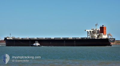
The vessel GLOBAL PROSPERITY (IMO: 9489508, MMSI: 636015714) is a Cargo It's sailing under the flag of [LR] Liberia.
In this page you can find informations about the vessels current position, last detected port calls, and current voyage information. If the vessels is not in coverage by AIS you will find the latest position.
The current position of GLOBAL PROSPERITY is detected by our AIS receivers and we are not responsible for the reliability of the data. The last position was recorded while the vessel was in Coverage by the Ais receivers of our vessel tracking app.
The current draught of GLOBAL PROSPERITY as reported by AIS is 18 meters
Weather
| Temperature | 19.3°C / 66.74°F |
|---|---|
| Wind Speed | 12 knots |
| Direction | 81° E |
| Pressure | 1010.3 hPa |
| Humidity | 82.9 % |
| Cloud Coverage | 100 % |
Featured Company
Most Visited Ports (Last year)
| Port | Arrivals | |
|---|---|---|
| 5 | ||
| 4 | ||
| 2 | ||
| 2 | ||
| 1 |
Events
| Time | Event | Details | Position / Dest | Info |
|---|---|---|---|---|
| 2024-05-31 18:22 | STOP Moving | 18.01 nm, South East of YEOSU |
34.59757 / 127.98828
KR KPO
|
Speed: 0.3 kn Course: 29° |
| 2024-05-31 11:22 | Status Changed | Default Under way using engine |
34.76765 / 129.15831
KR KPO
|
Speed: 12.2 kn Course: 220.4° |
| 2024-05-31 11:16 | OUT of Coverage |
34.78204 / 129.17351
Japan Sea
|
Speed: 12.2 kn Course: 220.4° |
|
| 2024-05-31 10:57 | Detected in Sea | Japanese part of the Japan Sea |
34.83074 / 129.22302
Japan Sea
|
Speed: 11.9 kn Course: 217.2° |
| 2024-05-31 10:57 | Status Changed | Under way using engine Default |
34.83074 / 129.22302
KR KPO
|
Speed: 11.9 kn Course: 217° |
| 2024-05-31 10:30 | Status Changed | Default Under way using engine |
34.90328 / 129.28742
KR KPO
|
Speed: 11.7 kn Course: 215.3° |
| 2024-05-31 09:57 | Status Changed | Under way using engine Default |
34.99214 / 129.36203
KR KPO
|
Speed: 11.8 kn Course: 212° |
| 2024-05-31 09:54 | Status Changed | Default Under way using engine |
35.00082 / 129.36890
KR KPO
|
Speed: 11.8 kn Course: 213.2° |
| 2024-05-31 09:51 | Status Changed | Under way using engine Default |
35.00955 / 129.37562
KR KPO
|
Speed: 11.9 kn Course: 207° |
| 2024-05-31 09:46 | Status Changed | Default Under way using engine |
35.02232 / 129.38580
KR KPO
|
Speed: 12 kn Course: 204.5° |