
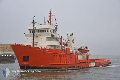
GLOMAR PATRIOT
Offshore Supply Ship
Current Trip
WINGATE
| Time Travelled | 27 days |
|---|---|
| Remaining Time | --- |
| Distance Travelled | 344.52 nm |
| Remaining Distance | --- |
| AVG Speed | 7.7 Knots |
| MAX Speed | 11.9 Knots |
| AVG Wind | 12.1 knots |
| MAX Wind | 21.8 knots |
| MIN Temp | 6.1°C / 42.98°F |
| MAX Temp | 12.9°C / 55.22°F |
| Draught | 4.3 m |
| Position Received | 15 h, 59 m ago |
Current Position
| Longitude | 2.65392° |
|---|---|
| Latitude | 54.31150° |
| Status | Under way using engine |
| Speed | 2.2 Knots |
| Course | --- |
| Area | North Sea |
| Station | T-AIS |
| Position Received | 15 h, 59 m ago |
Info
Information
The current position of GLOMAR PATRIOT is in North Sea with coordinates 54.31150° / 2.65392° as reported on 2024-05-20 04:57 by AIS to our vessel tracker app. The vessel's current speed is 2.2 Knots
The vessel GLOMAR PATRIOT (IMO: 7404176, MMSI: 353186000) is a Offshore Supply Ship that was built in 1975 ( 49 years old ). It's sailing under the flag of [PA] Panama.
In this page you can find informations about the vessels current position, last detected port calls, and current voyage information. If the vessels is not in coverage by AIS you will find the latest position.
The current position of GLOMAR PATRIOT is detected by our AIS receivers and we are not responsible for the reliability of the data. The last position was recorded while the vessel was in Coverage by the Ais receivers of our vessel tracking app.
The current draught of GLOMAR PATRIOT as reported by AIS is 4.3 meters
Weather
| Temperature | 11.5°C / 52.7°F |
|---|---|
| Wind Speed | 14 knots |
| Direction | 16° NNE |
| Pressure | 1014.7 hPa |
| Humidity | 86.2 % |
| Cloud Coverage | 5 % |
Featured Company
Last Port Calls
| Port | Arrival | Departure | Time In Port |
|---|---|---|---|
| 2024-04-22 23:14 | 2024-04-23 10:28 | 11 h | |
| 2024-03-30 14:46 | 2024-04-01 15:12 | 2 d | |
| 2024-03-23 10:06 | 2024-03-28 16:12 | 5 d | |
| 2024-03-04 16:10 |
Most Visited Ports (Last year)
| Port | Arrivals | |
|---|---|---|
| 26 | ||
| 2 | ||
| 1 | ||
| 1 | ||
| 1 |
Last Trips
| Origin | Departure | Destination | Arrival | Distance | |
|---|---|---|---|---|---|
| 2024-04-01 17:12 | 2024-04-23 01:14 | 236.42 nm | |||
| 2024-03-28 17:12 | 2024-03-30 15:46 | 116.91 nm | |||
| 2024-03-04 17:10 | 2024-03-23 11:06 | 285.76 nm |
Events
| Time | Event | Details | Position / Dest | Info |
|---|---|---|---|---|
| 2024-05-20 04:57 | OUT of Coverage |
54.31150 / 2.65392
North Sea
|
Speed: 2.2 kn Course: 20.1° |
|
| 2024-05-20 03:30 | IN Coverage |
54.26389 / 2.63636
North Sea
|
Speed: 1.9 kn Course: 5.7° |
|
| 2024-05-20 00:04 | OUT of Coverage |
54.26747 / 2.63625
North Sea
|
Speed: 3.5 kn Course: 351.8° |
|
| 2024-05-19 23:54 | IN Coverage |
54.25709 / 2.63891
North Sea
|
Speed: 3.7 kn Course: 352.4° |
|
| 2024-05-19 20:22 | OUT of Coverage |
54.33089 / 2.64828
North Sea
|
Speed: 2.8 kn Course: 358.1° |
|
| 2024-05-19 17:12 | START Moving |
54.35908 / 2.62815
WINGATE
|
Speed: 4.3 kn Course: 213.1° |
|
| 2024-05-19 10:19 | STOP Moving |
54.31567 / 2.56989
WINGATE
|
Speed: 0.3 kn Course: 511° |
|
| 2024-05-19 04:52 | IN Coverage |
54.31357 / 2.58461
North Sea
|
Speed: 3.2 kn Course: 220° |
|
| 2024-05-19 03:50 | OUT of Coverage |
54.35645 / 2.64423
North Sea
|
Speed: 2.2 kn Course: 168.4° |
|
| 2024-05-19 02:42 | IN Coverage |
54.32322 / 2.57692
North Sea
|
Speed: 2.6 kn Course: 47.9° |