
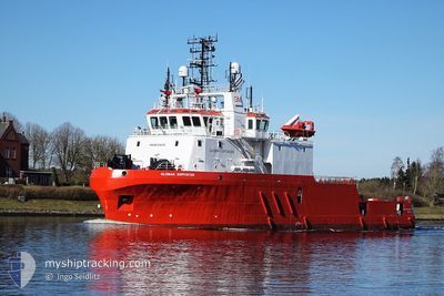
GLOMAR SUPPORTER
Dredging or underwater ops
Current Trip
GREEN VOLT OWF
| Time Travelled | 8 days |
|---|---|
| Remaining Time | --- |
| Distance Travelled | 138.05 nm |
| Remaining Distance | --- |
| AVG Speed | 4.3 Knoten |
| MAX Speed | 10.4 Knoten |
| AVG Wind | 10.6 knots |
| MAX Wind | 18.8 knots |
| MIN Temp | 13.1°C / 55.58°F |
| MAX Temp | 14.6°C / 58.28°F |
| Tiefgang | 5.5 m |
| Position erhalten | 7 h, 48 m alt |
Current Position
| Länge | -0.68420° |
|---|---|
| Breite | 57.89374° |
| Zustand | Restricted manoeuverability |
| Geschwindigkeit | 3.7 Knoten |
| Kurs | 358° |
| Gebiet | North Sea |
| Station | T-AIS |
| Position erhalten | 7 h, 48 m alt |
Info
Information
Die aktuelle Position von GLOMAR SUPPORTER befindet sich in North Sea mit den Koordinaten 57.89374° / -0.68420°, wie von AIS am 2024-07-26 15:57 an unsere Schiffsverfolgungs-App. Die aktuelle Geschwindigkeit des Schiffes betragt 3.7 Knoten
Das Schiff GLOMAR SUPPORTER (IMO: 9394301, MMSI: 374689000) ist Dredging or underwater ops Es segelt unter der Flagge [PA] Panama.
Auf dieser Seite finden Sie Informationen zur aktuellen Position des Schiffes, zu den zuletzt erkannten Hafenanlaufen und zu aktuellen Reiseinformationen. Wenn die Schiffe nicht von AIS abgedeckt werden, finden Sie die neueste Position.
Die aktuelle Position von GLOMAR SUPPORTER wird von unseren AIS-Empfangern erkannt und wir sind nicht fur die Zuverlassigkeit der Daten verantwortlich. Die letzte Position wurde von den Ais-Empfangern unserer Schiffsverfolgungs-App aufgezeichnet, wahrend sich das Schiff in Deckung befand.
Der aktuelle Entwurf von GLOMAR SUPPORTER, wie von AIS gemeldet, betragt 5.5 meter
Weather
| Temperature | 14.3°C / 57.74°F |
|---|---|
| Wind Speed | 11 knots |
| Direction | 179° S |
| Pressure | 1005.8 hPa |
| Humidity | 79.3 % |
| Cloud Coverage | 13 % |
Featured Company
Last Port Calls
| Port | Arrival | Departure | Time In Port |
|---|---|---|---|
| 2024-07-11 18:14 | 2024-07-18 12:08 | 6 d | |
| 2024-07-04 03:30 | 2024-07-05 03:40 | 1 d | |
| 2024-06-28 08:51 | 2024-06-28 21:36 | 12 h | |
| 2024-06-10 12:03 | 2024-06-11 10:14 | 22 h | |
| 2024-05-23 12:14 | 2024-05-30 11:12 | 6 d | |
| 2024-05-16 17:59 | 2024-05-17 23:07 | 1 d | |
| 2024-05-07 16:11 | 2024-05-13 20:36 | 6 d | |
| 2024-05-01 10:17 |
Most Visited Ports (Last year)
| Port | Arrivals | |
|---|---|---|
| 19 | ||
| 7 | ||
| 4 | ||
| 4 | ||
| 4 | ||
| 2 |
Last Trips
| Origin | Departure | Destination | Arrival | Distance | |
|---|---|---|---|---|---|
| 2024-07-05 04:40 | 2024-07-11 19:14 | 457.84 nm | |||
| 2024-06-28 22:36 | 2024-07-04 04:30 | 371.31 nm | |||
| 2024-06-11 11:14 | 2024-06-28 09:51 | 1127.13 nm | |||
| 2024-05-30 12:12 | 2024-06-10 13:03 | 789.05 nm | |||
| 2024-05-18 00:07 | 2024-05-23 13:14 | 266.79 nm | |||
| 2024-05-13 21:36 | 2024-05-16 18:59 | 302.76 nm | |||
| 2024-05-01 11:17 | 2024-05-07 17:11 | 43.70 nm |
Events
| Zeit | Ereignis | Details | Position / Ziel | Information |
|---|---|---|---|---|
| 2024-07-26 15:57 | außerhalb Abdeckung |
57.89374 / -.68420
North Sea
|
Geschwindigkeit: 3.7 kn Kurs: 1° |
|
| 2024-07-26 15:57 | in Abdeckung |
57.89374 / -.68420
North Sea
|
Geschwindigkeit: 3.7 kn Kurs: 1° |
|
| 2024-07-26 13:25 | außerhalb Abdeckung |
57.89957 / -.67865
North Sea
|
Geschwindigkeit: 3.1 kn Kurs: 1.3° |
|
| 2024-07-26 13:11 | in Abdeckung |
57.88750 / -.67913
North Sea
|
Geschwindigkeit: 3.1 kn Kurs: 3.7° |
|
| 2024-07-24 22:25 | außerhalb Abdeckung |
57.91210 / -.68469
North Sea
|
Geschwindigkeit: 4.1 kn Kurs: 179.3° |
|
| 2024-07-24 16:44 | in Abdeckung |
57.93730 / -.65725
North Sea
|
Geschwindigkeit: 3.8 kn Kurs: 6.6° |
|
| 2024-07-24 08:19 | außerhalb Abdeckung |
57.87280 / -.65743
North Sea
|
Geschwindigkeit: 4 kn Kurs: 3° |
|
| 2024-07-24 00:45 | in Abdeckung |
57.83508 / -.65023
North Sea
|
Geschwindigkeit: 2 kn Kurs: 319.1° |
|
| 2024-07-23 22:40 | außerhalb Abdeckung |
57.93829 / -.64457
North Sea
|
Geschwindigkeit: 4.1 kn Kurs: 20° |
|
| 2024-07-23 22:40 | in Abdeckung |
57.93829 / -.64457
North Sea
|
Geschwindigkeit: 4.1 kn Kurs: 20° |