
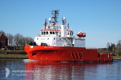
GLOMAR SUPPORTER
Dredging or underwater ops
Current Trip
OUTER DOWSING OW
| Time Travelled | 3 days |
|---|---|
| Remaining Time | --- |
| Distance Travelled | 362.96 nm |
| Remaining Distance | --- |
| AVG Speed | 4.8 Knots |
| MAX Speed | 10.1 Knots |
| AVG Wind | 11.5 knots |
| MAX Wind | 25 knots |
| MIN Temp | 10.7°C / 51.26°F |
| MAX Temp | 12.9°C / 55.22°F |
| Draught | 5.5 m |
| Position Received | 6 m ago |
Current Position
| Longitude | 0.83648° |
|---|---|
| Latitude | 53.73660° |
| Status | Restricted manoeuverability |
| Speed | 3.5 Knots |
| Course | 164° |
| Area | North Sea |
| Station | T-AIS |
| Position Received | 6 m ago |
Info
Information
The current position of GLOMAR SUPPORTER is in North Sea with coordinates 53.73660° / 0.83648° as reported on 2024-06-03 07:52 by AIS to our vessel tracker app. The vessel's current speed is 3.5 Knots
The vessel GLOMAR SUPPORTER (IMO: 9394301, MMSI: 374689000) is a Dredging or underwater ops It's sailing under the flag of [PA] Panama.
In this page you can find informations about the vessels current position, last detected port calls, and current voyage information. If the vessels is not in coverage by AIS you will find the latest position.
The current position of GLOMAR SUPPORTER is detected by our AIS receivers and we are not responsible for the reliability of the data. The last position was recorded while the vessel was in Coverage by the Ais receivers of our vessel tracking app.
The current draught of GLOMAR SUPPORTER as reported by AIS is 5.5 meters
Weather
| Temperature | 11.2°C / 52.16°F |
|---|---|
| Wind Speed | 8 knots |
| Direction | 299° WNW |
| Pressure | 1020.3 hPa |
| Humidity | 93 % |
| Cloud Coverage | 100 % |
Featured Company
Most Visited Ports (Last year)
| Port | Arrivals | |
|---|---|---|
| 19 | ||
| 7 | ||
| 4 | ||
| 3 | ||
| 2 | ||
| 2 |
Last Trips
Events
| Time | Event | Details | Position / Dest | Info |
|---|---|---|---|---|
| 2024-06-02 15:56 | IN Coverage |
53.75564 / .86112
North Sea
|
Speed: 3.6 kn Course: 40.4° |
|
| 2024-06-02 14:49 | OUT of Coverage |
53.71496 / .79601
North Sea
|
Speed: 2.5 kn Course: 17.1° |
|
| 2024-06-02 12:33 | START Moving |
53.73497 / .84592
OUTER DOWSING OW
|
Speed: 3.2 kn Course: 354° |
|
| 2024-06-02 10:58 | IN Coverage |
53.73443 / .83932
North Sea
|
Speed: 0.2 kn Course: 42.8° |
|
| 2024-06-02 08:03 | OUT of Coverage |
53.74036 / .82935
North Sea
|
Speed: 4.2 kn Course: 319.9° |
|
| 2024-06-02 06:00 | START Moving |
53.72793 / .84670
OUTER DOWSING OW
|
Speed: 4.7 kn Course: 331° |
|
| 2024-06-02 03:58 | IN Coverage |
53.72175 / .84712
North Sea
|
Speed: 0.3 kn Course: 273.5° |
|
| 2024-06-02 01:28 | OUT of Coverage |
53.72280 / .84889
North Sea
|
Speed: 0.2 kn Course: 29.1° |
|
| 2024-06-01 22:16 | IN Coverage |
53.72154 / .83392
North Sea
|
Speed: Course: 214.4° |
|
| 2024-06-01 21:02 | OUT of Coverage |
53.72220 / .83913
North Sea
|
Speed: 0.1 kn Course: 262.3° |